Lake of the Ozarks Fishing Report
Synthesis generated comprehensive plan with professional recommendations.
Lake of the Ozarks Fishing Report
Generated Mar 4, 2026, 6:20 PM.
Key fishing read
- Loud/bright: chartreuse/black, Colorado blades, big profile cranks
- Day 1: High pressure (1016mb) - tougher bite, use finesse tactics
- Day 1: Moderate wind (12mph) - ideal conditions, target windblown points
- Day 1: Thunderstorms, High: 61°F, Low: 47°F
- Day 2: High pressure (1015mb) - tougher bite, use finesse tactics
- Day 2: High winds (16mph) - seek protected areas, use heavier lures
- Day 2: Thunderstorms, High: 66°F, Low: 50°F
- Day 3: High pressure (1011mb) - tougher bite, use finesse tactics
Tool analysis details
Lure Matrix Wind Clarity
Lure guidance for wind=moderate, clarity=unknown.
Findings:
- Loud/bright: chartreuse/black, Colorado blades, big profile cranks
Analyze Weather Conditions
Weather analysis for Lake of the Ozarks completed
Findings:
- Day 1: High pressure (1016mb) - tougher bite, use finesse tactics
- Day 1: Moderate wind (12mph) - ideal conditions, target windblown points
- Day 1: Thunderstorms, High: 61°F, Low: 47°F
- Day 2: High pressure (1015mb) - tougher bite, use finesse tactics
- Day 2: High winds (16mph) - seek protected areas, use heavier lures
Analyze Pressure Trends
Barometric pressure analysis for Lake of the Ozarks: falling trend at 1016.00mb
Findings:
- Falling pressure trend detected (1016.00 → lower). Fish will be more active - excellent feeding windows ahead!
- Target shallow areas, use aggressive presentations. Fish are actively feeding.
Analyze Thermal Patterns
Overall Thermal Landscape Summary
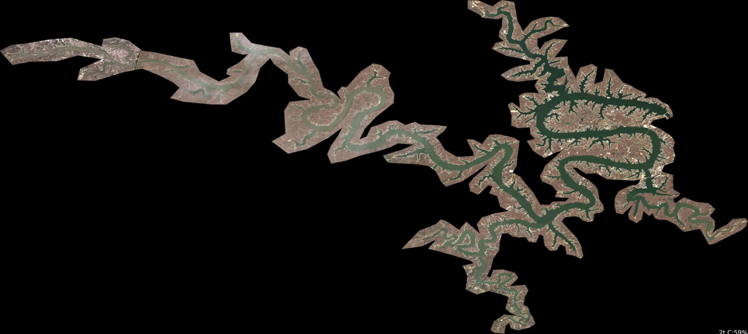
Assuming North is at the top of the image, East to the right, West to the left, and South at the bottom (standard orientation for satellite imagery). The lake features a highly irregular, dendritic shape with multiple narrow, branching arms, fingers, and coves extending in all directions, resembling a flooded river system or reservoir with numerous inlets. No major islands or prominent peninsulas are clearly distinguishable; instead, key visual anchors include: (1) the long, sinuous main channel running diagonally from top-left (NW) to bottom-right (SE), (2) a cluster of tight, parallel fingers in the central-eastern section, and (3) a broad, open area at the bottom-center where arms converge. The entire water body appears uniformly colored in dark blue tones with no clearly visible color variations, gradients, or thermal patterns across the image. Approximate min/max temperatures cannot be precisely determined due to lack of color differentiation, but the uniform dark blue suggests consistently cold surface water in the 42-52°F (6-11°C) range (Dark Blue to Medium Blue).
Detailed Thermal Feature Analysis
Temperature Breaks
No clearly visible temperature breaks or abrupt color transitions are present in the image. The water surface shows no boundaries between different colors, indicating no discernible surface temperature edges.
Pockets/Patches
No isolated pockets, patches, or distinct color areas (e.g., warmer yellows/greens or cooler navies) are visible. The water appears uniformly dark blue throughout all arms, coves, and open areas.
Gradients
No gradual color transitions or thermal gradients are observable. The coloring is consistent across the entire lake body, with no shifts from blue to teal, green, or warmer hues.
Uniform Areas
The entire lake—including the main channel, branching fingers (e.g., the cluster in the central-eastern section relative to the sinuous NW-SE channel), and convergent bottom-center area—exhibits uniform dark blue coloring. This corresponds to cold surface temperatures around 42-52°F (6-11°C) (Dark Blue to Medium Blue). Shoreline transitions are not analyzable due to lack of land-water color contrast in the provided image.
Insightful Fish Behavior Interpretation
With uniform cold surface temperatures (42-52°F / 6-11°C) across the lake, fish are likely very sluggish and structure-oriented, holding tight to deeper areas or heavy cover rather than actively feeding on the surface. Minimal surface activity is expected, with long but slow feeding windows in slightly less cold zones (if any exist below resolution). Fish may congregate along shoreline geometry like the branching fingers or main channel for minor comfort, but no thermal drivers for movement or feeding concentrations are visible.
Satellite Correlation Analysis
No additional standard satellite imagery (e.g., visible light photos) is provided alongside the thermal data. The thermal patterns (or lack thereof) cannot be correlated with inflows, outflows, springs, or surface structures. The dendritic shoreline geometry suggests potential for wind-mixing in open areas like the bottom-center convergence, but uniform temperatures indicate no surface disruption from creeks, points, or flats.
Actionable Fishing Recommendations
Due to the uniform cold surface temperatures (42-52°F / 6-11°C) and absence of thermal variations, focus on general slow-pitch tactics in protected coves and fingers (e.g., the central-eastern cluster off the main NW-SE channel) where fish may seek subtle structure comfort. Use finesse presentations like small jigs or suspended baits with long pauses, targeting dawn/dusk in any shoreline-adjacent areas. Avoid open water; prioritize slow, methodical searches along the sinuous main channel. Image quality limits hyper-specific spotting—rely on sonar for subsurface confirmation. If warmer inflows exist, they are not visible here.
Findings:
- Current surface temperature: 35.0°F. Fish metabolism significantly reduced in cold water. Target sunny, protected shorelines and use extremely slow presentations. Focus on midday when surface temperatures are warmest.
-
Overall Thermal Landscape Summary
Assuming North is at the top of the image, East to the right, West to the left, and South at the bottom (standard orientation for satellite imagery). The lake features a highly irregular, dendritic shape with multiple narrow, branching arms, fingers, and coves extending in all directions, resembling a flooded river system or reservoir with numerous inlets. No major islands or prominent peninsulas are clearly distinguishable; instead, key visual anchors include: (1) the long, sinuous main channel running diagonally from top-left (NW) to bottom-right (SE), (2) a cluster of tight, parallel fingers in the central-eastern section, and (3) a broad, open area at the bottom-center where arms converge. The entire water body appears uniformly colored in dark blue tones with no clearly visible color variations, gradients, or thermal patterns across the image. Approximate min/max temperatures cannot be precisely determined due to lack of color differentiation, but the uniform dark blue suggests consistently cold surface water in the 42-52°F (6-11°C) range (Dark Blue to Medium Blue).
Detailed Thermal Feature Analysis
Temperature Breaks
No clearly visible temperature breaks or abrupt color transitions are present in the image. The water surface shows no boundaries between different colors, indicating no discernible surface temperature edges.
Pockets/Patches
No isolated pockets, patches, or distinct color areas (e.g., warmer yellows/greens or cooler navies) are visible. The water appears uniformly dark blue throughout all arms, coves, and open areas.
Gradients
No gradual color transitions or thermal gradients are observable. The coloring is consistent across the entire lake body, with no shifts from blue to teal, green, or warmer hues.
Uniform Areas
The entire lake—including the main channel, branching fingers (e.g., the cluster in the central-eastern section relative to the sinuous NW-SE channel), and convergent bottom-center area—exhibits uniform dark blue coloring. This corresponds to cold surface temperatures around 42-52°F (6-11°C) (Dark Blue to Medium Blue). Shoreline transitions are not analyzable due to lack of land-water color contrast in the provided image.
Insightful Fish Behavior Interpretation
With uniform cold surface temperatures (42-52°F / 6-11°C) across the lake, fish are likely very sluggish and structure-oriented, holding tight to deeper areas or heavy cover rather than actively feeding on the surface. Minimal surface activity is expected, with long but slow feeding windows in slightly less cold zones (if any exist below resolution). Fish may congregate along shoreline geometry like the branching fingers or main channel for minor comfort, but no thermal drivers for movement or feeding concentrations are visible.
Satellite Correlation Analysis
No additional standard satellite imagery (e.g., visible light photos) is provided alongside the thermal data. The thermal patterns (or lack thereof) cannot be correlated with inflows, outflows, springs, or surface structures. The dendritic shoreline geometry suggests potential for wind-mixing in open areas like the bottom-center convergence, but uniform temperatures indicate no surface disruption from creeks, points, or flats.
Actionable Fishing Recommendations
Due to the uniform cold surface temperatures (42-52°F / 6-11°C) and absence of thermal variations, focus on general slow-pitch tactics in protected coves and fingers (e.g., the central-eastern cluster off the main NW-SE channel) where fish may seek subtle structure comfort. Use finesse presentations like small jigs or suspended baits with long pauses, targeting dawn/dusk in any shoreline-adjacent areas. Avoid open water; prioritize slow, methodical searches along the sinuous main channel. Image quality limits hyper-specific spotting—rely on sonar for subsurface confirmation. If warmer inflows exist, they are not visible here.
- Spring warming: Focus on shallow bays and areas showing the warmest surface temperatures in thermal imagery as fish move into spawning areas.
Analyze Water Clarity
1. Overall Water Quality Summary
The imagery reveals a lake dominated by clear to moderately stained conditions, with extensive dark blue/teal areas (bottom-left matrix: low sediment + low chlorophyll) covering the main basin, indicating 15-25+ feet visibility in deeper central waters. Snaking green (bottom-center: moderate chlorophyll + low sediment) and orange/red-yellow tendrils (bottom-right: high chlorophyll + low sediment) extend into numerous arms and coves, suggesting localized algae influence with 3-15 feet visibility. The second image shifts toward tan/brown dominance (top-left/top-center: high sediment + low/moderate chlorophyll), with 1-6 feet visibility in branching shallows, overlaid by white/cream highlights possibly indicating ultra-low sediment pockets. Overall, a transition from pristine main-lake clarity to algae-tinged coves and sediment-laden extremities, with high-productivity edges at color breaks.
2. Detailed Clarity Zone Mapping & Characterization (4 Key Zones)
Zone 1: Dark Blue/Teal Main Basin (Bottom-Left Quadrant)
- Color Identification & Matrix Translation: Predominant dark blue/teal across ~70% of both images' central expanse = low sediment + low chlorophyll.
- Location Mapping: Central main lake body, spanning from mid-western shoreline to eastern central basin (compass: south-central core, avoiding protruding arms).
- Visibility Assessment: 15-25+ feet; premium clear water ideal for sight-related tactics.
- Tactical Implications: Finesse focus; natural presentations excel in minimal particles/algae.
- Transition Zone Identification: Sharp edges where teal fades to green snaking lines (prime productivity break).
Zone 2: Bright Green Channels/Arms (Bottom-Center Quadrant)
- Color Identification & Matrix Translation: Vivid green tendrils branching northeast and southwest from center in first image = moderate chlorophyll + low sediment.
- Location Mapping: Northern and southern arm inlets, snaking eastward ~1/3 into main basin (e.g., northwest cove cluster to southeast channel).
- Visibility Assessment: 8-15 feet; productive green-tinted clarity.
- Tactical Implications: Balanced presentations; slight vibration to match algae presence.
- Transition Zone Identification: Gradual shift to adjacent orange/red, forming bait-trapping edges.
Zone 3: Orange/Red-Yellow Extensions (Bottom-Right Quadrant)
- Color Identification & Matrix Translation: Orange/red with yellow fringes in first image's protruding fingers = high chlorophyll + low sediment.
- Location Mapping: Eastern and northeastern terminal coves/arms (e.g., northeast corner extremities, southeast shallow bays).
- Visibility Assessment: 3-8 feet; algae-stained but sediment-free.
- Tactical Implications: Reaction baits with vibration to penetrate bloom edges.
- Transition Zone Identification: Distinct boundaries back to green/teal, high ambush potential.
Zone 4: Tan/Brown Branching Shallows (Top-Left/Top-Center Quadrant)
- Color Identification & Matrix Translation: Uniform tan/brown with minor green mixes in second image's intricate branches = high sediment + low/moderate chlorophyll.
- Location Mapping: Western and southern peripheral arms/shallows (e.g., southwest shoreline fingers, northwest shallow flats near implied inflows).
- Visibility Assessment: 1-6 feet; muddy from stirred sediment.
- Tactical Implications: Noise-heavy power tactics; sound critical over visuals.
- Transition Zone Identification: White/cream highlights to tan create micro-edges; tan-to-teal main basin breaks.
3. Turbidity/Algae Sources & Transition Zones Analysis
Source Identification (Visual): High chlorophyll (orange/red-yellow in first image) sources trace to protected northeastern/southeastern coves, likely nutrient inflows stirring algae blooms along sheltered shorelines. Sediment turbidity (tan/brown in second image) originates from western/southern shallow arms, with branching white lines suggesting wind-stirred flats or runoff points at arm heads. No extreme top-right dark brown/red mixes visible, limiting worst-case murk.
Clarity Breaks/Edges:
- Sharp mudline (tan-brown meets dark blue/teal) along south-central basin edge, running east-west ~1/4 from west shore—bait concentration hotspot.
- Gradual green-to-orange shift in northern arms, northeast progression—ambush corridor for prey fleeing clearer water.
- White-to-tan micro-breaks in western shallows, pinpointing stirred-up productivity walls. These edges signify high fishing potential as fish hold on clearer side, ambushing into turbid zones.
4. Species-Specific Clarity Strategy (Recommendations tied to zones)
- Bass (Largemouth/Smallmouth): Target Zone 2/3 green-orange transitions in northern/eastern arms (e.g., northeast cove edges)—algae edges match shad schools; patrol Zone 1 teal basin for deep suspenders. Avoid deep Zone 4 tan unless reaction strikes.
- Crappie: Suspend near cover in Zone 1 dark blue/teal south-central basin (15+ ft vis for sighting); finesse edges of Zone 2 green northern channels where slight tint hides schools.
- Walleye: Low-light Zone 3 orange/red northeastern corners (3-8 ft, algae camouflage); troll Zone 4 tan western shallows for bottom-huggers in 1-6 ft mud.
- Catfish: Power-fish Zone 4 tan/sediment southwest arms (high sed attracts via scent); channel edges of tan-to-teal south-central for ambushes. Compass-focused: Northeast for bass/crappie, west for cats/walleye.
5. Tactical Fishing Adjustments (Lures/Presentations tied to zones)
Zone 1 (Dark Blue/Teal Clear, 15-25+ ft): Natural colors (green pumpkin, shad, watermelon seed) on jigs/soft plastics/suspending jerkbaits; slow finesse retrieves, long casts (40+ yd), fluorocarbon 8-12 lb, stealth boat positioning. Fish teal-to-green breaks with subtle twitches for spooky fish.
Zone 2 (Green Mod Chlor, 8-15 ft): Mix natural/bright (chartreuse tails on green pumpkin) spinnerbaits/chatterbaits; steady medium retrieve, 20-30 yd casts, 12 lb fluoro/mono. Parallel green edges for reaction.
Zone 3 (Orange/Red High Chlor, 3-8 ft): Bright vibration (chartreuse/white, bright blue) crankbaits/spinnerbaits; fast aggressive pulls to trigger through algae, moderate casts. Burn along orange-to-green shifts.
Zone 4 (Tan/Brown High Sed, 1-6 ft): High-contrast/noise (black/blue, chartreuse/orange) lipless cranks/big worms with rattles; slow vibrating/yo-yo retrieves, braided 15-20 lb, close 10-20 yd power positioning. Drag tan-to-teal walls bottom-bouncing.
Clarity Breaks General: Long casts into clearer side, retrieve toward turbid (e.g., teal into tan); downsize 25% for 35°F cold (e.g., 1/4 oz instead of 1/2 oz), ultra-slow in all.
6. Seasonal Context (Interpretation of visual patterns)
Visuals show resilient deep teal clarity in the main basin despite peripheral algae (green/orange) and sediment (tan) staining, suggesting stable cold-water conditions where turnover limits widespread murk—consistent with winter-like low-aggression patterns (e.g., localized cove algae from decaying matter, wind-stirred shallows). Unusual extent of clean central blue amid arm staining implies recent calm minimizing sediment spread; target deep clear zones for sluggish fish resilience.
Findings:
-
1. Overall Water Quality Summary
The imagery reveals a lake dominated by clear to moderately stained conditions, with extensive dark blue/teal areas (bottom-left matrix: low sediment + low chlorophyll) covering the main basin, indicating 15-25+ feet visibility in deeper central waters. Snaking green (bottom-center: moderate chlorophyll + low sediment) and orange/red-yellow tendrils (bottom-right: high chlorophyll + low sediment) extend into numerous arms and coves, suggesting localized algae influence with 3-15 feet visibility. The second image shifts toward tan/brown dominance (top-left/top-center: high sediment + low/moderate chlorophyll), with 1-6 feet visibility in branching shallows, overlaid by white/cream highlights possibly indicating ultra-low sediment pockets. Overall, a transition from pristine main-lake clarity to algae-tinged coves and sediment-laden extremities, with high-productivity edges at color breaks.
2. Detailed Clarity Zone Mapping & Characterization (4 Key Zones)
Zone 1: Dark Blue/Teal Main Basin (Bottom-Left Quadrant)
- Color Identification & Matrix Translation: Predominant dark blue/teal across ~70% of both images' central expanse = low sediment + low chlorophyll.
- Location Mapping: Central main lake body, spanning from mid-western shoreline to eastern central basin (compass: south-central core, avoiding protruding arms).
- Visibility Assessment: 15-25+ feet; premium clear water ideal for sight-related tactics.
- Tactical Implications: Finesse focus; natural presentations excel in minimal particles/algae.
- Transition Zone Identification: Sharp edges where teal fades to green snaking lines (prime productivity break).
Zone 2: Bright Green Channels/Arms (Bottom-Center Quadrant)
- Color Identification & Matrix Translation: Vivid green tendrils branching northeast and southwest from center in first image = moderate chlorophyll + low sediment.
- Location Mapping: Northern and southern arm inlets, snaking eastward ~1/3 into main basin (e.g., northwest cove cluster to southeast channel).
- Visibility Assessment: 8-15 feet; productive green-tinted clarity.
- Tactical Implications: Balanced presentations; slight vibration to match algae presence.
- Transition Zone Identification: Gradual shift to adjacent orange/red, forming bait-trapping edges.
Zone 3: Orange/Red-Yellow Extensions (Bottom-Right Quadrant)
- Color Identification & Matrix Translation: Orange/red with yellow fringes in first image's protruding fingers = high chlorophyll + low sediment.
- Location Mapping: Eastern and northeastern terminal coves/arms (e.g., northeast corner extremities, southeast shallow bays).
- Visibility Assessment: 3-8 feet; algae-stained but sediment-free.
- Tactical Implications: Reaction baits with vibration to penetrate bloom edges.
- Transition Zone Identification: Distinct boundaries back to green/teal, high ambush potential.
Zone 4: Tan/Brown Branching Shallows (Top-Left/Top-Center Quadrant)
- Color Identification & Matrix Translation: Uniform tan/brown with minor green mixes in second image's intricate branches = high sediment + low/moderate chlorophyll.
- Location Mapping: Western and southern peripheral arms/shallows (e.g., southwest shoreline fingers, northwest shallow flats near implied inflows).
- Visibility Assessment: 1-6 feet; muddy from stirred sediment.
- Tactical Implications: Noise-heavy power tactics; sound critical over visuals.
- Transition Zone Identification: White/cream highlights to tan create micro-edges; tan-to-teal main basin breaks.
3. Turbidity/Algae Sources & Transition Zones Analysis
Source Identification (Visual): High chlorophyll (orange/red-yellow in first image) sources trace to protected northeastern/southeastern coves, likely nutrient inflows stirring algae blooms along sheltered shorelines. Sediment turbidity (tan/brown in second image) originates from western/southern shallow arms, with branching white lines suggesting wind-stirred flats or runoff points at arm heads. No extreme top-right dark brown/red mixes visible, limiting worst-case murk.
Clarity Breaks/Edges:
- Sharp mudline (tan-brown meets dark blue/teal) along south-central basin edge, running east-west ~1/4 from west shore—bait concentration hotspot.
- Gradual green-to-orange shift in northern arms, northeast progression—ambush corridor for prey fleeing clearer water.
- White-to-tan micro-breaks in western shallows, pinpointing stirred-up productivity walls. These edges signify high fishing potential as fish hold on clearer side, ambushing into turbid zones.
4. Species-Specific Clarity Strategy (Recommendations tied to zones)
- Bass (Largemouth/Smallmouth): Target Zone 2/3 green-orange transitions in northern/eastern arms (e.g., northeast cove edges)—algae edges match shad schools; patrol Zone 1 teal basin for deep suspenders. Avoid deep Zone 4 tan unless reaction strikes.
- Crappie: Suspend near cover in Zone 1 dark blue/teal south-central basin (15+ ft vis for sighting); finesse edges of Zone 2 green northern channels where slight tint hides schools.
- Walleye: Low-light Zone 3 orange/red northeastern corners (3-8 ft, algae camouflage); troll Zone 4 tan western shallows for bottom-huggers in 1-6 ft mud.
- Catfish: Power-fish Zone 4 tan/sediment southwest arms (high sed attracts via scent); channel edges of tan-to-teal south-central for ambushes. Compass-focused: Northeast for bass/crappie, west for cats/walleye.
5. Tactical Fishing Adjustments (Lures/Presentations tied to zones)
Zone 1 (Dark Blue/Teal Clear, 15-25+ ft): Natural colors (green pumpkin, shad, watermelon seed) on jigs/soft plastics/suspending jerkbaits; slow finesse retrieves, long casts (40+ yd), fluorocarbon 8-12 lb, stealth boat positioning. Fish teal-to-green breaks with subtle twitches for spooky fish.
Zone 2 (Green Mod Chlor, 8-15 ft): Mix natural/bright (chartreuse tails on green pumpkin) spinnerbaits/chatterbaits; steady medium retrieve, 20-30 yd casts, 12 lb fluoro/mono. Parallel green edges for reaction.
Zone 3 (Orange/Red High Chlor, 3-8 ft): Bright vibration (chartreuse/white, bright blue) crankbaits/spinnerbaits; fast aggressive pulls to trigger through algae, moderate casts. Burn along orange-to-green shifts.
Zone 4 (Tan/Brown High Sed, 1-6 ft): High-contrast/noise (black/blue, chartreuse/orange) lipless cranks/big worms with rattles; slow vibrating/yo-yo retrieves, braided 15-20 lb, close 10-20 yd power positioning. Drag tan-to-teal walls bottom-bouncing.
Clarity Breaks General: Long casts into clearer side, retrieve toward turbid (e.g., teal into tan); downsize 25% for 35°F cold (e.g., 1/4 oz instead of 1/2 oz), ultra-slow in all.
6. Seasonal Context (Interpretation of visual patterns)
Visuals show resilient deep teal clarity in the main basin despite peripheral algae (green/orange) and sediment (tan) staining, suggesting stable cold-water conditions where turnover limits widespread murk—consistent with winter-like low-aggression patterns (e.g., localized cove algae from decaying matter, wind-stirred shallows). Unusual extent of clean central blue amid arm staining implies recent calm minimizing sediment spread; target deep clear zones for sluggish fish resilience.
Analyze Solunar Timing
Solunar timing analysis for Lake of the Ozarks completed
Findings:
- Plan trips around major solunar periods for peak activity, minor periods offer secondary opportunities
Analyze Satellite Imagery
SATELLITE ANALYSIS: Lake of the Ozarks - Camden Area (March 04, 2026, 35°F Winter/Pre-Spawn)
1. LAKE OVERVIEW (Natural Sections & Landmarks)
The image shows a winding section of the lake with a central main channel that snakes northwest to southeast, flanked by steep, irregular shorelines covered in tan/brown forested areas. The lake naturally divides into:
- Northern section/arm: Narrower, more protected coves and points along the upper (northwestern) edge, with tighter windings.
- Main lake body: Wider central open water with the primary serpentine channel running through it.
- Southern section/arm: Broader coves and extended shorelines on the lower (southeastern) edge, opening into larger bays.
- Eastern arm: A distinct creek-like inlet branching off the eastern shore into a multi-fingered cove system.
- Western arm: Shallower bays and points along the western shoreline, with more clustered development.
Major landmarks visible:
- Multiple boat ramps: Straight gravel/tan paths leading directly to the water (one prominent in the northern section's eastern shore, another near the main channel's western bend).
- Marinas: Large clusters of perpendicular docks (one big one mid-main lake on the western shore with 20+ slips; smaller ones scattered).
- No bridges or dams visible in this frame.
- Small islands: A couple of tiny vegetated humps in the southern section's eastern cove.
- The lake necks down at a narrow pinch point in the central main body where the channel tightens between opposing points.
2. FINDABLE FISHING SPOTS
Here are 7 high-priority, boat-findable spots based on visible structure/cover combos (points, docks, creek mouths, color transitions). Ranked 1-10 using the system (structure complexity, cover density, depth transitions via color shifts from tan/light blue to dark blue, winter suitability for deep refuge/channel edges, wind protection).
-
Northern section - Main point just south of the boat ramp
How to Find It: Launch at the visible boat ramp on the eastern shore of the northern section, head south along the shore 0.2 miles to the first big protruding point.
What You See: Long point extending into the channel with a sharp tan-to-dark blue color shift at the tip; 5-6 docks along the shore side.
Why Fish It: Point geometry + docks = structure/cover combo for pre-spawn bass staging; color change suggests drop-off to deeper channel (Rank: 9/10).
Best Approach: Troll or cast jigs along the point edge from shallow tan toward dark blue. -
Main lake body - Western shore marina cluster
How to Find It: From the main channel, spot the largest marina (20+ docks) on the western shore midway through the central open water.
What You See: Dense rectangular dock shadows clustered around a central pier; adjacent point with light tan flat transitioning to medium-dark blue.
Why Fish It: High cover density (docks) on a point for crappie/bass; protected from wind, winter refuge (Rank: 10/10).
Best Approach: Slow-drift or vertical jig under docks, focus on outer edges. -
Eastern arm - Creek mouth at the multi-fingered cove entrance
How to Find It: Head east from main channel centerline to the obvious narrow creek inlet splitting into 3-4 fingers; target the mouth point.
What You See: Serpentine dark line narrowing into the cove; flanking points with scattered docks and tan shallows.
Why Fish It: Channel bend/transition for walleye/bass migrating to spawning flats; visible inflow path (Rank: 8/10).
Best Approach: Cast to channel edges, follow the dark line upstream. -
Southern section - Cove behind the small eastern island
How to Find It: In the southern bays, find the tiny green island off the eastern shore, then duck into the protected cove immediately behind it.
What You See: Small vegetated island with a sharp-pointed cove; docks lining the back wall, dark patches suggesting cover.
Why Fish It: Wind-protected with island point + docks for crappie brush/dock fishing; adjacent deep channel (Rank: 9/10).
Best Approach: Pitch to docks and laydowns from the island side. -
Main lake body - Narrow pinch point between opposing bluffs
How to Find It: Cruise the main channel south until the water visibly narrows between tall tan bluffs on both sides.
What You See: Tight channel constriction with abrupt color gradients from light edges to solid dark blue center; sparse docks on west bank.
Why Fish It: Funnel effect concentrates fish on ledges/drop-offs; winter channel holdover (Rank: 7/10).
Best Approach: Drift through with crankbaits or jigs along the darker transitions. -
Western arm - Big point north of the secondary boat ramp
How to Find It: Western shore bays, locate the smaller boat ramp path, then north to the prominent point jutting into the bay.
What You See: Bold shoreline point with tan flat and dock stringer; surrounds lighter water shifting darker offshore.
Why Fish It: Point + cover for bass; accessible flats to deep (Rank: 8/10).
Best Approach: Fan-cast from point tip, work offshore color change. -
Northern section - Eastern shore dock cluster above the ramp
How to Find It: From the northern boat ramp, hug the eastern shore north 0.1 miles to the tight group of 10+ docks.
What You See: Heavy dock concentration on a subtle point; irregular dark patches amid tan shallows.
Why Fish It: Dense cover for crappie; steep bank transition (Rank: 7/10).
Best Approach: Shoot jigs under docks, target gaps.
3. VISIBLE FEATURES BY LAKE SECTION
Northern section: Boat ramp on eastern shore; protruding points with dock strings (e.g., south of ramp); subtle creek inlets; tan flats along west shore transitioning to dark channel. Main lake body: Large western marina; central channel pinch with bluff walls; scattered islands/humps; sharp color lines at major points. Southern section: Small islands in eastern coves; deep protected bays with back-wall docks; broader tan shorelines with laydown shadows. Eastern arm: Multi-fingered creek cove with mouth points and dark channel line; dock clusters at fingers. Western arm: Secondary boat ramp; bay points with flats; linear dock rows paralleling shore.
4. PRACTICAL FISHING GUIDANCE
Suggested fishing progression (winter 35°F focus: deep channels/points early, cover midday):
- Start (dawn/early): Northern section boat ramp point (#1) - quick access, wind-protected staging area for bass/crappie.
- Mid-morning: Move to main lake marina (#2) as sun warms docks; then pinch point (#5) for current edges.
- Pattern: Northern shallows/points early → main lake channels midday → southern coves afternoon for refuge. Navigation between sections:
- Northern to main: South down eastern shore past ramp, straight-shot 0.5 miles.
- Main to southern: Follow central channel southeast around the marina bend.
- Eastern arm: East perpendicular from main channel midpoint.
- Western arm: West from marina, skirt the bays.
- Pro tip: Use mile markers if posted (this Camden frame ~MM 18-22); watch wind - favor leeward shores like western marina. Target visible color shifts for drop-offs, docks for cover.
Findings:
-
SATELLITE ANALYSIS: Lake of the Ozarks - Camden Area (March 04, 2026, 35°F Winter/Pre-Spawn)
1. LAKE OVERVIEW (Natural Sections & Landmarks)
The image shows a winding section of the lake with a central main channel that snakes northwest to southeast, flanked by steep, irregular shorelines covered in tan/brown forested areas. The lake naturally divides into:
- Northern section/arm: Narrower, more protected coves and points along the upper (northwestern) edge, with tighter windings.
- Main lake body: Wider central open water with the primary serpentine channel running through it.
- Southern section/arm: Broader coves and extended shorelines on the lower (southeastern) edge, opening into larger bays.
- Eastern arm: A distinct creek-like inlet branching off the eastern shore into a multi-fingered cove system.
- Western arm: Shallower bays and points along the western shoreline, with more clustered development.
Major landmarks visible:
- Multiple boat ramps: Straight gravel/tan paths leading directly to the water (one prominent in the northern section's eastern shore, another near the main channel's western bend).
- Marinas: Large clusters of perpendicular docks (one big one mid-main lake on the western shore with 20+ slips; smaller ones scattered).
- No bridges or dams visible in this frame.
- Small islands: A couple of tiny vegetated humps in the southern section's eastern cove.
- The lake necks down at a narrow pinch point in the central main body where the channel tightens between opposing points.
2. FINDABLE FISHING SPOTS
Here are 7 high-priority, boat-findable spots based on visible structure/cover combos (points, docks, creek mouths, color transitions). Ranked 1-10 using the system (structure complexity, cover density, depth transitions via color shifts from tan/light blue to dark blue, winter suitability for deep refuge/channel edges, wind protection).
-
Northern section - Main point just south of the boat ramp
How to Find It: Launch at the visible boat ramp on the eastern shore of the northern section, head south along the shore 0.2 miles to the first big protruding point.
What You See: Long point extending into the channel with a sharp tan-to-dark blue color shift at the tip; 5-6 docks along the shore side.
Why Fish It: Point geometry + docks = structure/cover combo for pre-spawn bass staging; color change suggests drop-off to deeper channel (Rank: 9/10).
Best Approach: Troll or cast jigs along the point edge from shallow tan toward dark blue. -
Main lake body - Western shore marina cluster
How to Find It: From the main channel, spot the largest marina (20+ docks) on the western shore midway through the central open water.
What You See: Dense rectangular dock shadows clustered around a central pier; adjacent point with light tan flat transitioning to medium-dark blue.
Why Fish It: High cover density (docks) on a point for crappie/bass; protected from wind, winter refuge (Rank: 10/10).
Best Approach: Slow-drift or vertical jig under docks, focus on outer edges. -
Eastern arm - Creek mouth at the multi-fingered cove entrance
How to Find It: Head east from main channel centerline to the obvious narrow creek inlet splitting into 3-4 fingers; target the mouth point.
What You See: Serpentine dark line narrowing into the cove; flanking points with scattered docks and tan shallows.
Why Fish It: Channel bend/transition for walleye/bass migrating to spawning flats; visible inflow path (Rank: 8/10).
Best Approach: Cast to channel edges, follow the dark line upstream. -
Southern section - Cove behind the small eastern island
How to Find It: In the southern bays, find the tiny green island off the eastern shore, then duck into the protected cove immediately behind it.
What You See: Small vegetated island with a sharp-pointed cove; docks lining the back wall, dark patches suggesting cover.
Why Fish It: Wind-protected with island point + docks for crappie brush/dock fishing; adjacent deep channel (Rank: 9/10).
Best Approach: Pitch to docks and laydowns from the island side. -
Main lake body - Narrow pinch point between opposing bluffs
How to Find It: Cruise the main channel south until the water visibly narrows between tall tan bluffs on both sides.
What You See: Tight channel constriction with abrupt color gradients from light edges to solid dark blue center; sparse docks on west bank.
Why Fish It: Funnel effect concentrates fish on ledges/drop-offs; winter channel holdover (Rank: 7/10).
Best Approach: Drift through with crankbaits or jigs along the darker transitions. -
Western arm - Big point north of the secondary boat ramp
How to Find It: Western shore bays, locate the smaller boat ramp path, then north to the prominent point jutting into the bay.
What You See: Bold shoreline point with tan flat and dock stringer; surrounds lighter water shifting darker offshore.
Why Fish It: Point + cover for bass; accessible flats to deep (Rank: 8/10).
Best Approach: Fan-cast from point tip, work offshore color change. -
Northern section - Eastern shore dock cluster above the ramp
How to Find It: From the northern boat ramp, hug the eastern shore north 0.1 miles to the tight group of 10+ docks.
What You See: Heavy dock concentration on a subtle point; irregular dark patches amid tan shallows.
Why Fish It: Dense cover for crappie; steep bank transition (Rank: 7/10).
Best Approach: Shoot jigs under docks, target gaps.
3. VISIBLE FEATURES BY LAKE SECTION
Northern section: Boat ramp on eastern shore; protruding points with dock strings (e.g., south of ramp); subtle creek inlets; tan flats along west shore transitioning to dark channel. Main lake body: Large western marina; central channel pinch with bluff walls; scattered islands/humps; sharp color lines at major points. Southern section: Small islands in eastern coves; deep protected bays with back-wall docks; broader tan shorelines with laydown shadows. Eastern arm: Multi-fingered creek cove with mouth points and dark channel line; dock clusters at fingers. Western arm: Secondary boat ramp; bay points with flats; linear dock rows paralleling shore.
4. PRACTICAL FISHING GUIDANCE
Suggested fishing progression (winter 35°F focus: deep channels/points early, cover midday):
- Start (dawn/early): Northern section boat ramp point (#1) - quick access, wind-protected staging area for bass/crappie.
- Mid-morning: Move to main lake marina (#2) as sun warms docks; then pinch point (#5) for current edges.
- Pattern: Northern shallows/points early → main lake channels midday → southern coves afternoon for refuge. Navigation between sections:
- Northern to main: South down eastern shore past ramp, straight-shot 0.5 miles.
- Main to southern: Follow central channel southeast around the marina bend.
- Eastern arm: East perpendicular from main channel midpoint.
- Western arm: West from marina, skirt the bays.
- Pro tip: Use mile markers if posted (this Camden frame ~MM 18-22); watch wind - favor leeward shores like western marina. Target visible color shifts for drop-offs, docks for cover.
Analyze Species Behavior
Species behavior analysis for Lake of the Ozarks completed
Findings:
- Largemouth bass: Sluggish in cold water (35.0°F), target deep structure with slow presentations
- Largemouth bass: Spring pre-spawn/spawn mode - target shallow flats and protected coves
- Spotted bass: Sluggish in cold water (35.0°F), target deep structure with slow presentations
- Spotted bass: Spring pre-spawn/spawn mode - target shallow flats and protected coves
- White bass: Sluggish in cold water (35.0°F), target deep structure with slow presentations
How this was synthesized
Professional fishing guide analysis integrating 10 tools: lure_matrix_wind_clarity, analyze_weather_conditions, analyze_pressure_trends, analyze_thermal_patterns, analyze_water_clarity, analyze_hourly_conditions, analyze_solunar_timing, analyze_satellite_imagery, get_community_reports, analyze_species_behavior. User request: 'Generate a comprehensive fishing report for Lake of the Ozarks. Use tools to analyze satellite structure, thermal patterns, water clarity, weather, and solunar timing, then synthesize a concise plan.'. Synthesis generated comprehensive plan with professional recommendations.