Belle Fourche Reservoir Fishing Report
Synthesis generated comprehensive plan with professional recommendations.
Belle Fourche Reservoir Fishing Report
Generated Mar 20, 2026, 1:51 PM.
Key fishing read
- Max thump: giant spinnerbaits, slow roll, contact cover
- Winter: slow presentations; jigs/spoons; sun-warmed banks/vertical structure
- Day 1: High pressure (1013mb) - tougher bite, use finesse tactics
- Day 1: High winds (27mph) - seek protected areas, use heavier lures
- Day 1: MostlyClear, High: 78°F, Low: 45°F
- Day 2: High pressure (1006mb) - tougher bite, use finesse tactics
- Day 2: High winds (32mph) - seek protected areas, use heavier lures
- Day 2: PartlyCloudy, High: 80°F, Low: 47°F
Tool analysis details
Lure Matrix Wind Clarity
Lure guidance for wind=windy, clarity=unknown, phase=winter.
Findings:
- Max thump: giant spinnerbaits, slow roll, contact cover
- Winter: slow presentations; jigs/spoons; sun-warmed banks/vertical structure
Analyze Weather Conditions
Weather analysis for Belle Fourche Reservoir (Orman Dam) completed
Findings:
- Day 1: High pressure (1013mb) - tougher bite, use finesse tactics
- Day 1: High winds (27mph) - seek protected areas, use heavier lures
- Day 1: MostlyClear, High: 78°F, Low: 45°F
- Day 2: High pressure (1006mb) - tougher bite, use finesse tactics
- Day 2: High winds (32mph) - seek protected areas, use heavier lures
Analyze Solunar Timing
Solunar timing analysis for Belle Fourche Reservoir (Orman Dam) completed
Findings:
- 2026-03-20 Major feeding periods: 01:54 PM - 04:24 PM, 12:00 AM - 12:00 AM
- 2026-03-20 Minor feeding periods: 06:57 AM - 08:27 AM, 09:08 PM - 10:38 PM
- 2026-03-21 Major feeding periods: 02:46 PM - 05:16 PM, 12:26 AM - 02:56 AM
- 2026-03-21 Minor feeding periods: 07:21 AM - 08:51 AM, 10:30 PM - 12:00 AM
- 2026-03-22 Major feeding periods: 03:43 PM - 06:13 PM, 01:21 AM - 03:51 AM
Analyze Species Behavior
Species behavior analysis for Belle Fourche Reservoir (Orman Dam) completed
Findings:
- Walleye: Cold water active (33.0°F), target deep edges with live bait or slow jigs
- Smallmouth bass: Sluggish in cold water (33.0°F), target deep structure with slow presentations
- Smallmouth bass: Spring pre-spawn/spawn mode - target shallow flats and protected coves
- Walleye: sluggish activity at 33.0°F (optimal: 45-65°F)
- Yellow perch: sluggish activity at 33.0°F (optimal: 55-70°F)
Estimate Seasonal Phase
Season estimate for Belle Fourche Reservoir (Orman Dam): winter.
Findings:
- Estimated phase: winter
- Temp change over window: -43.5°F
Analyze Satellite Imagery
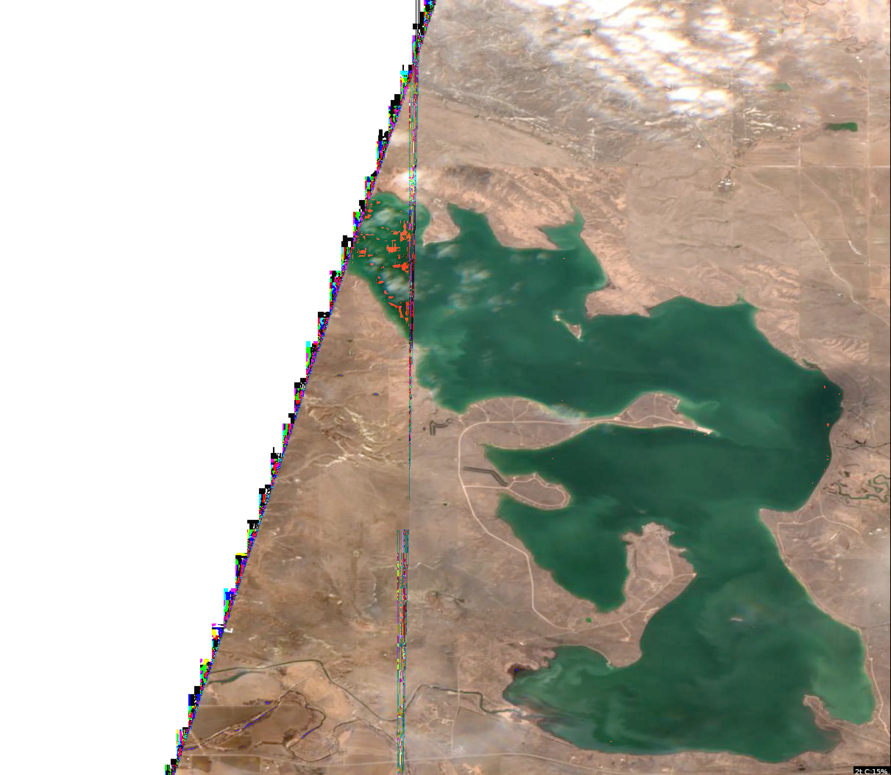
The image provided is a high-altitude, monochromatic satellite view of the Belle Fourche Reservoir (Orman Dam). Due to the extreme scale and the specific rendering of the image, it functions as a topographical map rather than a detailed surface-level view.
1. LAKE OVERVIEW
Belle Fourche Reservoir is a large, roughly triangular impoundment.
- The Dam: The most prominent feature is the long, straight line of the Orman Dam forming the southern boundary of the reservoir.
- Main Body: The central area is wide and open, providing the primary basin for the reservoir.
- Northern/Western Arms: The reservoir extends into distinct arms where the primary inflows enter, creating a more complex shoreline with multiple points and bays.
- Landmarks: The dam itself is the primary navigational reference point. The shoreline is characterized by a series of prominent points and recessed coves, particularly along the western and northern perimeters.
2. FINDABLE FISHING SPOTS
Given the current water temperature of 33°F (ice-out/pre-spawn conditions), fish will be lethargic and holding near deep-water access.
-
The Dam Face (Southern Boundary):
- How to Find: Navigate to the long, straight concrete/earthen structure at the southern end of the lake.
- Why Fish It: The dam represents the deepest water in the reservoir. In 33°F water, fish will hold near the base of the dam structure for thermal stability.
- Approach: Vertical jigging or slow-moving bottom baits along the rip-rap.
-
The Southwest Point:
- How to Find: Follow the western shoreline south until you reach the last major projection before the dam.
- Why Fish It: This point offers a transition from the main basin into the deeper water near the dam.
- Approach: Target the "nose" of the point where it drops into the main channel.
-
The Northwest "Cove" Entrance:
- How to Find: Locate the large, wide bay on the northwest side. Focus on the points flanking the entrance to this bay.
- Why Fish It: These points act as "funnels" for fish moving between the shallow bay and the main lake.
- Approach: Slow-trolling or casting jigs toward the deeper side of the point.
-
The Northeast Point:
- How to Find: On the eastern side of the reservoir, identify the most prominent point extending into the main body.
- Why Fish It: Wind-blown points are classic walleye structure. Even in cold water, these areas attract baitfish.
- Approach: Work the edges of the point where the bottom contour changes.
-
The Central Basin "Hump" Area:
- How to Find: In the center of the main lake, look for the subtle color variations that indicate a rise in the lake floor.
- Why Fish It: Offshore structure is critical when the shallows are too cold.
- Approach: Use electronics to locate the top of the structure and fish the transition zone.
3. VISIBLE FEATURES BY SECTION
- Southern Section (The Dam): The most consistent deep-water structure. Focus on the transition where the rip-rap meets the natural lake bottom.
- Western Section: Characterized by long, tapering points. These are ideal for intercepting fish moving toward the northern shallows as the water begins to warm.
- Northern Section: Contains the most complex shoreline. Look for the mouths of the primary inflows; these are the first areas to warm up, though they may be too cold currently.
4. PRACTICAL FISHING GUIDANCE
- Progression:
- Start: Begin at the Dam Face. It is the most reliable area for holding fish in 33°F water.
- Mid-Day: Move to the Southwest or Northeast points. As the sun hits the water, these points may see a slight increase in activity.
- Pattern: Focus on "Deep to Shallow" transitions. Do not waste time in the back of shallow coves yet; the water is too cold. Stay near the main lake basin.
- Navigation: The reservoir is open and exposed. Use the dam as your "home base" for navigation. When moving between the northern arms and the dam, stay in the center of the main basin to avoid shallow, unmarked points.
Safety Note: At 33°F, water safety is critical. Ensure your vessel is equipped for cold-water conditions and be aware of potential ice or debris near the shoreline.
Findings:
- The image provided is a high-altitude, monochromatic satellite view of the Belle Fourche Reservoir (Orman Dam). Due to the extreme scale and the specific rendering of the image, it functions as a topographical map rather than a detailed surface-level view.
1. LAKE OVERVIEW
Belle Fourche Reservoir is a large, roughly triangular impoundment.
- The Dam: The most prominent feature is the long, straight line of the Orman Dam forming the southern boundary of the reservoir.
- Main Body: The central area is wide and open, providing the primary basin for the reservoir.
- Northern/Western Arms: The reservoir extends into distinct arms where the primary inflows enter, creating a more complex shoreline with multiple points and bays.
- Landmarks: The dam itself is the primary navigational reference point. The shoreline is characterized by a series of prominent points and recessed coves, particularly along the western and northern perimeters.
2. FINDABLE FISHING SPOTS
Given the current water temperature of 33°F (ice-out/pre-spawn conditions), fish will be lethargic and holding near deep-water access.
-
The Dam Face (Southern Boundary):
- How to Find: Navigate to the long, straight concrete/earthen structure at the southern end of the lake.
- Why Fish It: The dam represents the deepest water in the reservoir. In 33°F water, fish will hold near the base of the dam structure for thermal stability.
- Approach: Vertical jigging or slow-moving bottom baits along the rip-rap.
-
The Southwest Point:
- How to Find: Follow the western shoreline south until you reach the last major projection before the dam.
- Why Fish It: This point offers a transition from the main basin into the deeper water near the dam.
- Approach: Target the "nose" of the point where it drops into the main channel.
-
The Northwest "Cove" Entrance:
- How to Find: Locate the large, wide bay on the northwest side. Focus on the points flanking the entrance to this bay.
- Why Fish It: These points act as "funnels" for fish moving between the shallow bay and the main lake.
- Approach: Slow-trolling or casting jigs toward the deeper side of the point.
-
The Northeast Point:
- How to Find: On the eastern side of the reservoir, identify the most prominent point extending into the main body.
- Why Fish It: Wind-blown points are classic walleye structure. Even in cold water, these areas attract baitfish.
- Approach: Work the edges of the point where the bottom contour changes.
-
The Central Basin "Hump" Area:
- How to Find: In the center of the main lake, look for the subtle color variations that indicate a rise in the lake floor.
- Why Fish It: Offshore structure is critical when the shallows are too cold.
- Approach: Use electronics to locate the top of the structure and fish the transition zone.
3. VISIBLE FEATURES BY SECTION
- Southern Section (The Dam): The most consistent deep-water structure. Focus on the transition where the rip-rap meets the natural lake bottom.
- Western Section: Characterized by long, tapering points. These are ideal for intercepting fish moving toward the northern shallows as the water begins to warm.
- Northern Section: Contains the most complex shoreline. Look for the mouths of the primary inflows; these are the first areas to warm up, though they may be too cold currently.
4. PRACTICAL FISHING GUIDANCE
- Progression:
- Start: Begin at the Dam Face. It is the most reliable area for holding fish in 33°F water.
- Mid-Day: Move to the Southwest or Northeast points. As the sun hits the water, these points may see a slight increase in activity.
- Pattern: Focus on "Deep to Shallow" transitions. Do not waste time in the back of shallow coves yet; the water is too cold. Stay near the main lake basin.
- Navigation: The reservoir is open and exposed. Use the dam as your "home base" for navigation. When moving between the northern arms and the dam, stay in the center of the main basin to avoid shallow, unmarked points.
Safety Note: At 33°F, water safety is critical. Ensure your vessel is equipped for cold-water conditions and be aware of potential ice or debris near the shoreline.
Analyze Thermal Patterns
1. Overall Thermal Landscape Summary
- Assumed Orientation: Assuming North is at the top of the image.
- Major Visual Anchors: The lake is characterized by a long, narrow, winding main body oriented from the NW to the SE. Key anchors include the narrow, finger-like inlet at the extreme NW tip and the broad, irregular basin in the SE quadrant.
- Thermal Summary: The image displays a binary thermal state. The water surface is dominated by a deep navy blue, indicating temperatures in the 40-42°F (4-6°C) range. Interspersed throughout the lake are white-pixelated clusters.
- Note on Data: The white pixels represent areas where the sensor is detecting temperatures at or near the freezing point (labeled 32°F/33°F). This indicates the lake is in a state of ice cover or slush/frazil ice formation.
2. Detailed Thermal Feature Analysis
- Temperature Breaks: The primary "breaks" are the edges of the white-pixelated ice/slush patches against the dark navy blue open water. These transitions are abrupt and represent the boundary between frozen surface conditions and open, cold water.
- Pockets/Patches:
- NW Inlet: The extreme NW tip shows a concentrated area of 33°F (0.5°C) water, suggesting the most stable ice formation in the system.
- Central Basin: The central portion of the lake shows a high density of white pixels, indicating significant surface ice coverage.
- SE Basin: The southern-most section contains several distinct patches of 32°F (0°C) water, indicating localized freezing in the more protected, wider areas of the lake.
- Uniform Areas: The dark navy blue areas (40-42°F / 4-6°C) represent the "warmest" water available, which is still extremely cold. These areas are found in the channels between the ice patches and along the main central corridor of the lake.
3. Insightful Fish Behavior Interpretation
- Metabolic State: At surface temperatures of 40-42°F (4-6°C) and with active ice formation (32-33°F), fish metabolism will be at its absolute minimum.
- Behavioral Expectations: Fish will be in a state of extreme lethargy. They will not be actively feeding at the surface. Any fish present will be holding tight to the bottom in the deepest available water to escape the freezing surface temperatures. The areas with ice cover (white pixels) will likely have lower dissolved oxygen levels, making them poor locations for fish activity.
4. Satellite Correlation Analysis
- Ice/Slush Identification: The white pixels are clearly correlated with the surface of the water body. The pattern suggests that the lake is currently undergoing a freeze-over process.
- Wind/Current Influence: The open water (dark navy blue) channels likely represent areas where current or wind has prevented solid ice formation, or where the ice has recently broken up. These channels are the only areas where the water is slightly "warmer" (40-42°F).
5. Actionable Fishing Recommendations
- Safety Warning: CRITICAL: The presence of 32°F/33°F surface temperatures and visible ice/slush patterns indicates that this lake is in a dangerous, near-freezing state. Do not attempt to fish this lake from a boat.
- Fishing Strategy: Under these conditions, traditional open-water fishing is not viable. If you are in a region where ice fishing is permitted and the ice is verified as safe by local authorities, focus your efforts on the areas identified as having the most stable ice (the white-pixelated clusters).
- Targeting: In these extreme cold conditions, fish will be extremely sedentary. If ice fishing, use very small, slow-moving presentations (jigs tipped with live bait) and focus on the deepest parts of the lake, as the surface water is currently too cold to support fish activity. Avoid the open-water channels (dark navy blue) unless you are equipped for safe, legal, and appropriate cold-water angling.
Findings:
- Current surface temperature: 33.0°F. Fish metabolism significantly reduced in cold water. Target sunny, protected shorelines and use extremely slow presentations. Focus on midday when surface temperatures are warmest.
-
1. Overall Thermal Landscape Summary
- Assumed Orientation: Assuming North is at the top of the image.
- Major Visual Anchors: The lake is characterized by a long, narrow, winding main body oriented from the NW to the SE. Key anchors include the narrow, finger-like inlet at the extreme NW tip and the broad, irregular basin in the SE quadrant.
- Thermal Summary: The image displays a binary thermal state. The water surface is dominated by a deep navy blue, indicating temperatures in the 40-42°F (4-6°C) range. Interspersed throughout the lake are white-pixelated clusters.
- Note on Data: The white pixels represent areas where the sensor is detecting temperatures at or near the freezing point (labeled 32°F/33°F). This indicates the lake is in a state of ice cover or slush/frazil ice formation.
2. Detailed Thermal Feature Analysis
- Temperature Breaks: The primary "breaks" are the edges of the white-pixelated ice/slush patches against the dark navy blue open water. These transitions are abrupt and represent the boundary between frozen surface conditions and open, cold water.
- Pockets/Patches:
- NW Inlet: The extreme NW tip shows a concentrated area of 33°F (0.5°C) water, suggesting the most stable ice formation in the system.
- Central Basin: The central portion of the lake shows a high density of white pixels, indicating significant surface ice coverage.
- SE Basin: The southern-most section contains several distinct patches of 32°F (0°C) water, indicating localized freezing in the more protected, wider areas of the lake.
- Uniform Areas: The dark navy blue areas (40-42°F / 4-6°C) represent the "warmest" water available, which is still extremely cold. These areas are found in the channels between the ice patches and along the main central corridor of the lake.
3. Insightful Fish Behavior Interpretation
- Metabolic State: At surface temperatures of 40-42°F (4-6°C) and with active ice formation (32-33°F), fish metabolism will be at its absolute minimum.
- Behavioral Expectations: Fish will be in a state of extreme lethargy. They will not be actively feeding at the surface. Any fish present will be holding tight to the bottom in the deepest available water to escape the freezing surface temperatures. The areas with ice cover (white pixels) will likely have lower dissolved oxygen levels, making them poor locations for fish activity.
4. Satellite Correlation Analysis
- Ice/Slush Identification: The white pixels are clearly correlated with the surface of the water body. The pattern suggests that the lake is currently undergoing a freeze-over process.
- Wind/Current Influence: The open water (dark navy blue) channels likely represent areas where current or wind has prevented solid ice formation, or where the ice has recently broken up. These channels are the only areas where the water is slightly "warmer" (40-42°F).
5. Actionable Fishing Recommendations
- Safety Warning: CRITICAL: The presence of 32°F/33°F surface temperatures and visible ice/slush patterns indicates that this lake is in a dangerous, near-freezing state. Do not attempt to fish this lake from a boat.
- Fishing Strategy: Under these conditions, traditional open-water fishing is not viable. If you are in a region where ice fishing is permitted and the ice is verified as safe by local authorities, focus your efforts on the areas identified as having the most stable ice (the white-pixelated clusters).
- Targeting: In these extreme cold conditions, fish will be extremely sedentary. If ice fishing, use very small, slow-moving presentations (jigs tipped with live bait) and focus on the deepest parts of the lake, as the surface water is currently too cold to support fish activity. Avoid the open-water channels (dark navy blue) unless you are equipped for safe, legal, and appropriate cold-water angling.
- Spring warming: Focus on shallow bays and areas showing the warmest surface temperatures in thermal imagery as fish move into spawning areas.
Analyze Water Clarity
This analysis of Belle Fourche Reservoir (Orman Dam) is based on the provided MCI (Chlorophyll) and TSS (Suspended Solids) imagery.
1. Overall Water Quality Summary
The reservoir exhibits a stark, binary water quality profile. The northwestern section (upper reservoir/inflow area) is characterized by high clarity, low chlorophyll, and low sediment (Deep Blue/Teal). Conversely, the main basin and southern reaches are dominated by high sediment loads (Tan/Brown) with moderate chlorophyll levels. This indicates a significant sediment-driven turbidity event, likely originating from the southern/eastern shorelines or inflows, creating a massive "mudline" that bisects the reservoir.
2. Detailed Clarity Zone Mapping & Characterization
-
Zone A: The Clear Basin (Northwest Arm)
- Matrix Position: Bottom-Left (Dark Blue/Teal).
- Conditions: Low sediment + Low chlorophyll.
- Visibility: 15-25+ feet.
- Tactical Implications: This is your "finesse" zone. Fish will be highly sensitive to line diameter and boat noise. Use fluorocarbon lines (8-10lb) and natural, translucent soft plastics.
-
Zone B: The Transition/Mudline (Central Reservoir)
- Matrix Position: Mid-section (Transition from Blue to Tan).
- Conditions: Rapidly increasing sediment.
- Visibility: 4-8 feet, dropping quickly to <4 feet.
- Tactical Implications: This is the "strike zone." Predators will use the edge of the mudline to ambush baitfish moving from clear to turbid water.
-
Zone C: The Turbid Basin (Southern/Eastern Main Body)
- Matrix Position: Top-Center (Tan/Brown).
- Conditions: High sediment + Moderate chlorophyll.
- Visibility: 1-4 feet.
- Tactical Implications: Power fishing zone. Fish rely on lateral line vibration and sound. Use high-profile baits with rattles.
3. Turbidity/Algae Sources & Transition Zones
- Source Identification: The heavy Tan/Brown coloration in the southern and eastern portions suggests significant sediment suspension, likely due to wind-driven wave action on shallow flats or recent runoff.
- Clarity Breaks: A sharp, high-contrast "mudline" exists running roughly southwest to northeast across the center of the reservoir. This is a high-percentage area for intercepting active fish.
4. Species-Specific Clarity Strategy
- Walleye: Target the Transition Zone (Zone B). Walleye prefer the lower light penetration of the stained water but will patrol the edge of the clear water to hunt. Use jigs with bright tails (chartreuse/white) to provide contrast against the stained water.
- Bass: Focus on the Clear Zone (Zone A) for sight-feeding, or the Mudline (Zone B) for reaction strikes. In the clear water, use finesse jigs or Ned rigs. In the turbid water, switch to a 1/2 oz spinnerbait with gold blades to maximize vibration and flash.
- Crappie: Look for structure near the Transition Zone. They will hold in the slightly clearer water just outside the heavy sediment, waiting for baitfish to be pushed into the turbid water.
5. Tactical Fishing Adjustments
- Clear Zone (Zone A): Long casts are mandatory. Use natural colors (Green Pumpkin, Watermelon). Minimize trolling motor usage.
- Transition Zone (Zone B): This is the "Power Finesse" area. Use a medium-fast retrieve with a vibrating jig (Chatterbait) in white or bluegill patterns.
- Turbid Zone (Zone C): Slow down. Use high-contrast colors (Black/Blue, Chartreuse/Orange). The goal is to move water and create noise. If using soft plastics, add a glass rattle to the bait.
6. Seasonal Context
Given the current water temperature of 33°F, the reservoir is in a deep winter state. The high turbidity in the southern basin is likely a result of wind-driven sediment suspension rather than a biological bloom. Because the water is near freezing, fish metabolism is at its lowest. Even in the turbid zones, do not over-power your retrieve. While the matrix suggests "fast/aggressive" for turbid water, the 33°F temperature overrides this—use the lure profile of a power bait (vibration/noise) but maintain a finesse speed (slow, dragging, or dead-sticking). Focus on the deepest, clearest water available (Zone A) where fish will be most comfortable in the cold.
Findings:
- This analysis of Belle Fourche Reservoir (Orman Dam) is based on the provided MCI (Chlorophyll) and TSS (Suspended Solids) imagery.
1. Overall Water Quality Summary
The reservoir exhibits a stark, binary water quality profile. The northwestern section (upper reservoir/inflow area) is characterized by high clarity, low chlorophyll, and low sediment (Deep Blue/Teal). Conversely, the main basin and southern reaches are dominated by high sediment loads (Tan/Brown) with moderate chlorophyll levels. This indicates a significant sediment-driven turbidity event, likely originating from the southern/eastern shorelines or inflows, creating a massive "mudline" that bisects the reservoir.
2. Detailed Clarity Zone Mapping & Characterization
-
Zone A: The Clear Basin (Northwest Arm)
- Matrix Position: Bottom-Left (Dark Blue/Teal).
- Conditions: Low sediment + Low chlorophyll.
- Visibility: 15-25+ feet.
- Tactical Implications: This is your "finesse" zone. Fish will be highly sensitive to line diameter and boat noise. Use fluorocarbon lines (8-10lb) and natural, translucent soft plastics.
-
Zone B: The Transition/Mudline (Central Reservoir)
- Matrix Position: Mid-section (Transition from Blue to Tan).
- Conditions: Rapidly increasing sediment.
- Visibility: 4-8 feet, dropping quickly to <4 feet.
- Tactical Implications: This is the "strike zone." Predators will use the edge of the mudline to ambush baitfish moving from clear to turbid water.
-
Zone C: The Turbid Basin (Southern/Eastern Main Body)
- Matrix Position: Top-Center (Tan/Brown).
- Conditions: High sediment + Moderate chlorophyll.
- Visibility: 1-4 feet.
- Tactical Implications: Power fishing zone. Fish rely on lateral line vibration and sound. Use high-profile baits with rattles.
3. Turbidity/Algae Sources & Transition Zones
- Source Identification: The heavy Tan/Brown coloration in the southern and eastern portions suggests significant sediment suspension, likely due to wind-driven wave action on shallow flats or recent runoff.
- Clarity Breaks: A sharp, high-contrast "mudline" exists running roughly southwest to northeast across the center of the reservoir. This is a high-percentage area for intercepting active fish.
4. Species-Specific Clarity Strategy
- Walleye: Target the Transition Zone (Zone B). Walleye prefer the lower light penetration of the stained water but will patrol the edge of the clear water to hunt. Use jigs with bright tails (chartreuse/white) to provide contrast against the stained water.
- Bass: Focus on the Clear Zone (Zone A) for sight-feeding, or the Mudline (Zone B) for reaction strikes. In the clear water, use finesse jigs or Ned rigs. In the turbid water, switch to a 1/2 oz spinnerbait with gold blades to maximize vibration and flash.
- Crappie: Look for structure near the Transition Zone. They will hold in the slightly clearer water just outside the heavy sediment, waiting for baitfish to be pushed into the turbid water.
5. Tactical Fishing Adjustments
- Clear Zone (Zone A): Long casts are mandatory. Use natural colors (Green Pumpkin, Watermelon). Minimize trolling motor usage.
- Transition Zone (Zone B): This is the "Power Finesse" area. Use a medium-fast retrieve with a vibrating jig (Chatterbait) in white or bluegill patterns.
- Turbid Zone (Zone C): Slow down. Use high-contrast colors (Black/Blue, Chartreuse/Orange). The goal is to move water and create noise. If using soft plastics, add a glass rattle to the bait.
6. Seasonal Context
Given the current water temperature of 33°F, the reservoir is in a deep winter state. The high turbidity in the southern basin is likely a result of wind-driven sediment suspension rather than a biological bloom. Because the water is near freezing, fish metabolism is at its lowest. Even in the turbid zones, do not over-power your retrieve. While the matrix suggests "fast/aggressive" for turbid water, the 33°F temperature overrides this—use the lure profile of a power bait (vibration/noise) but maintain a finesse speed (slow, dragging, or dead-sticking). Focus on the deepest, clearest water available (Zone A) where fish will be most comfortable in the cold.
How this was synthesized
Professional fishing guide analysis integrating 8 tools: lure_matrix_wind_clarity, analyze_weather_conditions, analyze_solunar_timing, analyze_species_behavior, estimate_seasonal_phase, analyze_satellite_imagery, analyze_thermal_patterns, analyze_water_clarity. User request: 'Generate a comprehensive fishing report for Belle Fourche Reservoir (Orman Dam). Use tools to analyze satellite structure, thermal patterns, water clarity, weather, and solunar timing, then synthesize a concise plan.'. Synthesis generated comprehensive plan with professional recommendations.