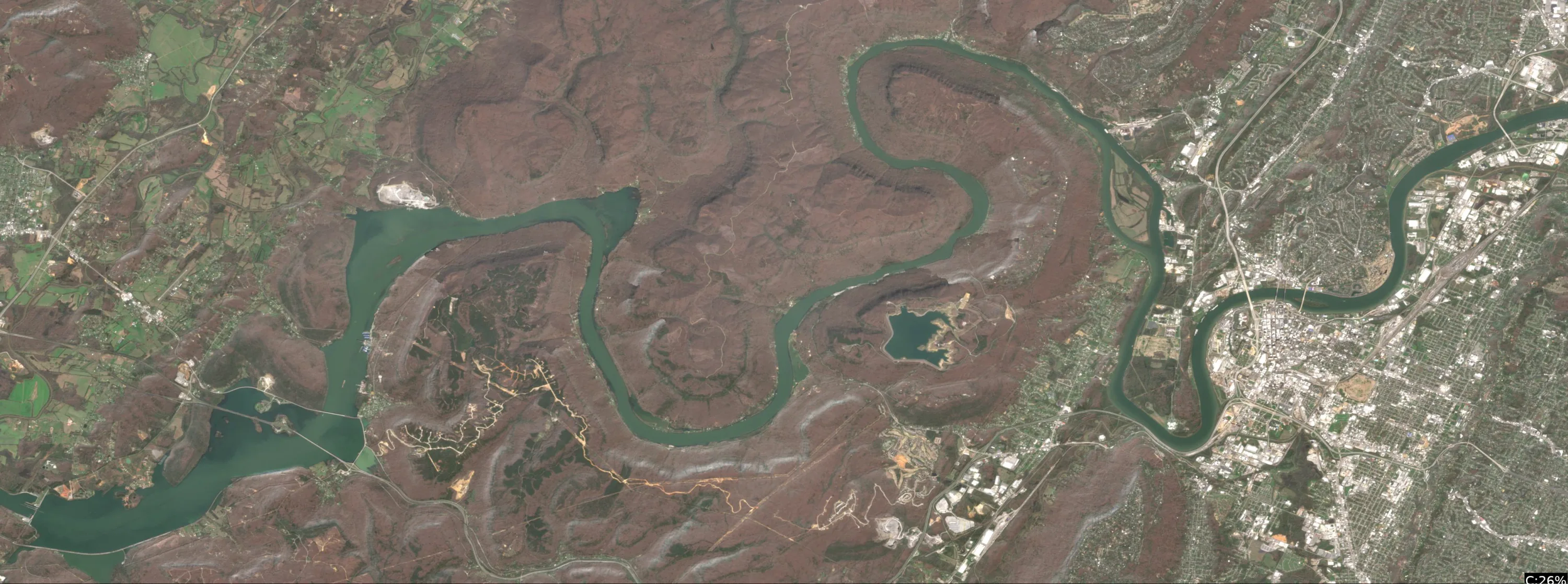
Nickajack Lake Fishing Report
Synthesis generated comprehensive plan with professional recommendations.
Nickajack Lake Fishing Report
Generated Dec 27, 2025, 5:45 PM.
Key fishing read
- Day 4: new - increased fish activity expected, especially at night
- Plan trips around major solunar periods for peak activity, minor periods offer secondary opportunities
- Loud/bright: chartreuse/black, Colorado blades, big profile cranks
-
1. Overall Water Quality Summary
The imagery reveals predominantly high sediment levels (tan/beige dominance in TSS visualization) across the entire lake body, combined with low chlorophyll in the main basin (dark navy blue in MCI) transitioning to moderate chlorophyll along shorelines and inflows (thin bright green lines in MCI). This maps primarily to the top-left (Brown/Tan: low chlorophyll + high sediment) and top-center (Brown/Green mix: moderate chlorophyll + high sediment) quadrants of the 2D matrix. Overall conditions indicate widespread muddy to stained water (visibility 1-6 feet), with no significant low-sediment clear zones (no dominant dark blue/teal or green bottom areas). Productivity edges exist where green chlorophyll streaks meet the dark blue main body.
2. Detailed Clarity Zone Mapping & Characterization
Zone 1: Main Basin (Central to Eastern Lake Body)
- Color Identification: Dark navy blue (MCI) + uniform tan/beige (TSS).
- Matrix Position Analysis: Top-left quadrant (low chlorophyll + high sediment).
- Location Mapping: Covers the broad central and eastern portions of the lake, from the midline westward to the narrow western arm, excluding shoreline fringes.
- Combined Conditions: High sediment with minimal algae = Brown/Tan muddy water, visibility 2-6 feet.
- Tactical Implications: Power fishing with vibration; target any subtle depth changes.
- Transition Zone Identification: Sharp edges where this meets Zone 2 green fringes (prime ambush lines).
Zone 2: Northern Shoreline Inflows and Fringes
- Color Identification: Bright green streaks/lines (MCI) + tan/beige overlay (TSS).
- Matrix Position Analysis: Top-center (moderate chlorophyll + high sediment).
- Location Mapping: Thin, sinuous green bands along the northern shoreline, extending into northwest and northeast inflows/arms, approximately 100-300 yards offshore from the northern edge.
- Combined Conditions: Sediment-laden with algae influence = Brown/Green stained productive water, visibility 1-4 feet.
- Tactical Implications: Loud, slow presentations; high fish activity likely at inflow mouths.
- Transition Zone Identification: Gradual fade from green to dark blue southward into main basin (clarity break running east-west across northern third).
Zone 3: Southern Shoreline Patches
- Color Identification: Scattered green patches (MCI) + tan/beige with minor yellow tinges (TSS).
- Matrix Position Analysis: Top-center shifting toward top-right (moderate-high chlorophyll + high sediment).
- Location Mapping: Intermittent green along the southern shoreline, concentrated in cove-like indentations near the southeastern corner.
- Combined Conditions: High particles + algae = Brown/Green to Dark Brown/Red mix, visibility 1-4 feet (locally <2 feet in yellow-tinged spots).
- Tactical Implications: Vibration and noise essential; finesse only near edges.
- Transition Zone Identification: Distinct breaks where southern green patches abut tan main body (short east-west lines in southern half).
Zone 4: Scattered Eastern Yellow/Orange Hotspots (TSS-Dominant)
- Color Identification: Isolated yellow/orange dots/clusters (TSS) over tan, with faint green MCI undertones.
- Matrix Position Analysis: Top-right (high chlorophyll + high sediment).
- Location Mapping: Small, discrete patches in the eastern central area, near the widest basin expansion.
- Combined Conditions: Maximum particles + algae = Dark Brown/Red worst visibility, <2 feet.
- Tactical Implications: Sound-only fishing; structure by electronics.
- Transition Zone Identification: Sharp halos around yellow spots into surrounding tan (high-contrast edges).
3. Turbidity/Algae Sources & Transition Zones Analysis
Source Identification (Visual): High sediment (tan/beige TSS dominance) appears widespread, likely from wind-stirred shallows or diffuse runoff, with no single massive inflow but contributing across the lake. Moderate algae (green MCI streaks) concentrates along northern shorelines and inflows (northwest/northeast arms), suggesting nutrient inputs from those riverine channels; southern patches indicate protected coves trapping algae. Yellow/orange TSS hotspots in the east point to localized high-sediment stir-up, possibly shallow flats.
Clarity Breaks/Edges:
- Sharp mudlines where tan main basin meets green northern fringes (east-west across northern third, ~1/3 mile long) – baitfish likely pinned, creating ambush points.
- Gradual green-to-blue shifts along northern inflows (fanning southward) – algae edges hold forage.
- Discrete halos around eastern yellow spots (circular, 50-100 yard radius) – turbidity walls for reaction feeding. These transitions are highly significant for fishing, as they concentrate prey and force predators to patrol edges, amplifying strike probability in otherwise uniform murk.
4. Species-Specific Clarity Strategy (Recommendations tied to zones)
- Largemouth/Smallmouth Bass: Target Zone 2 northern shoreline inflows and transitions (stained Brown/Green, 1-4ft vis) where bass ambush from structure into chlorophyll-rich water; also patrol Zone 1 main basin edges (muddy Tan, 2-6ft). Avoid deep Zone 4 yellow hotspots unless electronics show cover.
- Crappie: Suspend near cover in Zone 3 southern patches (Brown/Green to Dark Brown, 1-4ft) and their blue transitions – algae fringes provide insect/plan zooplankton cover.
- Stripers/Hybrids: Run inflows in Zone 2 north (moderate chl high sed) chasing shad pushed by turbidity; hit sharp northern mudlines for blitzes.
- Catfish: Bottom-bounce Zone 4 eastern yellow hotspots (<2ft Dark Brown/Red) and widespread Zone 1 tan – sediment hides scent trails near inflows. Use northern inflow mouths (NW/NE) and southern cove edges as primary compass-referenced spots; transitions amplify all species activity.
5. Tactical Fishing Adjustments (Lures/Presentations tied to zones)
Zone 1 Main Basin (Muddy Tan, 2-6ft vis): High-contrast colors (black/blue, chartreuse/orange) for silhouette; large profile baits like 1/2oz spinnerbaits, lipless crankbaits with rattles. Fast retrieves to cover water; long casts (20-30 yards), 12-15lb mono/fluoro. Fish transitions with steady ripple.
Zone 2 Northern Inflows (Stained Brown/Green, 1-4ft vis): Bright colors (chartreuse, white) with noise; chatterbaits, big worms on Carolina rigs. Slow, aggressive pops; moderate casts (20-30 yards), 12-15lb fluoro. Parallel clarity breaks with yo-yo retrieve.
Zone 3 Southern Patches (Stained to Worst, 1-4ft): Loud rattles (bright blues, orange); jigs with trailers or swimbaits. Very slow drag/ hop; braided 15lb for punch through algae. Stealth boat position 30+ yards off.
Zone 4 Eastern Hotspots (<2ft Dark Brown/Red): Vibration-only (black/chartreuse lipless, punch rigs); sound critical. Dead-stick or shake on bottom; close casts (10-20 yards), heavy braid 20lb.
Clarity Breaks General: Reaction baits (spinnerbaits, jerkbaits) parallel edges; fan-cast from clear side into turbid for spook-free approaches. Fluorocarbon in lighter zones, braid in heavy.
6. Seasonal Context (Interpretation of visual patterns)
The widespread tan sediment with localized green algae along inflows appears consistent with moderate wind/runoff events stirring shallows, potentially post-rain or fall turnover patterns at 64°F temps – not extreme blooms but elevated turbidity suggesting recent disturbance. Northern green fringes indicate resilient algae in nutrient paths despite sediment load, while the persistent dark blue MCI in the main basin shows core clarity maintenance in deeper water. Eastern yellow hotspots hint at isolated stir-up, typical of transitional conditions where fish adapt via edges.
- Day 1: High pressure (1021mb) - tougher bite, use finesse tactics
- Day 1: Moderate wind (7mph) - ideal conditions, target windblown points
- Day 1: MostlyCloudy, High: 53°F, Low: 34°F
- Day 2: High pressure (1012mb) - tougher bite, use finesse tactics
Tool analysis details
Estimate Seasonal Phase
No historical temperature data for Nickajack Lake
Analyze Solunar Timing
Solunar timing analysis for Nickajack Lake completed
Findings:
- Day 4: new - increased fish activity expected, especially at night
- Plan trips around major solunar periods for peak activity, minor periods offer secondary opportunities
Lure Matrix Wind Clarity
Lure guidance for wind=moderate, clarity=unknown.
Findings:
- Loud/bright: chartreuse/black, Colorado blades, big profile cranks
Analyze Water Clarity
1. Overall Water Quality Summary
The imagery reveals predominantly high sediment levels (tan/beige dominance in TSS visualization) across the entire lake body, combined with low chlorophyll in the main basin (dark navy blue in MCI) transitioning to moderate chlorophyll along shorelines and inflows (thin bright green lines in MCI). This maps primarily to the top-left (Brown/Tan: low chlorophyll + high sediment) and top-center (Brown/Green mix: moderate chlorophyll + high sediment) quadrants of the 2D matrix. Overall conditions indicate widespread muddy to stained water (visibility 1-6 feet), with no significant low-sediment clear zones (no dominant dark blue/teal or green bottom areas). Productivity edges exist where green chlorophyll streaks meet the dark blue main body.
2. Detailed Clarity Zone Mapping & Characterization
Zone 1: Main Basin (Central to Eastern Lake Body)
- Color Identification: Dark navy blue (MCI) + uniform tan/beige (TSS).
- Matrix Position Analysis: Top-left quadrant (low chlorophyll + high sediment).
- Location Mapping: Covers the broad central and eastern portions of the lake, from the midline westward to the narrow western arm, excluding shoreline fringes.
- Combined Conditions: High sediment with minimal algae = Brown/Tan muddy water, visibility 2-6 feet.
- Tactical Implications: Power fishing with vibration; target any subtle depth changes.
- Transition Zone Identification: Sharp edges where this meets Zone 2 green fringes (prime ambush lines).
Zone 2: Northern Shoreline Inflows and Fringes
- Color Identification: Bright green streaks/lines (MCI) + tan/beige overlay (TSS).
- Matrix Position Analysis: Top-center (moderate chlorophyll + high sediment).
- Location Mapping: Thin, sinuous green bands along the northern shoreline, extending into northwest and northeast inflows/arms, approximately 100-300 yards offshore from the northern edge.
- Combined Conditions: Sediment-laden with algae influence = Brown/Green stained productive water, visibility 1-4 feet.
- Tactical Implications: Loud, slow presentations; high fish activity likely at inflow mouths.
- Transition Zone Identification: Gradual fade from green to dark blue southward into main basin (clarity break running east-west across northern third).
Zone 3: Southern Shoreline Patches
- Color Identification: Scattered green patches (MCI) + tan/beige with minor yellow tinges (TSS).
- Matrix Position Analysis: Top-center shifting toward top-right (moderate-high chlorophyll + high sediment).
- Location Mapping: Intermittent green along the southern shoreline, concentrated in cove-like indentations near the southeastern corner.
- Combined Conditions: High particles + algae = Brown/Green to Dark Brown/Red mix, visibility 1-4 feet (locally <2 feet in yellow-tinged spots).
- Tactical Implications: Vibration and noise essential; finesse only near edges.
- Transition Zone Identification: Distinct breaks where southern green patches abut tan main body (short east-west lines in southern half).
Zone 4: Scattered Eastern Yellow/Orange Hotspots (TSS-Dominant)
- Color Identification: Isolated yellow/orange dots/clusters (TSS) over tan, with faint green MCI undertones.
- Matrix Position Analysis: Top-right (high chlorophyll + high sediment).
- Location Mapping: Small, discrete patches in the eastern central area, near the widest basin expansion.
- Combined Conditions: Maximum particles + algae = Dark Brown/Red worst visibility, <2 feet.
- Tactical Implications: Sound-only fishing; structure by electronics.
- Transition Zone Identification: Sharp halos around yellow spots into surrounding tan (high-contrast edges).
3. Turbidity/Algae Sources & Transition Zones Analysis
Source Identification (Visual): High sediment (tan/beige TSS dominance) appears widespread, likely from wind-stirred shallows or diffuse runoff, with no single massive inflow but contributing across the lake. Moderate algae (green MCI streaks) concentrates along northern shorelines and inflows (northwest/northeast arms), suggesting nutrient inputs from those riverine channels; southern patches indicate protected coves trapping algae. Yellow/orange TSS hotspots in the east point to localized high-sediment stir-up, possibly shallow flats.
Clarity Breaks/Edges:
- Sharp mudlines where tan main basin meets green northern fringes (east-west across northern third, ~1/3 mile long) – baitfish likely pinned, creating ambush points.
- Gradual green-to-blue shifts along northern inflows (fanning southward) – algae edges hold forage.
- Discrete halos around eastern yellow spots (circular, 50-100 yard radius) – turbidity walls for reaction feeding. These transitions are highly significant for fishing, as they concentrate prey and force predators to patrol edges, amplifying strike probability in otherwise uniform murk.
4. Species-Specific Clarity Strategy (Recommendations tied to zones)
- Largemouth/Smallmouth Bass: Target Zone 2 northern shoreline inflows and transitions (stained Brown/Green, 1-4ft vis) where bass ambush from structure into chlorophyll-rich water; also patrol Zone 1 main basin edges (muddy Tan, 2-6ft). Avoid deep Zone 4 yellow hotspots unless electronics show cover.
- Crappie: Suspend near cover in Zone 3 southern patches (Brown/Green to Dark Brown, 1-4ft) and their blue transitions – algae fringes provide insect/plan zooplankton cover.
- Stripers/Hybrids: Run inflows in Zone 2 north (moderate chl high sed) chasing shad pushed by turbidity; hit sharp northern mudlines for blitzes.
- Catfish: Bottom-bounce Zone 4 eastern yellow hotspots (<2ft Dark Brown/Red) and widespread Zone 1 tan – sediment hides scent trails near inflows. Use northern inflow mouths (NW/NE) and southern cove edges as primary compass-referenced spots; transitions amplify all species activity.
5. Tactical Fishing Adjustments (Lures/Presentations tied to zones)
Zone 1 Main Basin (Muddy Tan, 2-6ft vis): High-contrast colors (black/blue, chartreuse/orange) for silhouette; large profile baits like 1/2oz spinnerbaits, lipless crankbaits with rattles. Fast retrieves to cover water; long casts (20-30 yards), 12-15lb mono/fluoro. Fish transitions with steady ripple.
Zone 2 Northern Inflows (Stained Brown/Green, 1-4ft vis): Bright colors (chartreuse, white) with noise; chatterbaits, big worms on Carolina rigs. Slow, aggressive pops; moderate casts (20-30 yards), 12-15lb fluoro. Parallel clarity breaks with yo-yo retrieve.
Zone 3 Southern Patches (Stained to Worst, 1-4ft): Loud rattles (bright blues, orange); jigs with trailers or swimbaits. Very slow drag/ hop; braided 15lb for punch through algae. Stealth boat position 30+ yards off.
Zone 4 Eastern Hotspots (<2ft Dark Brown/Red): Vibration-only (black/chartreuse lipless, punch rigs); sound critical. Dead-stick or shake on bottom; close casts (10-20 yards), heavy braid 20lb.
Clarity Breaks General: Reaction baits (spinnerbaits, jerkbaits) parallel edges; fan-cast from clear side into turbid for spook-free approaches. Fluorocarbon in lighter zones, braid in heavy.
6. Seasonal Context (Interpretation of visual patterns)
The widespread tan sediment with localized green algae along inflows appears consistent with moderate wind/runoff events stirring shallows, potentially post-rain or fall turnover patterns at 64°F temps – not extreme blooms but elevated turbidity suggesting recent disturbance. Northern green fringes indicate resilient algae in nutrient paths despite sediment load, while the persistent dark blue MCI in the main basin shows core clarity maintenance in deeper water. Eastern yellow hotspots hint at isolated stir-up, typical of transitional conditions where fish adapt via edges.
Findings:
-
1. Overall Water Quality Summary
The imagery reveals predominantly high sediment levels (tan/beige dominance in TSS visualization) across the entire lake body, combined with low chlorophyll in the main basin (dark navy blue in MCI) transitioning to moderate chlorophyll along shorelines and inflows (thin bright green lines in MCI). This maps primarily to the top-left (Brown/Tan: low chlorophyll + high sediment) and top-center (Brown/Green mix: moderate chlorophyll + high sediment) quadrants of the 2D matrix. Overall conditions indicate widespread muddy to stained water (visibility 1-6 feet), with no significant low-sediment clear zones (no dominant dark blue/teal or green bottom areas). Productivity edges exist where green chlorophyll streaks meet the dark blue main body.
2. Detailed Clarity Zone Mapping & Characterization
Zone 1: Main Basin (Central to Eastern Lake Body)
- Color Identification: Dark navy blue (MCI) + uniform tan/beige (TSS).
- Matrix Position Analysis: Top-left quadrant (low chlorophyll + high sediment).
- Location Mapping: Covers the broad central and eastern portions of the lake, from the midline westward to the narrow western arm, excluding shoreline fringes.
- Combined Conditions: High sediment with minimal algae = Brown/Tan muddy water, visibility 2-6 feet.
- Tactical Implications: Power fishing with vibration; target any subtle depth changes.
- Transition Zone Identification: Sharp edges where this meets Zone 2 green fringes (prime ambush lines).
Zone 2: Northern Shoreline Inflows and Fringes
- Color Identification: Bright green streaks/lines (MCI) + tan/beige overlay (TSS).
- Matrix Position Analysis: Top-center (moderate chlorophyll + high sediment).
- Location Mapping: Thin, sinuous green bands along the northern shoreline, extending into northwest and northeast inflows/arms, approximately 100-300 yards offshore from the northern edge.
- Combined Conditions: Sediment-laden with algae influence = Brown/Green stained productive water, visibility 1-4 feet.
- Tactical Implications: Loud, slow presentations; high fish activity likely at inflow mouths.
- Transition Zone Identification: Gradual fade from green to dark blue southward into main basin (clarity break running east-west across northern third).
Zone 3: Southern Shoreline Patches
- Color Identification: Scattered green patches (MCI) + tan/beige with minor yellow tinges (TSS).
- Matrix Position Analysis: Top-center shifting toward top-right (moderate-high chlorophyll + high sediment).
- Location Mapping: Intermittent green along the southern shoreline, concentrated in cove-like indentations near the southeastern corner.
- Combined Conditions: High particles + algae = Brown/Green to Dark Brown/Red mix, visibility 1-4 feet (locally <2 feet in yellow-tinged spots).
- Tactical Implications: Vibration and noise essential; finesse only near edges.
- Transition Zone Identification: Distinct breaks where southern green patches abut tan main body (short east-west lines in southern half).
Zone 4: Scattered Eastern Yellow/Orange Hotspots (TSS-Dominant)
- Color Identification: Isolated yellow/orange dots/clusters (TSS) over tan, with faint green MCI undertones.
- Matrix Position Analysis: Top-right (high chlorophyll + high sediment).
- Location Mapping: Small, discrete patches in the eastern central area, near the widest basin expansion.
- Combined Conditions: Maximum particles + algae = Dark Brown/Red worst visibility, <2 feet.
- Tactical Implications: Sound-only fishing; structure by electronics.
- Transition Zone Identification: Sharp halos around yellow spots into surrounding tan (high-contrast edges).
3. Turbidity/Algae Sources & Transition Zones Analysis
Source Identification (Visual): High sediment (tan/beige TSS dominance) appears widespread, likely from wind-stirred shallows or diffuse runoff, with no single massive inflow but contributing across the lake. Moderate algae (green MCI streaks) concentrates along northern shorelines and inflows (northwest/northeast arms), suggesting nutrient inputs from those riverine channels; southern patches indicate protected coves trapping algae. Yellow/orange TSS hotspots in the east point to localized high-sediment stir-up, possibly shallow flats.
Clarity Breaks/Edges:
- Sharp mudlines where tan main basin meets green northern fringes (east-west across northern third, ~1/3 mile long) – baitfish likely pinned, creating ambush points.
- Gradual green-to-blue shifts along northern inflows (fanning southward) – algae edges hold forage.
- Discrete halos around eastern yellow spots (circular, 50-100 yard radius) – turbidity walls for reaction feeding. These transitions are highly significant for fishing, as they concentrate prey and force predators to patrol edges, amplifying strike probability in otherwise uniform murk.
4. Species-Specific Clarity Strategy (Recommendations tied to zones)
- Largemouth/Smallmouth Bass: Target Zone 2 northern shoreline inflows and transitions (stained Brown/Green, 1-4ft vis) where bass ambush from structure into chlorophyll-rich water; also patrol Zone 1 main basin edges (muddy Tan, 2-6ft). Avoid deep Zone 4 yellow hotspots unless electronics show cover.
- Crappie: Suspend near cover in Zone 3 southern patches (Brown/Green to Dark Brown, 1-4ft) and their blue transitions – algae fringes provide insect/plan zooplankton cover.
- Stripers/Hybrids: Run inflows in Zone 2 north (moderate chl high sed) chasing shad pushed by turbidity; hit sharp northern mudlines for blitzes.
- Catfish: Bottom-bounce Zone 4 eastern yellow hotspots (<2ft Dark Brown/Red) and widespread Zone 1 tan – sediment hides scent trails near inflows. Use northern inflow mouths (NW/NE) and southern cove edges as primary compass-referenced spots; transitions amplify all species activity.
5. Tactical Fishing Adjustments (Lures/Presentations tied to zones)
Zone 1 Main Basin (Muddy Tan, 2-6ft vis): High-contrast colors (black/blue, chartreuse/orange) for silhouette; large profile baits like 1/2oz spinnerbaits, lipless crankbaits with rattles. Fast retrieves to cover water; long casts (20-30 yards), 12-15lb mono/fluoro. Fish transitions with steady ripple.
Zone 2 Northern Inflows (Stained Brown/Green, 1-4ft vis): Bright colors (chartreuse, white) with noise; chatterbaits, big worms on Carolina rigs. Slow, aggressive pops; moderate casts (20-30 yards), 12-15lb fluoro. Parallel clarity breaks with yo-yo retrieve.
Zone 3 Southern Patches (Stained to Worst, 1-4ft): Loud rattles (bright blues, orange); jigs with trailers or swimbaits. Very slow drag/ hop; braided 15lb for punch through algae. Stealth boat position 30+ yards off.
Zone 4 Eastern Hotspots (<2ft Dark Brown/Red): Vibration-only (black/chartreuse lipless, punch rigs); sound critical. Dead-stick or shake on bottom; close casts (10-20 yards), heavy braid 20lb.
Clarity Breaks General: Reaction baits (spinnerbaits, jerkbaits) parallel edges; fan-cast from clear side into turbid for spook-free approaches. Fluorocarbon in lighter zones, braid in heavy.
6. Seasonal Context (Interpretation of visual patterns)
The widespread tan sediment with localized green algae along inflows appears consistent with moderate wind/runoff events stirring shallows, potentially post-rain or fall turnover patterns at 64°F temps – not extreme blooms but elevated turbidity suggesting recent disturbance. Northern green fringes indicate resilient algae in nutrient paths despite sediment load, while the persistent dark blue MCI in the main basin shows core clarity maintenance in deeper water. Eastern yellow hotspots hint at isolated stir-up, typical of transitional conditions where fish adapt via edges.
Analyze Weather Conditions
Weather analysis for Nickajack Lake completed
Findings:
- Day 1: High pressure (1021mb) - tougher bite, use finesse tactics
- Day 1: Moderate wind (7mph) - ideal conditions, target windblown points
- Day 1: MostlyCloudy, High: 53°F, Low: 34°F
- Day 2: High pressure (1012mb) - tougher bite, use finesse tactics
- Day 2: High winds (26mph) - seek protected areas, use heavier lures
Analyze Satellite Imagery
PRO-LEVEL SATELLITE ANALYSIS: Nickajack Lake, TN (Marion County)
1. LAKE OVERVIEW (Natural Sections & Landmarks)
Nickajack Lake is a long, winding reservoir stretching northwest-southeast along the Tennessee River valley, about 30 miles long with several wider pockets and narrow channels. It divides naturally into three main sections:
- Lower Lake (southeast near the dam): Narrower river channel opening into a broader basin, with the Nickajack Dam as the key divider.
- Main Lake Body (central section): Widest open water with islands and major points, flanked by steep bluffs and developed shorelines.
- Upper Lake (northwest arms): Branched creek arms like Island Creek and areas toward Jasper, with more coves and shallower bays.
Major Landmarks Visible:
- Nickajack Dam (straight concrete structure at the southeast end of the lower lake).
- Multiple boat ramps: One right at the dam (lower lake), another near Island Creek mouth (upper lake), and one by the marina cluster in the main body.
- Marinas: Prominent one in the main lake body on the northeast shore with boat slips and parking; smaller clusters near the dam.
- Bridges: Highway bridge crossing the lower lake channel just upstream of the dam.
- Islands: Several small islands in the main lake body, including a cluster near the central narrows.
- Inflows: Obvious creek mouths on the northwest (upper lake) and smaller ones on the southwest shore of the main body.
The lake narrows at a couple of points—like between the main body and upper arms via a choked channel past the islands—making navigation straightforward from boat ramps.
2. FINDABLE FISHING SPOTS
Here are 7 high-priority, boat-findable spots based on visible structure (points, channels) and cover (docks, laydowns). Prioritized 1-10 using structure/cover complexity, depth transitions (color gradients), seasonal fit (64°F suggests bass staging near transitions, crappie on vertical cover), and wind protection. All descriptions use visible satellite features only.
-
Spot: Lower Lake - Main Point Upstream of Dam
Priority: 9/10
General Area: Lower lake, just northwest of the dam.
How to Find It: Launch at the dam boat ramp, head northwest up the channel 0.5 miles to the first big rocky point on your right (southwest shore).
What You See: Prominent point jutting into the channel with a sharp color shift from light tan shallows to dark blue; cluster of 4-5 docks along the base.
Why Fish It: Point with docks offers structure-cover combo for staging bass; color transition suggests drop-off for crappie refuge. Wind-protected in the channel.
Best Approach: Cast jigs or soft plastics along the dock edges and color line; fan-cast the point face for smallmouth/largemouth. -
Spot: Main Lake Body - Island Cluster Point
Priority: 10/10
General Area: Central main lake, near the islands.
How to Find It: From the marina boat ramp, head southwest past the big island cluster to the northeast shore's longest point extending toward the islands.
What You See: Long point with multiple color gradients (tan to medium blue); scattered docks and linear laydowns from shore; islands create wind blocks.
Why Fish It: Complex point-island geometry with cover = prime bass ambush; transitions ideal for current-feeding spotted bass/crappie at 64°F.
Best Approach: Drift or troll the point edges with crankbaits; flip laydowns for largemouth. -
Spot: Main Lake Body - Marina Cove Point
Priority: 8/10
General Area: Northeast shore of main lake body.
How to Find It: Launch at the marina ramp, hug the northeast shore to the first cove with heavy dock clusters—the point at the cove mouth.
What You See: Dense row of boat house docks in the cove; point shows tan flats transitioning to darker water.
Why Fish It: Docks on a point provide vertical cover over transitions—perfect for crappie and pre-spawn bass holding tight. Sheltered from main lake wind.
Best Approach: Shoot jigs under docks; work the point with spinnerbaits. -
Spot: Upper Lake - Island Creek Mouth Point
Priority: 9/10
General Area: Northwest upper lake arm.
How to Find It: From main lake, go through the narrows past islands, then northwest up Island Creek arm to the obvious creek mouth point on the east shore.
What You See: Creek channel (dark serpentine line) dumping into lake at a broad point with light shallows and dock clusters.
Why Fish It: Creek inflow + point = migration funnel for bass; shallows for spawning flats transitioning to deeper refuge.
Best Approach: Fish the creek channel swing with swimbaits; target docks on the point. -
Spot: Main Lake Body - Southwest Shore Bluff Point
Priority: 7/10
General Area: Southwest shore of main lake.
How to Find It: From marina, cross to southwest shore, find the tallest bluff line then the point just north with a few laydowns.
What You See: Steep bluff backdrop to a point with linear dark laydowns extending into medium blue water.
Why Fish It: Bluff point with laydowns offers wind-blown cover for walleye/bass; exposed but structure-rich.
Best Approach: Parallel the laydowns with jigs; watch for wind pushing bait. -
Spot: Lower Lake - Bridge Channel Swing
Priority: 8/10
General Area: Lower lake channel.
How to Find It: From dam ramp, head under the highway bridge—the outside bend point on the north shore.
What You See: Channel bend with darker water hugging the point; small dock cluster at base.
Why Fish It: Channel swing pulls current for feeding bass/crappie; dock cover adds holding spots.
Best Approach: Anchor and cast into the bend; use live bait on bridge-side docks. -
Spot: Upper Lake - Western Arm Cove
Priority: 6/10
General Area: Far northwest upper lake.
How to Find It: Up Island Creek arm past the ramp, into the westernmost cove with clustered houses/docks.
What You See: Protected cove with irregular dark patches (possible vegetation) and dock lines along the back wall.
Why Fish It: Cove docks/veggies for crappie; shallow back for bass warmth at 64°F.
Best Approach: Pitch to back cove docks; edge the front with finesse worms.
3. VISIBLE FEATURES BY LAKE SECTION
Lower Lake (SE near dam): Channel points with docks (esp. post-dam and bridge), color shifts at bends, boat ramp at dam, highway bridge narrowing flow.
Main Lake Body (Central): Island clusters creating protected pockets, long points on NE/SW shores with docks/laydowns, marina with slips on NE shore, boat ramp nearby, prominent color gradients on points.
Upper Lake (NW arms): Creek mouths (Island Creek primary), coves with dock clusters, shallower tan bays, boat ramp near Island Creek, serpentine channels leading in.
Eastern/Western Arms (Minor off main/upper): Small coves on east main shore with houses; western upper arm coves more vegetated-looking dark patches.
4. PRACTICAL FISHING GUIDANCE
Suggested Fishing Progression (64°F Winter Transition):
- Start (Early AM): Lower lake - main point upstream of dam (wind-protected staging area; hit docks first for crappie).
- Mid-Morning: Move to main lake body - island cluster point (open water warms first; bass move up transitions).
- Pattern: Fish lower shallows/points early for active fish, transition to main lake docks midday as sun hits, end in upper creek mouths for afternoon bite. Crappie vertical on docks all day; bass horizontal on points.
Navigation Between Sections:
- Lower to main: Straight northwest from dam ramp past bridge (1-2 miles open channel).
- Main to upper: Southwest through island narrows, then NW up Island Creek arm (pass marina first).
- Quick loops: Circle main lake islands from marina ramp for multi-spot access.
These spots are all visible from the water—use your graph for fine-tuning color lines once on-site. Tight lines!
Findings:
-
PRO-LEVEL SATELLITE ANALYSIS: Nickajack Lake, TN (Marion County)
1. LAKE OVERVIEW (Natural Sections & Landmarks)
Nickajack Lake is a long, winding reservoir stretching northwest-southeast along the Tennessee River valley, about 30 miles long with several wider pockets and narrow channels. It divides naturally into three main sections:
- Lower Lake (southeast near the dam): Narrower river channel opening into a broader basin, with the Nickajack Dam as the key divider.
- Main Lake Body (central section): Widest open water with islands and major points, flanked by steep bluffs and developed shorelines.
- Upper Lake (northwest arms): Branched creek arms like Island Creek and areas toward Jasper, with more coves and shallower bays.
Major Landmarks Visible:
- Nickajack Dam (straight concrete structure at the southeast end of the lower lake).
- Multiple boat ramps: One right at the dam (lower lake), another near Island Creek mouth (upper lake), and one by the marina cluster in the main body.
- Marinas: Prominent one in the main lake body on the northeast shore with boat slips and parking; smaller clusters near the dam.
- Bridges: Highway bridge crossing the lower lake channel just upstream of the dam.
- Islands: Several small islands in the main lake body, including a cluster near the central narrows.
- Inflows: Obvious creek mouths on the northwest (upper lake) and smaller ones on the southwest shore of the main body.
The lake narrows at a couple of points—like between the main body and upper arms via a choked channel past the islands—making navigation straightforward from boat ramps.
2. FINDABLE FISHING SPOTS
Here are 7 high-priority, boat-findable spots based on visible structure (points, channels) and cover (docks, laydowns). Prioritized 1-10 using structure/cover complexity, depth transitions (color gradients), seasonal fit (64°F suggests bass staging near transitions, crappie on vertical cover), and wind protection. All descriptions use visible satellite features only.
-
Spot: Lower Lake - Main Point Upstream of Dam
Priority: 9/10
General Area: Lower lake, just northwest of the dam.
How to Find It: Launch at the dam boat ramp, head northwest up the channel 0.5 miles to the first big rocky point on your right (southwest shore).
What You See: Prominent point jutting into the channel with a sharp color shift from light tan shallows to dark blue; cluster of 4-5 docks along the base.
Why Fish It: Point with docks offers structure-cover combo for staging bass; color transition suggests drop-off for crappie refuge. Wind-protected in the channel.
Best Approach: Cast jigs or soft plastics along the dock edges and color line; fan-cast the point face for smallmouth/largemouth. -
Spot: Main Lake Body - Island Cluster Point
Priority: 10/10
General Area: Central main lake, near the islands.
How to Find It: From the marina boat ramp, head southwest past the big island cluster to the northeast shore's longest point extending toward the islands.
What You See: Long point with multiple color gradients (tan to medium blue); scattered docks and linear laydowns from shore; islands create wind blocks.
Why Fish It: Complex point-island geometry with cover = prime bass ambush; transitions ideal for current-feeding spotted bass/crappie at 64°F.
Best Approach: Drift or troll the point edges with crankbaits; flip laydowns for largemouth. -
Spot: Main Lake Body - Marina Cove Point
Priority: 8/10
General Area: Northeast shore of main lake body.
How to Find It: Launch at the marina ramp, hug the northeast shore to the first cove with heavy dock clusters—the point at the cove mouth.
What You See: Dense row of boat house docks in the cove; point shows tan flats transitioning to darker water.
Why Fish It: Docks on a point provide vertical cover over transitions—perfect for crappie and pre-spawn bass holding tight. Sheltered from main lake wind.
Best Approach: Shoot jigs under docks; work the point with spinnerbaits. -
Spot: Upper Lake - Island Creek Mouth Point
Priority: 9/10
General Area: Northwest upper lake arm.
How to Find It: From main lake, go through the narrows past islands, then northwest up Island Creek arm to the obvious creek mouth point on the east shore.
What You See: Creek channel (dark serpentine line) dumping into lake at a broad point with light shallows and dock clusters.
Why Fish It: Creek inflow + point = migration funnel for bass; shallows for spawning flats transitioning to deeper refuge.
Best Approach: Fish the creek channel swing with swimbaits; target docks on the point. -
Spot: Main Lake Body - Southwest Shore Bluff Point
Priority: 7/10
General Area: Southwest shore of main lake.
How to Find It: From marina, cross to southwest shore, find the tallest bluff line then the point just north with a few laydowns.
What You See: Steep bluff backdrop to a point with linear dark laydowns extending into medium blue water.
Why Fish It: Bluff point with laydowns offers wind-blown cover for walleye/bass; exposed but structure-rich.
Best Approach: Parallel the laydowns with jigs; watch for wind pushing bait. -
Spot: Lower Lake - Bridge Channel Swing
Priority: 8/10
General Area: Lower lake channel.
How to Find It: From dam ramp, head under the highway bridge—the outside bend point on the north shore.
What You See: Channel bend with darker water hugging the point; small dock cluster at base.
Why Fish It: Channel swing pulls current for feeding bass/crappie; dock cover adds holding spots.
Best Approach: Anchor and cast into the bend; use live bait on bridge-side docks. -
Spot: Upper Lake - Western Arm Cove
Priority: 6/10
General Area: Far northwest upper lake.
How to Find It: Up Island Creek arm past the ramp, into the westernmost cove with clustered houses/docks.
What You See: Protected cove with irregular dark patches (possible vegetation) and dock lines along the back wall.
Why Fish It: Cove docks/veggies for crappie; shallow back for bass warmth at 64°F.
Best Approach: Pitch to back cove docks; edge the front with finesse worms.
3. VISIBLE FEATURES BY LAKE SECTION
Lower Lake (SE near dam): Channel points with docks (esp. post-dam and bridge), color shifts at bends, boat ramp at dam, highway bridge narrowing flow.
Main Lake Body (Central): Island clusters creating protected pockets, long points on NE/SW shores with docks/laydowns, marina with slips on NE shore, boat ramp nearby, prominent color gradients on points.
Upper Lake (NW arms): Creek mouths (Island Creek primary), coves with dock clusters, shallower tan bays, boat ramp near Island Creek, serpentine channels leading in.
Eastern/Western Arms (Minor off main/upper): Small coves on east main shore with houses; western upper arm coves more vegetated-looking dark patches.
4. PRACTICAL FISHING GUIDANCE
Suggested Fishing Progression (64°F Winter Transition):
- Start (Early AM): Lower lake - main point upstream of dam (wind-protected staging area; hit docks first for crappie).
- Mid-Morning: Move to main lake body - island cluster point (open water warms first; bass move up transitions).
- Pattern: Fish lower shallows/points early for active fish, transition to main lake docks midday as sun hits, end in upper creek mouths for afternoon bite. Crappie vertical on docks all day; bass horizontal on points.
Navigation Between Sections:
- Lower to main: Straight northwest from dam ramp past bridge (1-2 miles open channel).
- Main to upper: Southwest through island narrows, then NW up Island Creek arm (pass marina first).
- Quick loops: Circle main lake islands from marina ramp for multi-spot access.
These spots are all visible from the water—use your graph for fine-tuning color lines once on-site. Tight lines!
Analyze Pressure Trends
Barometric pressure analysis for Nickajack Lake: rising trend at 1021.00mb
Findings:
- Rising pressure trend (1021.00 → higher). Bite may slow down as fish become less active.
- Switch to finesse tactics, target deeper structure. Fish will be less aggressive.
Analyze Thermal Patterns
Overall Thermal Landscape Summary
Assuming North is at the top of the image, East to the right, West to the left, and South at the bottom. The lake features an irregular, elongated shape oriented roughly northwest-southeast, with a prominent river-like inlet entering from the northeast shore (top-right quadrant, marked by the narrow channel extending southwest from the 39° label). Major visual anchors include: (1) the northeast river mouth/inlet (narrow, curving channel near 39° and 38° labels), (2) the highly indented western shoreline (left side) with multiple narrow coves and points extending eastward, and (3) the relatively straighter eastern shoreline (right side) narrowing toward the south. Dominant colors across water areas are very dark navy blue to dark blue, indicating the coldest ranges on the scale: very dark navy blue (40-42°F / 4-6°C) and dark blue (42-46°F / 6-8°C). Approximate min/max visible temperatures: 40°F (4°C) minimum in most areas to around 46°F (8°C) maximum near the northeast inlet; overlaid numerical labels (34°-39°) suggest slightly sub-scale cold but align visually with the darkest blues.
Detailed Thermal Feature Analysis
Temperature Breaks
Clearly visible abrupt color transitions are limited due to overall uniformity, but a subtle break exists along the water-side of the northeast river mouth (narrow channel from top-right edge, near 39° label), shifting from dark blue (42-46°F / 6-8°C) in the inlet to very dark navy blue (40-42°F / 4-6°C) in the adjacent main lake body to its southwest. This break runs parallel to the inlet's southern bank for about one-third the lake's width. No other sharp breaks are distinguishable; shoreline transitions show expected land-water jumps (warmer land tones ignored).
Pockets/Patches
No distinct isolated pockets or patches of differing colors are clearly visible in open water areas. The northeast inlet area (curving channel near 39° and 38° labels) shows a slightly less intense very dark navy blue, visually aligning with dark blue (42-46°F / 6-8°C), forming a narrow, elongated patch extending southwest ~20% into the lake before blending uniformly.
Gradients
A gradual transition is observable from the northeast inlet (dark blue, 42-46°F / 6-8°C near 39°/38° labels) southward along the eastern shoreline, fading into very dark navy blue (40-42°F / 4-6°C) toward the 36°, 35°, and 34° label areas in the southeast (bottom-right). This gradient follows the straighter eastern bank, spanning ~half the lake's length. Western coves (indented left shoreline) show no discernible gradient, remaining uniformly very dark navy blue.
Uniform Areas
The majority of the lake—covering the central body, all western coves (left indented shore), and southern half (below central constriction)—appears uniformly very dark navy blue (40-42°F / 4-6°C), with overlaid labels (36°, 35°, 34° in southeast) reinforcing extreme cold consistency. Eastern shoreline south of inlet is uniformly dark blue transitioning to very dark navy (42-46°F / 6-8°C fading to 40-42°F / 4-6°C).
Insightful Fish Behavior Interpretation
Visible thermal patterns indicate extremely cold surface conditions (dominant 40-46°F / 4-8°C), corresponding to very dark navy blue/dark blue zones where fish behavior would be extremely sluggish with minimal surface feeding; fish likely hold tight to structure in deep patterns, showing very slow metabolism and long but infrequent feeding windows oriented toward any subtle warmer inflows. The subtle warmer break/gradient near the northeast inlet (dark blue, 42-46°F / 6-8°C) may attract fish following these minor surface temperature changes for comfort, promoting very slow, structure-oriented activity at the surface-shallow interface. Uniform cold areas suggest fish avoiding open surfaces, concentrating near shorelines or inflows for any relative warmth. Focus on surface behavior only: expect negligible shallow-water activity except possibly dawn/dusk near the inlet transition.
Satellite Correlation Analysis
No additional standard satellite imagery (e.g., visible light photos) is provided alongside the thermal data. Thermal patterns correlate directly with shoreline geometry: the northeast inlet (river mouth near 39°/38°) shows the only relative warming, likely caused by surface inflow mixing cooler main-lake water; indented western coves exhibit uniform cold, suggesting no significant surface inflows or wind-mixing; straighter eastern gradient aligns with narrowing channel, possibly indicating reduced mixing southward. No springs, outflows, or wind-mixed zones clearly identifiable beyond these geometry-driven patterns.
Actionable Fishing Recommendations
Target the subtle temperature break/gradient at the northeast river mouth (narrow curving inlet from top-right, near 39°/38° labels, extending southwest along eastern bank), fishing the dark blue (42-46°F / 6-8°C) transition edge into very dark navy blue (40-42°F / 4-6°C)—prime for sluggish fish staging on inflow structure; use slow presentations (jigs, dead-stick bait) parallel to the inlet's southern bank. Avoid uniform very dark navy blue central/western areas due to minimal surface activity. In extreme cold, prioritize long soaks near this single warmer transition over open water. Image quality limits further specificity; patterns are subtle and uniform overall.
Findings:
- Current surface temperature: 64.0°F. Fish showing moderate activity levels. Target temperature transition zones where warmer water meets cooler areas, often near inflows or wind-protected bays.
-
Overall Thermal Landscape Summary
Assuming North is at the top of the image, East to the right, West to the left, and South at the bottom. The lake features an irregular, elongated shape oriented roughly northwest-southeast, with a prominent river-like inlet entering from the northeast shore (top-right quadrant, marked by the narrow channel extending southwest from the 39° label). Major visual anchors include: (1) the northeast river mouth/inlet (narrow, curving channel near 39° and 38° labels), (2) the highly indented western shoreline (left side) with multiple narrow coves and points extending eastward, and (3) the relatively straighter eastern shoreline (right side) narrowing toward the south. Dominant colors across water areas are very dark navy blue to dark blue, indicating the coldest ranges on the scale: very dark navy blue (40-42°F / 4-6°C) and dark blue (42-46°F / 6-8°C). Approximate min/max visible temperatures: 40°F (4°C) minimum in most areas to around 46°F (8°C) maximum near the northeast inlet; overlaid numerical labels (34°-39°) suggest slightly sub-scale cold but align visually with the darkest blues.
Detailed Thermal Feature Analysis
Temperature Breaks
Clearly visible abrupt color transitions are limited due to overall uniformity, but a subtle break exists along the water-side of the northeast river mouth (narrow channel from top-right edge, near 39° label), shifting from dark blue (42-46°F / 6-8°C) in the inlet to very dark navy blue (40-42°F / 4-6°C) in the adjacent main lake body to its southwest. This break runs parallel to the inlet's southern bank for about one-third the lake's width. No other sharp breaks are distinguishable; shoreline transitions show expected land-water jumps (warmer land tones ignored).
Pockets/Patches
No distinct isolated pockets or patches of differing colors are clearly visible in open water areas. The northeast inlet area (curving channel near 39° and 38° labels) shows a slightly less intense very dark navy blue, visually aligning with dark blue (42-46°F / 6-8°C), forming a narrow, elongated patch extending southwest ~20% into the lake before blending uniformly.
Gradients
A gradual transition is observable from the northeast inlet (dark blue, 42-46°F / 6-8°C near 39°/38° labels) southward along the eastern shoreline, fading into very dark navy blue (40-42°F / 4-6°C) toward the 36°, 35°, and 34° label areas in the southeast (bottom-right). This gradient follows the straighter eastern bank, spanning ~half the lake's length. Western coves (indented left shoreline) show no discernible gradient, remaining uniformly very dark navy blue.
Uniform Areas
The majority of the lake—covering the central body, all western coves (left indented shore), and southern half (below central constriction)—appears uniformly very dark navy blue (40-42°F / 4-6°C), with overlaid labels (36°, 35°, 34° in southeast) reinforcing extreme cold consistency. Eastern shoreline south of inlet is uniformly dark blue transitioning to very dark navy (42-46°F / 6-8°C fading to 40-42°F / 4-6°C).
Insightful Fish Behavior Interpretation
Visible thermal patterns indicate extremely cold surface conditions (dominant 40-46°F / 4-8°C), corresponding to very dark navy blue/dark blue zones where fish behavior would be extremely sluggish with minimal surface feeding; fish likely hold tight to structure in deep patterns, showing very slow metabolism and long but infrequent feeding windows oriented toward any subtle warmer inflows. The subtle warmer break/gradient near the northeast inlet (dark blue, 42-46°F / 6-8°C) may attract fish following these minor surface temperature changes for comfort, promoting very slow, structure-oriented activity at the surface-shallow interface. Uniform cold areas suggest fish avoiding open surfaces, concentrating near shorelines or inflows for any relative warmth. Focus on surface behavior only: expect negligible shallow-water activity except possibly dawn/dusk near the inlet transition.
Satellite Correlation Analysis
No additional standard satellite imagery (e.g., visible light photos) is provided alongside the thermal data. Thermal patterns correlate directly with shoreline geometry: the northeast inlet (river mouth near 39°/38°) shows the only relative warming, likely caused by surface inflow mixing cooler main-lake water; indented western coves exhibit uniform cold, suggesting no significant surface inflows or wind-mixing; straighter eastern gradient aligns with narrowing channel, possibly indicating reduced mixing southward. No springs, outflows, or wind-mixed zones clearly identifiable beyond these geometry-driven patterns.
Actionable Fishing Recommendations
Target the subtle temperature break/gradient at the northeast river mouth (narrow curving inlet from top-right, near 39°/38° labels, extending southwest along eastern bank), fishing the dark blue (42-46°F / 6-8°C) transition edge into very dark navy blue (40-42°F / 4-6°C)—prime for sluggish fish staging on inflow structure; use slow presentations (jigs, dead-stick bait) parallel to the inlet's southern bank. Avoid uniform very dark navy blue central/western areas due to minimal surface activity. In extreme cold, prioritize long soaks near this single warmer transition over open water. Image quality limits further specificity; patterns are subtle and uniform overall.
- Winter surface patterns: Target the warmest surface areas during midday, typically along north-facing shorelines and sun-exposed areas. Use slow presentations as fish metabolism is reduced.
Analyze Species Behavior
Species behavior analysis for Nickajack Lake completed
Findings:
- Largemouth bass: Active in optimal temps (64.0°F), aggressive feeding on structure and cover
- Smallmouth bass: Active in optimal temps (64.0°F), aggressive feeding on structure and cover
- Spotted bass: Active in optimal temps (64.0°F), aggressive feeding on structure and cover
- White crappie: Pre-spawn/spawn temps (64.0°F), target shallow cover with small jigs
- Black crappie: Pre-spawn/spawn temps (64.0°F), target shallow cover with small jigs
How this was synthesized
Professional fishing guide analysis integrating 11 tools: estimate_seasonal_phase, analyze_hourly_conditions, analyze_solunar_timing, lure_matrix_wind_clarity, analyze_water_clarity, analyze_weather_conditions, analyze_satellite_imagery, analyze_pressure_trends, analyze_thermal_patterns, get_community_reports, analyze_species_behavior. User request: 'Generate a comprehensive fishing report for Nickajack Lake. Use tools to analyze satellite structure, thermal patterns, water clarity, weather, and solunar timing, then synthesize a concise plan.'. Synthesis generated comprehensive plan with professional recommendations.