Rufus Woods Lake Fishing Report
Synthesis generated comprehensive plan with professional recommendations.
Rufus Woods Lake Fishing Report
Generated Mar 31, 2026, 2:46 PM.
Key fishing read
- Day 1: High pressure (1013mb) - tougher bite, use finesse tactics
- Day 1: Moderate wind (10mph) - ideal conditions, target windblown points
- Day 1: Cloudy, High: 49°F, Low: 29°F
- Day 2: High pressure (1003mb) - tougher bite, use finesse tactics
- Day 2: High winds (19mph) - seek protected areas, use heavier lures
- Day 2: Rain, High: 45°F, Low: 33°F
- Day 3: High pressure (1010mb) - tougher bite, use finesse tactics
- Day 3: High winds (20mph) - seek protected areas, use heavier lures
Tool analysis details
Analyze Weather Conditions
Weather analysis for Rufus Woods Lake completed
Findings:
- Day 1: High pressure (1013mb) - tougher bite, use finesse tactics
- Day 1: Moderate wind (10mph) - ideal conditions, target windblown points
- Day 1: Cloudy, High: 49°F, Low: 29°F
- Day 2: High pressure (1003mb) - tougher bite, use finesse tactics
- Day 2: High winds (19mph) - seek protected areas, use heavier lures
Analyze Pressure Trends
Barometric pressure analysis for Rufus Woods Lake: rising trend at 1013.00mb
Findings:
- Rising pressure trend (1013.00 → higher). Bite may slow down as fish become less active.
- Switch to finesse tactics, target deeper structure. Fish will be less aggressive.
Analyze Solunar Timing
Solunar timing analysis for Rufus Woods Lake completed
Findings:
- 2026-03-31 Major feeding periods: 12:00 AM - 12:00 AM, 07:31 AM - 10:01 AM
- 2026-03-31 Minor feeding periods: 05:51 PM - 07:21 PM, 05:30 AM - 07:00 AM
- 2026-04-01 Major feeding periods: 12:00 AM - 12:00 AM, 08:13 AM - 10:43 AM
- 2026-04-01 Minor feeding periods: 07:02 PM - 08:32 PM, 05:44 AM - 07:14 AM
- 2026-04-02 Major feeding periods: 12:36 AM - 03:06 AM, 08:56 AM - 11:26 AM
Analyze Thermal Patterns
1. Overall Thermal Landscape Summary
- Assumed Orientation: Assuming North is at the top of the image.
- Major Visual Anchors:
- The Western Basin: A distinct, wider body of water on the left side of the image.
- The Central Channel: A long, narrow, winding section connecting the western basin to the eastern section.
- The Eastern Shoreline: A sweeping, curved bank on the far right.
- Summary: The lake is dominated by very cold, uniform surface temperatures. The entire visible water surface falls within the Very Dark Navy Blue (40-42°F / 4-6°C) to Dark Blue (42-46°F / 6-8°C) range. There is no evidence of warmer surface water, indicating a cold-water environment consistent with late winter or early spring conditions.
2. Detailed Thermal Feature Analysis
- Temperature Breaks:
- There are no significant thermal breaks or "edges" visible. The transition between the water and the surrounding land (white/black borders) is sharp, but the water itself maintains a consistent, cold thermal signature across the entire visible area.
- Pockets/Patches:
- The Western Basin shows a slightly lighter blue hue compared to the rest of the channel, suggesting it is at the warmer end of the observed spectrum (approaching 45-46°F / 7-8°C).
- The Central Channel is uniformly dark, representing the coldest water in the image (40-42°F / 4-6°C).
- Gradients:
- There are no visible thermal gradients. The lack of color variation indicates a well-mixed or uniformly cold surface layer.
- Uniform Areas:
- The vast majority of the lake, particularly the central and eastern sections, is uniform in color, indicating a stable, cold surface temperature environment.
3. Insightful Fish Behavior Interpretation
- General Expectations: Given the surface temperatures are consistently in the 40-46°F (4-8°C) range, fish metabolism will be extremely low.
- Behavioral Patterns: Fish are likely in a "wintering" mode. They will be lethargic, holding tight to the bottom or near structure to conserve energy. Surface feeding activity will be virtually non-existent.
- Movement: Fish will not be actively roaming or chasing bait. They are likely holding in the most stable thermal environments available, which, based on this image, is the entire lake.
4. Satellite Correlation Analysis
- Inflow/Outflow: No specific thermal signatures (such as warmer or cooler plumes) are visible that would indicate active river inflows or spring activity. The water temperature is uniform, suggesting that any inflows are currently at the same temperature as the main lake body.
- Wind-Mixing: The uniformity of the temperature suggests that the lake is likely well-mixed by wind, preventing any surface stratification or localized warming.
5. Actionable Fishing Recommendations
- Targeting Strategy: Because the entire surface is uniformly cold, do not look for "warm spots" on the surface. Instead, focus on structure. Since the fish are sluggish, you must present your bait directly to them.
- Technique: Use slow-moving, finesse presentations. Vertical jigging or slow-dragging baits along the bottom will be more effective than any horizontal or fast-moving lures.
- Location: Focus on the Western Basin. While the temperature difference is subtle, the slightly lighter blue color suggests it may be marginally more comfortable for fish than the colder, narrow central channel.
- Depth: Since the surface is uniformly cold, ignore surface temperature as a guide for depth. Focus on finding the deepest, most stable water or identifiable bottom structure, as the fish will be seeking the most stable environment possible in these cold conditions.
- Timing: Given the cold water, the "best" time to fish will be during the warmest part of the day (mid-afternoon), even if the surface temperature change is negligible, as it may provide a slight psychological or metabolic boost to the fish.
Findings:
- Current surface temperature: 38.0°F. Fish metabolism significantly reduced in cold water. Target sunny, protected shorelines and use extremely slow presentations. Focus on midday when surface temperatures are warmest.
-
1. Overall Thermal Landscape Summary
- Assumed Orientation: Assuming North is at the top of the image.
- Major Visual Anchors:
- The Western Basin: A distinct, wider body of water on the left side of the image.
- The Central Channel: A long, narrow, winding section connecting the western basin to the eastern section.
- The Eastern Shoreline: A sweeping, curved bank on the far right.
- Summary: The lake is dominated by very cold, uniform surface temperatures. The entire visible water surface falls within the Very Dark Navy Blue (40-42°F / 4-6°C) to Dark Blue (42-46°F / 6-8°C) range. There is no evidence of warmer surface water, indicating a cold-water environment consistent with late winter or early spring conditions.
2. Detailed Thermal Feature Analysis
- Temperature Breaks:
- There are no significant thermal breaks or "edges" visible. The transition between the water and the surrounding land (white/black borders) is sharp, but the water itself maintains a consistent, cold thermal signature across the entire visible area.
- Pockets/Patches:
- The Western Basin shows a slightly lighter blue hue compared to the rest of the channel, suggesting it is at the warmer end of the observed spectrum (approaching 45-46°F / 7-8°C).
- The Central Channel is uniformly dark, representing the coldest water in the image (40-42°F / 4-6°C).
- Gradients:
- There are no visible thermal gradients. The lack of color variation indicates a well-mixed or uniformly cold surface layer.
- Uniform Areas:
- The vast majority of the lake, particularly the central and eastern sections, is uniform in color, indicating a stable, cold surface temperature environment.
3. Insightful Fish Behavior Interpretation
- General Expectations: Given the surface temperatures are consistently in the 40-46°F (4-8°C) range, fish metabolism will be extremely low.
- Behavioral Patterns: Fish are likely in a "wintering" mode. They will be lethargic, holding tight to the bottom or near structure to conserve energy. Surface feeding activity will be virtually non-existent.
- Movement: Fish will not be actively roaming or chasing bait. They are likely holding in the most stable thermal environments available, which, based on this image, is the entire lake.
4. Satellite Correlation Analysis
- Inflow/Outflow: No specific thermal signatures (such as warmer or cooler plumes) are visible that would indicate active river inflows or spring activity. The water temperature is uniform, suggesting that any inflows are currently at the same temperature as the main lake body.
- Wind-Mixing: The uniformity of the temperature suggests that the lake is likely well-mixed by wind, preventing any surface stratification or localized warming.
5. Actionable Fishing Recommendations
- Targeting Strategy: Because the entire surface is uniformly cold, do not look for "warm spots" on the surface. Instead, focus on structure. Since the fish are sluggish, you must present your bait directly to them.
- Technique: Use slow-moving, finesse presentations. Vertical jigging or slow-dragging baits along the bottom will be more effective than any horizontal or fast-moving lures.
- Location: Focus on the Western Basin. While the temperature difference is subtle, the slightly lighter blue color suggests it may be marginally more comfortable for fish than the colder, narrow central channel.
- Depth: Since the surface is uniformly cold, ignore surface temperature as a guide for depth. Focus on finding the deepest, most stable water or identifiable bottom structure, as the fish will be seeking the most stable environment possible in these cold conditions.
- Timing: Given the cold water, the "best" time to fish will be during the warmest part of the day (mid-afternoon), even if the surface temperature change is negligible, as it may provide a slight psychological or metabolic boost to the fish.
- Spring warming: Focus on shallow bays and areas showing the warmest surface temperatures in thermal imagery as fish move into spawning areas.
Analyze Satellite Imagery
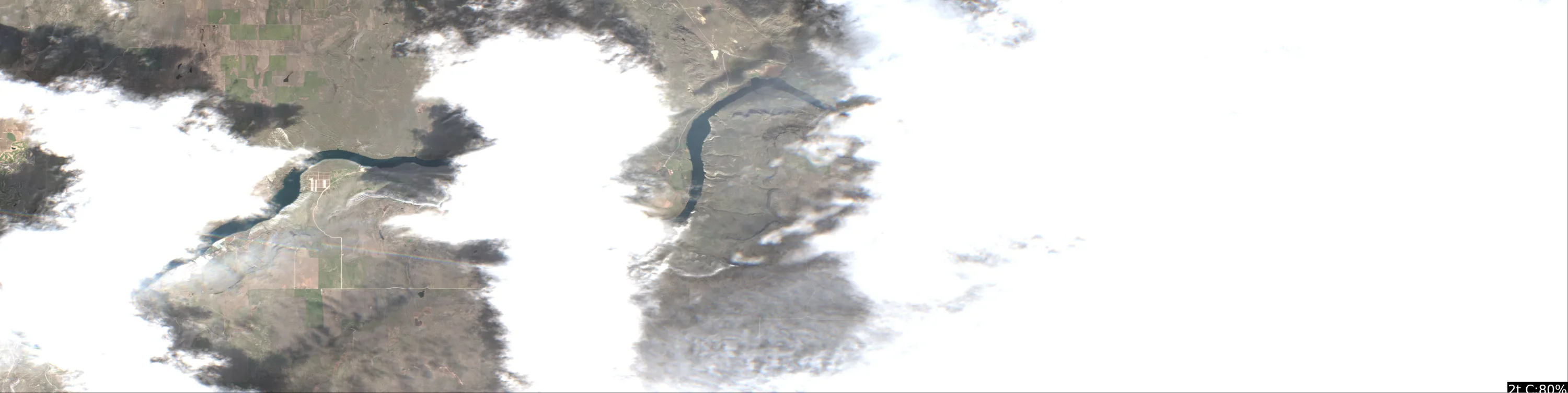
This analysis focuses on the visible sections of Rufus Woods Lake as captured in the provided satellite imagery. Given the current water temperature of 38°F, the fish are in a winter/pre-spawn holding pattern, meaning they will be tightly associated with the main river channel and deeper structural breaks.
1. LAKE OVERVIEW
Rufus Woods Lake is a long, narrow reservoir formed by the Columbia River. In this imagery, we see two distinct segments separated by cloud cover:
- Western Section: Features a prominent bend in the river channel with a visible facility/infrastructure complex on the northern bank.
- Eastern Section: A more linear stretch of the main river channel.
- Navigation Note: The lake acts as a riverine system. The "main lake" is essentially the deep, dark-blue channel that snakes through the center of the frame.
2. FINDABLE FISHING SPOTS
Spot 1: The Western Bend Point
- General Area: Western Section.
- How to Find It: Locate the facility complex on the north bank; the point is the sharp land protrusion immediately to the west of the facility.
- What You See: A sharp, angular point where the river channel makes a significant turn.
- Why Fish It: The sharp geometry indicates a steep drop-off. In 38°F water, fish will hold on these "corners" to minimize energy expenditure while staying near the main current.
- Best Approach: Vertical jigging or slow-trolling along the edge of the dark-blue channel line.
Spot 2: The Facility Channel Edge
- General Area: Western Section.
- How to Find It: Directly in front of the visible facility complex on the north bank.
- What You See: A straight, deep-water bank where the dark blue water meets the shoreline.
- Why Fish It: The proximity to man-made structures often provides a heat-sink effect or structural variation that attracts baitfish.
- Best Approach: Cast parallel to the bank, allowing your lure to sink into the transition zone between the light-colored shallows and the dark channel.
Spot 3: The Eastern Channel Straight
- General Area: Eastern Section.
- How to Find It: Follow the main river channel as it runs north-to-south in the eastern portion of the image.
- What You See: A long, uniform stretch of deep, dark water.
- Why Fish It: During cold-water periods, the main channel is the primary highway for trout and walleye.
- Best Approach: Trolling with downriggers or lead-core line to keep baits in the deep, dark-blue water column.
3. VISIBLE FEATURES BY SECTION
- Western Section:
- The Sharp Bend: A high-priority structural point where the channel turns.
- Facility Bank: A long, deep-water stretch adjacent to the visible buildings.
- Eastern Section:
- The Channel Run: A long, consistent stretch of deep water that provides the primary thermal refuge for fish in the current 38°F conditions.
4. PRACTICAL FISHING GUIDANCE
- Start: Begin in the Western Section near the sharp bend. The structural change here is the most significant feature visible and is likely to hold fish transitioning along the channel.
- Mid-Morning: Move to the Eastern Section channel run. As the sun hits the water, fish may suspend slightly higher in the water column over the deepest parts of the channel.
- Pattern: Because the water is 38°F, do not waste time in the shallow, light-colored flats. Focus 100% of your effort on the dark-blue/black water lines—this is where the main river channel flows, and it is the only place fish will be active.
- Navigation: The two sections are connected by the main river channel. When moving between them, stay within the dark-blue water to ensure you remain in the navigable channel and the primary fish-holding zone.
Priority Target Ranking:
- Western Bend Point: 9/10 (High structural complexity, clear channel access).
- Facility Bank: 7/10 (Good depth transition, easy to navigate).
- Eastern Channel Run: 6/10 (Consistent, but lacks the structural "corners" of the western section).
Findings:
- This analysis focuses on the visible sections of Rufus Woods Lake as captured in the provided satellite imagery. Given the current water temperature of 38°F, the fish are in a winter/pre-spawn holding pattern, meaning they will be tightly associated with the main river channel and deeper structural breaks.
1. LAKE OVERVIEW
Rufus Woods Lake is a long, narrow reservoir formed by the Columbia River. In this imagery, we see two distinct segments separated by cloud cover:
- Western Section: Features a prominent bend in the river channel with a visible facility/infrastructure complex on the northern bank.
- Eastern Section: A more linear stretch of the main river channel.
- Navigation Note: The lake acts as a riverine system. The "main lake" is essentially the deep, dark-blue channel that snakes through the center of the frame.
2. FINDABLE FISHING SPOTS
Spot 1: The Western Bend Point
- General Area: Western Section.
- How to Find It: Locate the facility complex on the north bank; the point is the sharp land protrusion immediately to the west of the facility.
- What You See: A sharp, angular point where the river channel makes a significant turn.
- Why Fish It: The sharp geometry indicates a steep drop-off. In 38°F water, fish will hold on these "corners" to minimize energy expenditure while staying near the main current.
- Best Approach: Vertical jigging or slow-trolling along the edge of the dark-blue channel line.
Spot 2: The Facility Channel Edge
- General Area: Western Section.
- How to Find It: Directly in front of the visible facility complex on the north bank.
- What You See: A straight, deep-water bank where the dark blue water meets the shoreline.
- Why Fish It: The proximity to man-made structures often provides a heat-sink effect or structural variation that attracts baitfish.
- Best Approach: Cast parallel to the bank, allowing your lure to sink into the transition zone between the light-colored shallows and the dark channel.
Spot 3: The Eastern Channel Straight
- General Area: Eastern Section.
- How to Find It: Follow the main river channel as it runs north-to-south in the eastern portion of the image.
- What You See: A long, uniform stretch of deep, dark water.
- Why Fish It: During cold-water periods, the main channel is the primary highway for trout and walleye.
- Best Approach: Trolling with downriggers or lead-core line to keep baits in the deep, dark-blue water column.
3. VISIBLE FEATURES BY SECTION
- Western Section:
- The Sharp Bend: A high-priority structural point where the channel turns.
- Facility Bank: A long, deep-water stretch adjacent to the visible buildings.
- Eastern Section:
- The Channel Run: A long, consistent stretch of deep water that provides the primary thermal refuge for fish in the current 38°F conditions.
4. PRACTICAL FISHING GUIDANCE
- Start: Begin in the Western Section near the sharp bend. The structural change here is the most significant feature visible and is likely to hold fish transitioning along the channel.
- Mid-Morning: Move to the Eastern Section channel run. As the sun hits the water, fish may suspend slightly higher in the water column over the deepest parts of the channel.
- Pattern: Because the water is 38°F, do not waste time in the shallow, light-colored flats. Focus 100% of your effort on the dark-blue/black water lines—this is where the main river channel flows, and it is the only place fish will be active.
- Navigation: The two sections are connected by the main river channel. When moving between them, stay within the dark-blue water to ensure you remain in the navigable channel and the primary fish-holding zone.
Priority Target Ranking:
- Western Bend Point: 9/10 (High structural complexity, clear channel access).
- Facility Bank: 7/10 (Good depth transition, easy to navigate).
- Eastern Channel Run: 6/10 (Consistent, but lacks the structural "corners" of the western section).
Analyze Water Clarity
This analysis of Rufus Woods Lake is based on the provided satellite imagery, which highlights a highly stable, low-turbidity environment.
1. Overall Water Quality Summary
The imagery indicates a remarkably consistent, high-clarity environment across the entire visible stretch of the lake. The dominant color profile is Dark Blue/Teal, which corresponds to the bottom-left quadrant of the clarity matrix (Low Sediment + Low Chlorophyll). There is a complete absence of significant sediment plumes or algae blooms, suggesting excellent water quality and high visibility (15-25+ feet).
2. Detailed Clarity Zone Mapping & Characterization
- Main Channel/Basin (Dominant Zone):
- Matrix Position: Bottom-left (Dark Blue/Teal).
- Conditions: Low sediment, low chlorophyll.
- Visibility: 15-25+ feet.
- Tactical Implications: This is a "finesse-first" zone. Fish will be highly sensitive to line diameter and lure profile. Stealth is paramount.
- Shoreline/Riparian Fringe (Secondary Zone):
- Matrix Position: Bottom-center (Subtle Green tint).
- Conditions: Minimal sediment, very low-level chlorophyll (likely periphyton or attached algae).
- Visibility: 8-15 feet.
- Tactical Implications: This is the primary transition zone where fish will likely hold to ambush prey. Standard presentations are effective here.
3. Turbidity/Algae Sources & Transition Zones
- Source Identification: There are no visible sources of turbidity (no tan/brown sediment plumes) or high-chlorophyll blooms (no red/orange patches). The water is exceptionally clean, likely due to the regulated nature of the reservoir and the cold water temperatures (38°F) suppressing biological activity.
- Transition Zones: The only "breaks" are the subtle shifts from the deep-water blue to the slightly greener shoreline edges. These edges are the most critical areas to target, as they represent the only variation in an otherwise uniform environment.
4. Species-Specific Clarity Strategy
- Salmonids (Trout): Given the cold water (38°F) and high clarity, trout will be highly active but cautious. Target the deeper, dark blue zones using long-line trolling or light-line finesse presentations.
- Bass/Predators: In such clear, cold water, predators will be lethargic. Focus on the "Green" transition zones near the shoreline. They will likely be holding tight to any structural features (rocks, drop-offs) to conserve energy.
5. Tactical Fishing Adjustments
- Lure Selection:
- Colors: Stick strictly to natural patterns. Use "Ghost," "Clear," or "Natural Shad" colors. Avoid bright chartreuse or loud, high-contrast patterns, as they will appear unnatural in 20+ feet of visibility.
- Presentation: Because the water is 38°F, the "Cold Water + Clarity" rule is in full effect. Downsize baits by 25%. Use small, subtle plastics (2-3 inch) on light jig heads.
- Retrieval: Extremely slow. In this clarity, fish can see your lure from a great distance; a fast retrieve will likely spook them or appear unrealistic.
- Stealth: Use 6-8lb fluorocarbon line. Long casts are mandatory. If fishing from a boat, minimize trolling motor usage and avoid sudden movements.
6. Seasonal Context
The visual evidence—specifically the deep, uniform blue color and lack of biological activity—is consistent with late winter/early spring conditions. The 38°F water temperature combined with the lack of chlorophyll indicates that the lake is in a "dormant" state. The water is at its peak clarity for the year, providing a challenging but rewarding environment for anglers who can master finesse techniques in ultra-clear, cold water.
Findings:
- This analysis of Rufus Woods Lake is based on the provided satellite imagery, which highlights a highly stable, low-turbidity environment.
1. Overall Water Quality Summary
The imagery indicates a remarkably consistent, high-clarity environment across the entire visible stretch of the lake. The dominant color profile is Dark Blue/Teal, which corresponds to the bottom-left quadrant of the clarity matrix (Low Sediment + Low Chlorophyll). There is a complete absence of significant sediment plumes or algae blooms, suggesting excellent water quality and high visibility (15-25+ feet).
2. Detailed Clarity Zone Mapping & Characterization
- Main Channel/Basin (Dominant Zone):
- Matrix Position: Bottom-left (Dark Blue/Teal).
- Conditions: Low sediment, low chlorophyll.
- Visibility: 15-25+ feet.
- Tactical Implications: This is a "finesse-first" zone. Fish will be highly sensitive to line diameter and lure profile. Stealth is paramount.
- Shoreline/Riparian Fringe (Secondary Zone):
- Matrix Position: Bottom-center (Subtle Green tint).
- Conditions: Minimal sediment, very low-level chlorophyll (likely periphyton or attached algae).
- Visibility: 8-15 feet.
- Tactical Implications: This is the primary transition zone where fish will likely hold to ambush prey. Standard presentations are effective here.
3. Turbidity/Algae Sources & Transition Zones
- Source Identification: There are no visible sources of turbidity (no tan/brown sediment plumes) or high-chlorophyll blooms (no red/orange patches). The water is exceptionally clean, likely due to the regulated nature of the reservoir and the cold water temperatures (38°F) suppressing biological activity.
- Transition Zones: The only "breaks" are the subtle shifts from the deep-water blue to the slightly greener shoreline edges. These edges are the most critical areas to target, as they represent the only variation in an otherwise uniform environment.
4. Species-Specific Clarity Strategy
- Salmonids (Trout): Given the cold water (38°F) and high clarity, trout will be highly active but cautious. Target the deeper, dark blue zones using long-line trolling or light-line finesse presentations.
- Bass/Predators: In such clear, cold water, predators will be lethargic. Focus on the "Green" transition zones near the shoreline. They will likely be holding tight to any structural features (rocks, drop-offs) to conserve energy.
5. Tactical Fishing Adjustments
- Lure Selection:
- Colors: Stick strictly to natural patterns. Use "Ghost," "Clear," or "Natural Shad" colors. Avoid bright chartreuse or loud, high-contrast patterns, as they will appear unnatural in 20+ feet of visibility.
- Presentation: Because the water is 38°F, the "Cold Water + Clarity" rule is in full effect. Downsize baits by 25%. Use small, subtle plastics (2-3 inch) on light jig heads.
- Retrieval: Extremely slow. In this clarity, fish can see your lure from a great distance; a fast retrieve will likely spook them or appear unrealistic.
- Stealth: Use 6-8lb fluorocarbon line. Long casts are mandatory. If fishing from a boat, minimize trolling motor usage and avoid sudden movements.
6. Seasonal Context
The visual evidence—specifically the deep, uniform blue color and lack of biological activity—is consistent with late winter/early spring conditions. The 38°F water temperature combined with the lack of chlorophyll indicates that the lake is in a "dormant" state. The water is at its peak clarity for the year, providing a challenging but rewarding environment for anglers who can master finesse techniques in ultra-clear, cold water.
How this was synthesized
Professional fishing guide analysis integrating 6 tools: analyze_weather_conditions, analyze_pressure_trends, analyze_solunar_timing, analyze_thermal_patterns, analyze_satellite_imagery, analyze_water_clarity. User request: 'Analyze the water clarity for Rufus Woods Lake. Identify clear vs. murky areas and suggest fishing strategies based on clarity conditions.'. Synthesis generated comprehensive plan with professional recommendations.