Glendo Reservoir Marina
LakeMonster AI fishing reportFirst stop
View lake imageryNo separate first stop in this report.
The call
Glendo Dam was built by the U.S. Bureau of Reclamation in the 1950s — construction ran from 1954 to 1958, and the reservoir began filling in 1957 as part of the Glendo Unit of the Pick-Sloan Missouri Basin Program. It's a young lake by fishing standards, which is part of why it holds such a strong walleye population on the flooded North Platte River channel.
Sources behind this plan (9)
LakeMonster AI generated this plan from the sources below. Each source carries its own observation or forecast date.
Water temperatureView details
Water temperature trend for Glendo Reservoir: unknown; Lake-page modeled surface-water estimate: 46°F from modelled, updated 2026-10-30T12:00:00+00:00; it is 371 hours old and stale for a current-conditions decision.
SolunarView details
Solunar timing hypotheses for Glendo Reservoir
Solunar periods do not measure feeding, fish activity, catches, depth, or location.
Water clarityUnavailable
No MCI/TSS imagery was available for Glendo Reservoir.
No measured clarity or usable current MCI/TSS imagery was available (imagery freshness: unavailable).
ThermalView details
Image quality: usable — Thermal imagery is recent (18 days old) and contains multiple legible printed temperature samples that establish a clear thermal gradient across the lake surface. Printed Fahrenheit samples: 36°F, 45°F, 48°F, 57°F, 49°F, 44°F. Observed printed range: 36–57°F. central warm zone | center right | Observed: large light-blue surface area | Position: center | Scale: 1km to_5km | Evidence: relative surface pattern (95% visual confidence) northwest cold zone | top left | Observed: dark-blue narrow channel | Position: upper left | Scale: 250m to_1km | Evidence: relative surface pattern (90% visual confidence) southern transition zone | bottom right | Observed: medium-blue surface band | Position: lower right | Scale: 1km to_5km | Evidence: relative surface pattern (85% visual confidence) Thermal false-color palette: calibration=reliable relative order; usable labels=3; tested pairs=3; order agreement=100.0%; semantics=capture-relative; exact pixel temperatures are unsupported. Interior palette bands: blue cyan #408CD1 (99.7%), pale yellow #D8EEEF (0.2%), mixed transition #55656A (0.1%). Color codes are relative within this capture and are never an absolute °F legend. Do not transfer a color-to-temperature mapping between lakes or capture dates. At least one printed sample is near the raster edge or water mask and is excluded from palette calibration.
WeatherView details
Weather analysis for Glendo Reservoir: moderate wind, rising pressure
TackleView details
Select a listed target species before generating tackle guidance; the lake catalog order is not a user selection.
No measured clarity or current dated clarity imagery is available; using a conservative starting presentation
SpeciesView details
Species behavior analysis for Glendo Reservoir completed
Hourly forecastView details
Hour-by-hour forecast control conditions for Glendo Reservoir
SatelliteView details
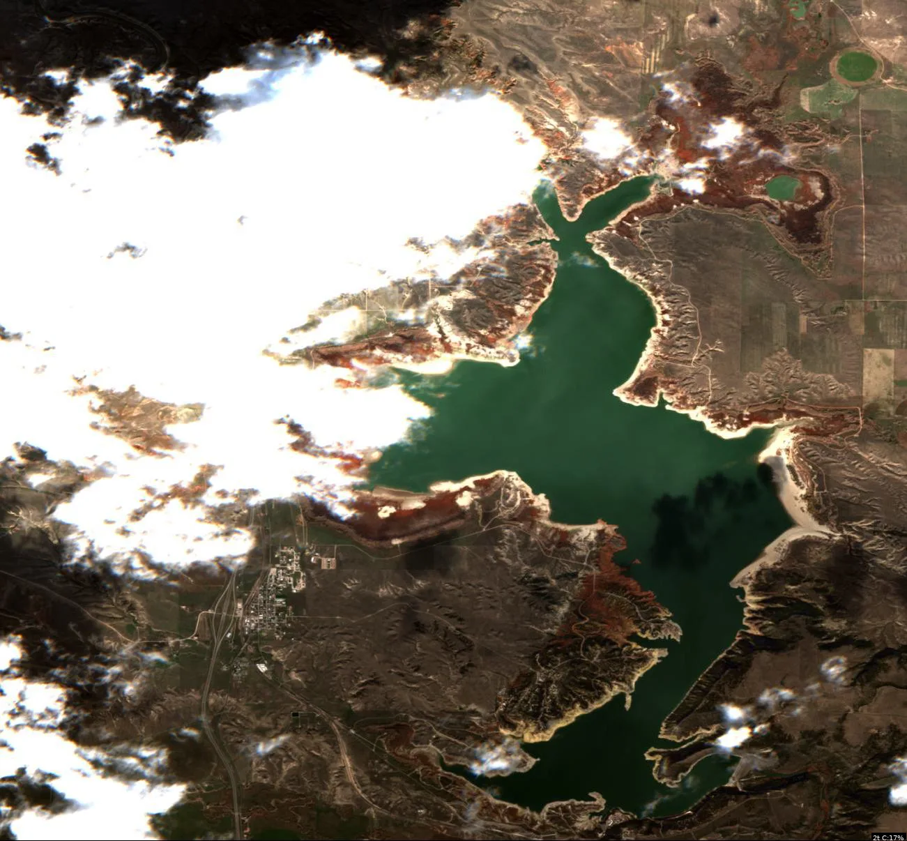
Image quality: limited — Significant cloud cover obscures the western and northwestern portions of the reservoir, preventing a complete assessment of shoreline geometry and surface-color transitions in those sectors. eastern shoreline indentation | center right of frame | Observed: irregular shoreline geometry | Position: center | Scale: 1km to_5km | Evidence: shoreline geometry (90% visual confidence) northeastern surface transitio | top right of frame | Observed: surface-color transition | Position: upper right | Scale: 250m to_1km | Evidence: surface pattern (70% visual confidence) southern inlet shape | bottom center of frame | Observed: narrow water extension | Position: lower center | Scale: 250m to_1km | Evidence: shoreline geometry (80% visual confidence) eastern shoreline indentation | Derived: The irregular shoreline geometry may provide varied habitat access points. Because: the pixels show complex, non-linear shoreline contact with the water body Verify: Use a GPS or depth finder to locate specific points of shoreline curvature and check for submerged structure or depth changes. Primary call: limited visibility due to clouds Backup call: none Switch condition: stale water temp data provided is_19_days old and modelled not observed in image Limitation: cloud obscuration Limitation: stale water temperature data
cloud obscuration
stale water temperature data
LakeMonster AI
Turn the lake into a fishing plan
Forecast read: Go · 6 AM. Use the imagery, weather, and listed species to choose your first area and when to move.
First area, exact setup, best window, and a backup.
Sign in or create a free account to use the quick questions. Building a plan and asking your own question are Pro.
Compare the next 3 days, scout imagery, and build a backup pattern.
8 sources for this lake
- Current water temp
- 61°F
- Water temp history
- 474 readings
- Hourly weather
- 224 hours
- Solunar timing
- 2/5
- Fish species
- 8 listed
- Satellite imagery
- 367 captures
- Thermal imagery
- 1475 captures
- Map structure
- available
Latest source update: Nov 22, 8:16 AM MST. Each image and reading has its own date.