Moosehead Lake, Maine

Lakes in Oxford County, Maine

Photo: Moosehead Lake, Maine. J. Passepartout, CC BY-SA 4.0, via Wikimedia Commons

LakeMonster tracks 37 lakes and reservoirs in Oxford County, Maine, with a combined recorded surface of about 54,500 acres. The largest is Mooselookmeguntic Lake (16,301 acres) and the most visited on LakeMonster is Thompson Lake. Fish species are listed for 7 of them, most often brook trout, lake trout and smallmouth bass. Each lake page shows water temperature, lake weather and wind, satellite imagery and a map, so you can compare lakes before you drive.

Lakes
37
Recorded surface
54,500
acres of water
Fish species
19
listed across 7 lakes

Map of lakes in Oxford County, Maine

Loading the map…


Oxford County, Maine lakes by the numbers

Most visited on LakeMonster

  1. 1.Thompson Lake4,429 acres
  2. 2.Kezar Lake2,510 acres
  3. 3.Umbagog Lake7,572 acres
  4. 4.Mooselookmeguntic Lake16,301 acres
  5. 5.Richardson Lakes5,100 acres

Largest by surface area

  1. 1.Mooselookmeguntic Lake16,301 acres
  2. 2.Umbagog Lake7,572 acres
  3. 3.Aziscohos Lake6,700 acres
  4. 4.Richardson Lakes5,100 acres
  5. 5.Thompson Lake4,429 acres

Deepest on record

  1. 1.Mooselookmeguntic Lake139 ft
  2. 2.Thompson Lake121 ft
  3. 3.Richardson Lakes108 ft
  4. 4.Lincoln Pond95 ft
  5. 5.Parmachenee Lake93 ft

Highest elevation on record

  1. 1.Parmachenee Lake1,627 ft
  2. 2.Aziscohos Lake1,516 ft
  3. 3.Mooselookmeguntic Lake1,470 ft
  4. 4.Richardson Lakes1,467 ft
  5. 5.Cupsuptic Lake1,460 ft

All 37 lakes in Oxford County, Maine

Showing 1–37 of 37 lakes

ListCards
  • Satellite view of Thompson Lake

    Thompson Lake

    Oxford · Oxford County

    Size
    4,429 acres
    Max depth
    121 ft
    Elevation
    325 ft
    Water temp, Oct 30
    55°F

    Fish: Largemouth bass, Smallmouth bass, Chain pickerel, White perch and 13 more

    Conditions, weather and map

  • Satellite view of Kezar Lake

    Kezar Lake

    Lovell · Oxford County

    Size
    2,510 acres
    Max depth
    89 ft
    Elevation
    387 ft
    Water temp, Oct 30
    54°F

    Fish: Largemouth bass, Smallmouth bass, Chain pickerel, White perch and 6 more

    Conditions, weather and map

  • Satellite view of Umbagog Lake

    Umbagog Lake

    Errol · Oxford County · NH

    Size
    7,572 acres
    Water temp, Oct 30
    48°F

    Fish: Brook trout, Brown trout, Rainbow trout, Lake trout and 14 more

    Conditions, weather and map

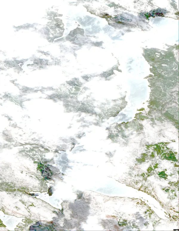
  • Satellite view of Mooselookmeguntic Lake

    Mooselookmeguntic Lake

    Rangeley · Franklin County and Oxford County

    Size
    16,301 acres
    Max depth
    139 ft
    Elevation
    1,470 ft
    Water temp, Oct 30
    49°F

    Fish: Brook trout, Lake trout, Smallmouth bass
    Conditions, weather and map

  • Satellite view of Richardson Lakes

    Richardson Lakes

    Magalloway Plt · Oxford County

    Size
    5,100 acres
    Max depth
    108 ft
    Elevation
    1,467 ft
    Water temp, Oct 30
    51°F

    Fish: Brook trout, Lake trout, White sucker, Yellow perch

    Conditions, weather and map

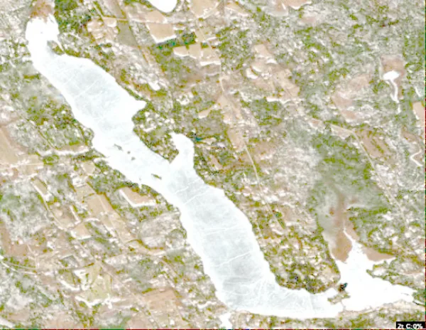
  • Satellite view of Cupsuptic Lake

    Cupsuptic Lake

    Rangeley · Franklin County and Oxford County

    Elevation
    1,460 ft
    Water temp, Oct 30
    49°F

    Fish: Brook trout, Lake trout, Smallmouth bass
    Conditions, weather and map

  • Satellite view of Pennesseewassee Lake

    Pennesseewassee Lake

    Norway · Oxford County

    Size
    922 acres
    Max depth
    48 ft
    Elevation
    410 ft
    Water temp, Oct 30
    54°F

    Conditions, weather and map

  • Satellite view of Bryant Pond

    Bryant Pond

    Woodstock · Oxford County

    Size
    275 acres
    Max depth
    63 ft
    Elevation
    709 ft
    Water temp, Oct 30
    53°F

    Fish: Brook trout, Brown trout, Rainbow trout, Largemouth bass and 5 more
    Conditions, weather and map

  • Satellite view of Moose Pond

    Moose Pond

    Denmark · Cumberland County and Oxford County

    Size
    1,694 acres
    Max depth
    84 ft
    Water temp, Oct 30
    54°F

    Conditions, weather and map

  • Satellite view of Aziscohos Lake

    Aziscohos Lake

    Lincoln · Oxford County

    Size
    6,700 acres
    Max depth
    60 ft
    Elevation
    1,516 ft
    Water temp, Oct 30
    49°F

    Conditions, weather and map

  • Satellite view of Parmachenee Lake

    Parmachenee Lake

    Rump Mountain · Oxford County

    Size
    914 acres
    Max depth
    93 ft
    Elevation
    1,627 ft
    Water temp, Oct 30
    48°F

    Conditions, weather and map

  • Satellite view of Keoka Lake

    Keoka Lake

    Waterford · Oxford County

    Size
    459 acres
    Max depth
    42 ft
    Elevation
    515 ft
    Water temp, Oct 30
    54°F
    • Fishing lake

    Conditions, weather and map

  • Satellite view of Hancock Pond

    Hancock Pond

    Denmark · Oxford County

    Size
    858 acres
    Max depth
    65 ft
    Water temp, Oct 30
    54°F

    Conditions, weather and map

  • Satellite view of Anasagunticook Lake

    Anasagunticook Lake

    Canton · Oxford County

    Size
    598 acres
    Water temp, Oct 30
    54°F

    Conditions, weather and map

  • Satellite view of Lincoln Pond

    Lincoln Pond

    Parkertown · Oxford County

    Size
    340 acres
    Max depth
    95 ft
    Water temp, Oct 30
    49°F

    Conditions, weather and map

  • Satellite view of Lovewell Pond

    Lovewell Pond

    Fryeburg · Oxford County

    Size
    1,120 acres
    Max depth
    49 ft
    Water temp, Oct 30
    54°F

    Conditions, weather and map

  • Satellite view of Stanley Pond

    Stanley Pond

    Hiram · Oxford County

    Size
    134 acres
    Max depth
    75 ft
    Water temp, Oct 30
    51°F

    Conditions, weather and map

  • Satellite view of Ellis Pond

    Ellis Pond

    Roxbury · Oxford County

    Size
    920 acres
    Max depth
    47 ft
    Water temp, Oct 30
    50°F

    Conditions, weather and map

  • Satellite view of Pleasant Lake

    Pleasant Lake

    Norway · Cumberland County and Oxford County
    Size
    1,077 acres
    Max depth
    62 ft
    Elevation
    397 ft
    Water temp, Oct 30
    48°F

    Conditions, weather and map

  • Satellite view of Concord Pond

    Concord Pond

    Woodstock · Oxford County

    Size
    135 acres
    Max depth
    13 ft
    Water temp, Oct 30
    50°F

    Conditions, weather and map

  • Satellite view of Richardson Pond

    Richardson Pond

    Lincoln Plantation · Oxford County

    Size
    423 acres
    Max depth
    41 ft
    Water temp, Oct 30
    48°F

    Conditions, weather and map

  • Satellite view of Stearns Pond

    Stearns Pond

    Sweden · Oxford County

    Size
    255 acres
    Max depth
    47 ft
    Water temp, Oct 30
    54°F

    Conditions, weather and map

  • Satellite view of South Pond

    South Pond

    Buckfield · Oxford County

    Size
    49 acres
    Max depth
    11 ft
    Water temp, Oct 30
    51°F

    Conditions, weather and map

  • Satellite view of Keewaydin Lake

    Keewaydin Lake

    Stoneham · Oxford County

    Size
    262 acres
    Max depth
    52 ft
    Elevation
    702 ft
    Water temp, Oct 30
    53°F

    Conditions, weather and map

  • Satellite view of Virginia Lake

    Virginia Lake

    Stoneham · Oxford County

    Size
    146 acres
    Max depth
    28 ft
    Elevation
    820 ft
    Water temp, Oct 30
    52°F

    Conditions, weather and map

  • Satellite view of Trout Pond

    Trout Pond

    Stoneham · Oxford County

    Size
    64 acres
    Max depth
    68 ft
    Water temp, Oct 30
    53°F

    Conditions, weather and map

  • Satellite view of Twitchell Pond

    Twitchell Pond

    Greenwood · Oxford County

    Size
    179 acres
    Max depth
    47 ft
    Water temp, Oct 30
    53°F

    Conditions, weather and map

  • Satellite view of Dead Lake

    Dead Lake

    Fryeburg · Oxford County

    Size
    54 acres
    Max depth
    2 ft
    Water temp, Oct 30
    58°F
    • Fishing lake

    Conditions, weather and map

  • Satellite view of Little Pennesseewassee Pond

    Little Pennesseewassee Pond

    Norway · Oxford County

    Size
    96 acres
    Max depth
    34 ft
    Water temp, Oct 30
    54°F

    Conditions, weather and map

  • Satellite view of Worthley Pond

    Worthley Pond

    Worthley Pond · Oxford County

    Size
    375 acres
    Max depth
    49 ft
    Water temp, Oct 30
    54°F

    Conditions, weather and map

  • Satellite view of Shagg Pond

    Shagg Pond

    Woodstock · Oxford County

    Size
    64 acres
    Max depth
    41 ft
    Water temp, Oct 30
    51°F

    Conditions, weather and map

  • Satellite view of Burnt Meadow Pond

    Burnt Meadow Pond

    Brownfield · Oxford County

    Size
    63 acres
    Max depth
    49 ft
    Water temp, Oct 30
    53°F

    Conditions, weather and map

  • Satellite view of Indian Pond

    Indian Pond

    Greenwood · Oxford County

    Size
    68 acres
    Max depth
    62 ft
    Water temp, Oct 30
    53°F

    Conditions, weather and map

  • Satellite view of Hutchinson Pond

    Hutchinson Pond

    Greenwood · Oxford County

    Size
    96 acres
    Max depth
    42 ft
    Water temp, Oct 30
    53°F

    Conditions, weather and map

  • Satellite view of Hall Pond

    Hall Pond

    Paris · Oxford County

    Size
    51 acres
    Max depth
    28 ft
    Water temp, Oct 30
    51°F

    Conditions, weather and map

  • Satellite view of Clemons Pond

    Clemons Pond

    Hiram · Oxford County

    Size
    109 acres
    Max depth
    48 ft
    Water temp, Oct 30
    53°F

    Conditions, weather and map

  • Satellite view of Middle Pond

    Middle Pond

    Hiram · Oxford County

    Size
    72 acres
    Max depth
    56 ft
    Water temp, Oct 30
    52°F

    Conditions, weather and map

Lakes in nearby counties

All 674 lakes in Maine

Questions about lakes in Oxford County, Maine

How many lakes are in Oxford County, Maine?
LakeMonster tracks 37 lakes and reservoirs in Oxford County, Maine. This counts the lakes LakeMonster follows, not every pond and water body.
What is the largest lake in Oxford County, Maine?
By recorded surface area, the largest lake in Oxford County, Maine on LakeMonster is Mooselookmeguntic Lake at 16,301 acres, followed by Umbagog Lake (7,572 acres), Aziscohos Lake (6,700 acres) and Richardson Lakes (5,100 acres).
What is the deepest lake in Oxford County, Maine?
Of the lakes with a recorded maximum depth, the deepest is Mooselookmeguntic Lake at about 139 feet, followed by Thompson Lake (121 ft), Richardson Lakes (108 ft) and Lincoln Pond (95 ft).
What fish can you catch in Oxford County, Maine lakes?
The species listed most often for Oxford County, Maine lakes on LakeMonster are brook trout (6 lakes), lake trout (6 lakes), smallmouth bass (6 lakes), yellow perch (5 lakes), brown trout (4 lakes) and chain pickerel (4 lakes). Species lists are available for 7 of the 37 lakes. Check state regulations and seasons before fishing.
What are the most popular lakes in Oxford County, Maine?
The most visited Oxford County, Maine lake pages on LakeMonster are Thompson Lake, Kezar Lake, Umbagog Lake, Mooselookmeguntic Lake and Richardson Lakes.
What is the highest lake in Oxford County, Maine?
Of the lakes with a recorded elevation, the highest is Parmachenee Lake at about 1,627 feet above sea level, followed by Aziscohos Lake (1,516 ft) and Mooselookmeguntic Lake (1,470 ft).

Keep exploring

This list is rebuilt every day from LakeMonster’s lake records. Newest lake data in Oxford County, Maine: . Sizes, depths and amenities are as recorded and are not available for every lake; water temperature readings show their own date.

Lakes in Oxford County, Maine: 37 Lakes & Map | LakeMonster