LakeMonster tracks 113 lakes and reservoirs in Kentucky across 77 counties, with a combined recorded surface of about 365,700 acres. The largest is Kentucky Lake (160,301 acres) and the most visited on LakeMonster is Lake Cumberland. Fish species are listed for 30 of them, most often bluegill, largemouth bass and black crappie. Each lake page shows water temperature, lake weather and wind, satellite imagery and a map, so you can compare lakes before you drive.

Lakes
113
Counties
77
Recorded surface
365,700
acres of water
Fish species
32
listed across 30 lakes

Map of lakes in Kentucky

Loading the map…


Kentucky lakes by county

Pick a county to see only its lakes, with their own map.

Kentucky lakes by the numbers

Most visited on LakeMonster

  1. 1.Lake Cumberland50,250 acres
  2. 2.Dale Hollow Lake27,700 acres
  3. 3.Cave Run Lake7,880 acres
  4. 4.Laurel River Lake5,658 acres
  5. 5.Nolin River Lake6,017 acres

Largest by surface area

  1. 1.Kentucky Lake160,301 acres
  2. 2.Lake Barkley57,901 acres
  3. 3.Lake Cumberland50,250 acres
  4. 4.Dale Hollow Lake27,700 acres
  5. 5.Barren River Lake10,099 acres

Deepest on record

  1. 1.Dewey Lake75 ft
  2. 2.Lake Beshear73 ft
  3. 3.Greenbo Lake49 ft
  4. 4.Energy Lake41 ft
  5. 5.Fern Lake38 ft

Highest elevation on record

  1. 1.Martins Fork Lake1,355 ft
  2. 2.Cannon Creek Lake1,335 ft
  3. 3.North Saluda Reservoir1,273 ft
  4. 4.Fern Lake1,260 ft
  5. 5.Wood Creek Lake1,056 ft

Kentucky lakes by fish species

All 113 lakes in Kentucky

Showing 1–48 of 113 lakes

ListCards
  • Satellite view of Lake Cumberland

    Lake Cumberland

    Jamestown · Clinton County and Laurel County

    Size
    50,250 acres
    Elevation
    738 ft
    Water temp, Oct 30
    70°F

    Fish: Largemouth bass, Smallmouth bass, Spotted bass, White bass and 15 more

    • Boat ramp
    • Camping
    • State park
    • Motor boats

    Conditions, weather and map

  • Satellite view of Dale Hollow Lake

    Dale Hollow Lake

    Fairview · Clinton County

    Size
    27,700 acres
    Elevation
    666 ft
    Water temp, Oct 30
    70°F

    Fish: Largemouth bass, Smallmouth bass, Spotted bass, White bass and 10 more

    • Boat ramp
    • Camping
    • Motor boats

    Conditions, weather and map

  • Satellite view of Cave Run Lake

    Cave Run Lake

    Scranton · Bath County and Rowan County

    Size
    7,880 acres
    Elevation
    787 ft
    Water temp, Oct 30
    67°F

    Fish: Largemouth bass, Smallmouth bass, Spotted bass, White bass and 11 more
    Conditions, weather and map

  • Satellite view of Laurel River Lake

    Laurel River Lake

    Corbin · Laurel County and Whitley County

    Size
    5,658 acres
    Elevation
    1,047 ft
    Water temp, Oct 30
    69°F

    Fish: Largemouth bass, Smallmouth bass, Spotted bass, White crappie and 8 more

    Conditions, weather and map

  • Satellite view of Nolin River Lake

    Nolin River Lake

    Mammoth Cave · Edmonson County and Grayson County

    Size
    6,017 acres
    Elevation
    551 ft
    Water temp, Oct 30
    69°F

    Fish: Largemouth bass, Smallmouth bass, Spotted bass, White crappie and 10 more

    Conditions, weather and map

  • Satellite view of Taylorsville Lake

    Taylorsville Lake

    Taylorsville · Spencer County

    Size
    3,014 acres
    Elevation
    558 ft
    Water temp, Oct 30
    69°F

    Fish: Largemouth bass, Smallmouth bass, Spotted bass, White crappie and 10 more
    Conditions, weather and map

  • Satellite view of Rough River Lake

    Rough River Lake

    Mcdaniels · Breckinridge County and Grayson County

    Size
    5,101 acres
    Elevation
    528 ft
    Water temp, Oct 30
    68°F

    Fish: Largemouth bass, Smallmouth bass, Spotted bass, White bass and 8 more
    Conditions, weather and map

  • Satellite view of Barren River Lake

    Barren River Lake

    Lucas · Barren County

    Size
    10,099 acres
    Elevation
    551 ft
    Water temp, Oct 30
    70°F

    Fish: Largemouth bass, Smallmouth bass, Spotted bass, White bass and 12 more
    Conditions, weather and map

  • Satellite view of Green River Lake

    Green River Lake

    Campbellsville · Adair County and Taylor County

    Size
    8,211 acres
    Elevation
    686 ft
    Water temp, Oct 30
    69°F

    Fish: Largemouth bass, Smallmouth bass, Spotted bass, White crappie and 13 more

    Conditions, weather and map

  • Satellite view of Kentucky Lake

    Kentucky Lake

    Tennessee · Lyon County

    Size
    160,301 acres
    Elevation
    351 ft
    Water temp, Oct 30
    60°F

    Fish: Largemouth bass, Smallmouth bass, Spotted bass, White bass and 20 more
    Conditions, weather and map

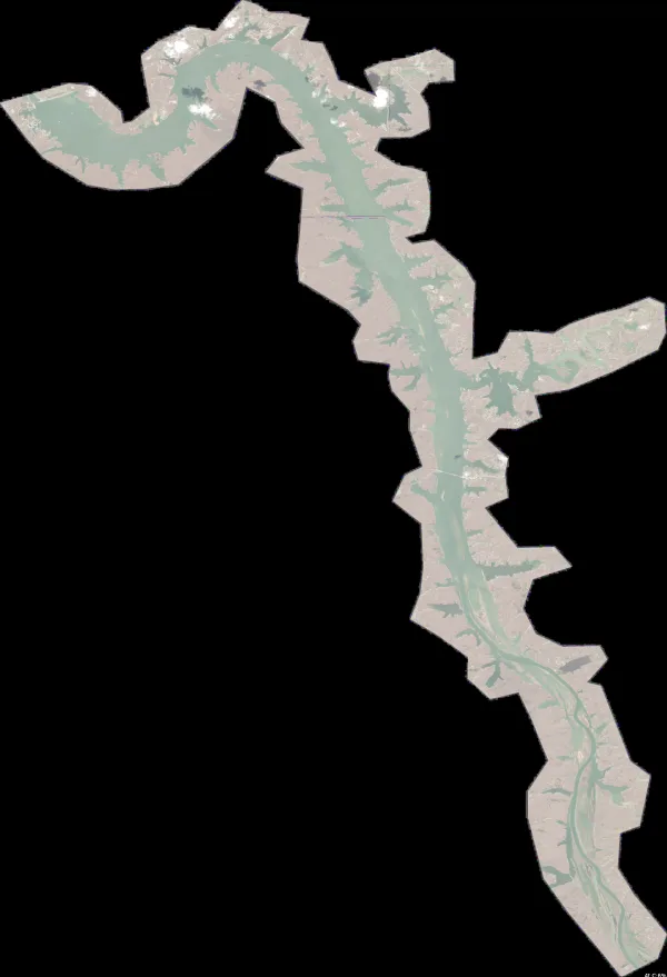
  • Satellite view of Herrington Lake

    Herrington Lake

    Harrodsburg · Boyle County and Mercer County

    Size
    2,649 acres
    Elevation
    771 ft
    Water temp, Oct 30
    71°F

    Fish: Largemouth bass, Smallmouth bass, Spotted bass, White bass and 9 more
    Conditions, weather and map

  • Satellite view of Lake Barkley

    Lake Barkley

    Cadiz · Livingston County · TN

    Size
    57,901 acres
    Elevation
    351 ft
    Water temp, Oct 30
    61°F

    Fish: Largemouth bass, Smallmouth bass, Spotted bass, White bass and 9 more

    Conditions, weather and map

  • Satellite view of Yatesville Lake

    Yatesville Lake

    Louisa · Lawrence County

    Size
    2,298 acres
    Elevation
    659 ft
    Water temp, Oct 30
    65°F

    Fish: Largemouth bass, Smallmouth bass, Spotted bass, Bluegill and 12 more

    Conditions, weather and map

  • Satellite view of Grayson Lake

    Grayson Lake

    Olive Hill · Carter County and Elliott County

    Size
    1,510 acres
    Elevation
    676 ft
    Water temp, Oct 30
    65°F

    Fish: Largemouth bass, Smallmouth bass, Spotted bass, White crappie and 6 more
    Conditions, weather and map

  • Satellite view of Guist Creek Lake

    Guist Creek Lake

    Shelbyville · Shelby County

    Size
    328 acres
    Elevation
    758 ft
    Water temp, Oct 30
    69°F

    Fish: Largemouth bass, Smallmouth bass, Spotted bass, Bluegill and 6 more
    Conditions, weather and map

  • Satellite view of Cedar Creek Reservoir

    Cedar Creek Reservoir

    Stanford · Lincoln County

    Size
    792 acres
    Water temp, Oct 30
    67°F

    Fish: Largemouth bass, Bluegill, Channel catfish, Black crappie and 2 more
    Conditions, weather and map

  • Satellite view of Lake Malone

    Lake Malone

    Dunmor · Logan County and Muhlenberg County

    Size
    814 acres
    Elevation
    479 ft
    Water temp, Oct 30
    70°F

    Fish: Largemouth bass, Smallmouth bass, Channel catfish, Bluegill and 3 more
    Conditions, weather and map

  • Satellite view of Wood Creek Lake

    Wood Creek Lake

    London · Laurel County

    Size
    625 acres
    Elevation
    1,056 ft
    Water temp, Oct 30
    67°F

    Fish: Largemouth bass, Smallmouth bass, Bluegill, Black crappie and 6 more

    Conditions, weather and map

  • Satellite view of Paintsville Lake

    Paintsville Lake

    Staffordsville · Johnson County and Morgan County

    Size
    996 acres
    Elevation
    735 ft
    Water temp, Oct 30
    65°F

    Fish: Largemouth bass, Smallmouth bass, Spotted bass, White crappie and 12 more

    Conditions, weather and map

  • Satellite view of Fishtrap Lake

    Fishtrap Lake

    Shelbiana · Pike County

    Size
    1,133 acres
    Elevation
    797 ft
    Water temp, Oct 30
    65°F

    Fish: Largemouth bass, Smallmouth bass, Spotted bass, White crappie and 19 more
    Conditions, weather and map

  • Satellite view of Lake Linville

    Lake Linville

    Renfro Valley · Rockcastle County

    Size
    356 acres
    Elevation
    1,001 ft
    Water temp, Oct 30
    67°F

    Conditions, weather and map

  • Satellite view of Buckhorn Lake

    Buckhorn Lake

    Buckhorn · Perry County and Leslie County

    Size
    1,229 acres
    Elevation
    820 ft
    Water temp, Oct 30
    66°F

    Fish: Largemouth bass, Smallmouth bass, Spotted bass, White crappie and 14 more

    Conditions, weather and map

  • Satellite view of Willisburg Lake

    Willisburg Lake

    Springfield · Washington County

    Size
    115 acres
    Elevation
    755 ft
    Water temp, Oct 30
    69°F

    Fish: Largemouth bass, Bluegill, Channel catfish, Black crappie and 2 more

    Conditions, weather and map

  • Satellite view of Williamstown Lake

    Williamstown Lake

    Williamstown · Grant County

    Size
    299 acres
    Max depth
    29 ft
    Elevation
    787 ft
    Water temp, Oct 30
    70°F

    Conditions, weather and map

  • Satellite view of Martins Fork Lake

    Martins Fork Lake

    Smith · Harlan County

    Size
    325 acres
    Elevation
    1,355 ft
    Water temp, Oct 30
    65°F

    Fish: Largemouth bass, Smallmouth bass, Spotted bass, Bluegill and 9 more

    • Fishing lake

    Conditions, weather and map

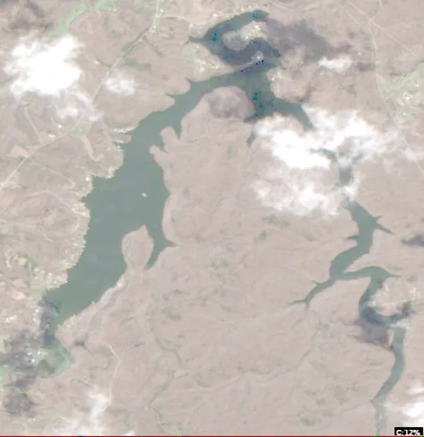
  • Satellite view of Corinth Lake

    Corinth Lake

    Blanchet · Grant County

    Size
    83 acres
    Elevation
    853 ft
    Water temp, Oct 30
    68°F

    Fish: Largemouth bass, Bluegill, Channel catfish, Black crappie and 1 more
    Conditions, weather and map

  • Satellite view of Lake Beshear

    Lake Beshear

    Dawson Springs · Caldwell County

    Size
    819 acres
    Max depth
    73 ft
    Elevation
    430 ft
    Water temp, Oct 30
    67°F

    Conditions, weather and map

  • Satellite view of Taylor Fork Lake

    Taylor Fork Lake

    Richmond · Madison County

    Size
    141 acres
    Elevation
    846 ft
    Water temp, Oct 30
    68°F

    Fish: Largemouth bass, Bluegill, Channel catfish, Black crappie and 2 more
    Conditions, weather and map

  • Satellite view of Cannon Creek Lake

    Cannon Creek Lake

    Pineville · Bell County

    Size
    218 acres
    Elevation
    1,335 ft
    Water temp, Oct 30
    65°F

    Fish: Largemouth bass, Bluegill, Channel catfish, Black crappie and 2 more
    Conditions, weather and map

  • Satellite view of Lake Reba

    Lake Reba

    Richmond · Madison County

    Size
    81 acres
    Max depth
    13 ft
    Elevation
    860 ft
    Water temp, Oct 30
    67°F

    Conditions, weather and map

  • Satellite view of Bolz Lake

    Bolz Lake

    Dry Ridge · Grant County

    Size
    92 acres
    Elevation
    840 ft
    Water temp, Oct 30
    69°F

    Fish: Largemouth bass, Bluegill, Channel catfish, Black crappie and 2 more

    Conditions, weather and map

  • Satellite view of Greenbrier Creek Reservoir

    Greenbrier Creek Reservoir

    Jeffersonville · Montgomery County

    Size
    117 acres
    Elevation
    843 ft
    Water temp, Oct 30
    69°F

    Fish: Largemouth bass, Bluegill, Channel catfish, Black crappie and 2 more
    Conditions, weather and map

  • Satellite view of Doe Valley Lake

    Doe Valley Lake

    Brandenburg · Meade County

    Size
    360 acres
    Water temp, Oct 30
    67°F

    Conditions, weather and map

  • Satellite view of Spa Lake

    Spa Lake

    Russellville · Logan County

    Size
    221 acres
    Elevation
    479 ft
    Water temp, Oct 30
    70°F

    Fish: Largemouth bass, Smallmouth bass, Bluegill, Gar

    • Fishing lake

    Conditions, weather and map

  • Satellite view of Dewey Lake

    Dewey Lake

    Auxier · Floyd County

    Size
    961 acres
    Max depth
    75 ft
    Water temp, Oct 30
    65°F

    Conditions, weather and map

  • Satellite view of Greenbo Lake

    Greenbo Lake

    Argillite · Greenup County

    Size
    176 acres
    Max depth
    49 ft
    Elevation
    656 ft
    Water temp, Oct 30
    64°F

    Conditions, weather and map

  • Satellite view of Bullock Pen Lake

    Bullock Pen Lake

    Crittenden · Boone County

    Size
    124 acres
    Max depth
    20 ft
    Elevation
    774 ft
    Water temp, Oct 30
    70°F

    Conditions, weather and map

  • Satellite view of Beaver Lake

    Beaver Lake

    Glensboro · Anderson County

    Size
    146 acres
    Max depth
    19 ft
    Elevation
    794 ft
    Water temp, Oct 30
    68°F

    Conditions, weather and map

  • Satellite view of Campbell County Lake

    Campbell County Lake

    Aspen Grove · Campbell County

    Size
    174 acres
    Elevation
    696 ft
    Water temp, Oct 30
    55°F

    Fish: Largemouth bass, Bluegill, Channel catfish, Black crappie and 2 more
    Conditions, weather and map

  • Satellite view of McNeely Lake

    McNeely Lake

    Ashville · Jefferson County

    Size
    55 acres
    Max depth
    10 ft
    Water temp, Oct 30
    59°F

    Conditions, weather and map

  • Satellite view of Lake Jericho

    Lake Jericho

    Pendleton · Henry County

    Size
    134 acres
    Max depth
    16 ft
    Elevation
    774 ft
    Water temp, Oct 30
    68°F

    Conditions, weather and map

  • Satellite view of Lake Peewee

    Lake Peewee

    Madisonville · Hopkins County

    Size
    360 acres
    Max depth
    18 ft
    Elevation
    436 ft
    Water temp, Oct 30
    70°F

    Conditions, weather and map

  • Satellite view of Freeman Lake

    Freeman Lake

    Elizabethtown · Hardin County

    Size
    161 acres
    Max depth
    10 ft
    Elevation
    735 ft
    Water temp, Oct 30
    69°F

    Conditions, weather and map

  • Satellite view of Winchester Reservoir

    Winchester Reservoir

    Becknerville · Clark County

    Size
    94 acres
    Max depth
    6 ft
    Elevation
    876 ft
    Water temp, Oct 30
    69°F

    Conditions, weather and map

Questions about lakes in Kentucky

How many lakes are in Kentucky?
LakeMonster tracks 113 lakes and reservoirs in Kentucky. They are spread over 77 counties; Hopkins County (6), Christian County (5) and Bell County (3) have the most. This counts the lakes LakeMonster follows, not every pond and water body.
What is the largest lake in Kentucky?
By recorded surface area, the largest lake in Kentucky on LakeMonster is Kentucky Lake at 160,301 acres, followed by Lake Barkley (57,901 acres), Lake Cumberland (50,250 acres) and Dale Hollow Lake (27,700 acres).
What is the deepest lake in Kentucky?
Of the lakes with a recorded maximum depth, the deepest is Dewey Lake at about 75 feet, followed by Lake Beshear (73 ft), Greenbo Lake (49 ft) and Energy Lake (41 ft).
What fish can you catch in Kentucky lakes?
The species listed most often for Kentucky lakes on LakeMonster are bluegill (30 lakes), largemouth bass (30 lakes), black crappie (29 lakes), channel catfish (29 lakes), white crappie (28 lakes) and redear sunfish (26 lakes). Species lists are available for 30 of the 113 lakes. Check state regulations and seasons before fishing.
What are the most popular lakes in Kentucky?
The most visited Kentucky lake pages on LakeMonster are Lake Cumberland, Dale Hollow Lake, Cave Run Lake, Laurel River Lake and Nolin River Lake.
Which lakes in Kentucky have a boat ramp?
LakeMonster has a boat ramp on record at 2 lakes in Kentucky, including Lake Cumberland and Dale Hollow Lake. Amenities are not recorded for every lake, so other lakes may have ramps too.
Which lakes in Kentucky have camping?
Camping is on record at 2 lakes in Kentucky, including Lake Cumberland and Dale Hollow Lake. Amenities are not recorded for every lake.
What is the highest lake in Kentucky?
Of the lakes with a recorded elevation, the highest is Martins Fork Lake at about 1,355 feet above sea level, followed by Cannon Creek Lake (1,335 ft) and North Saluda Reservoir (1,273 ft).

Keep exploring

This list is rebuilt every day from LakeMonster’s lake records. Newest lake data in Kentucky: . Sizes, depths and amenities are as recorded and are not available for every lake; water temperature readings show their own date.

Lakes in Kentucky: 113 Lakes, Map & Counties | LakeMonster