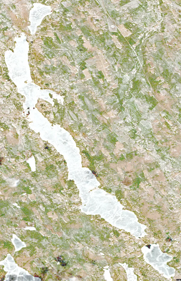
Moosehead Lake, Maine

Lakes in Maine, page 10

Photo: Moosehead Lake, Maine. J. Passepartout, CC BY-SA 4.0, via Wikimedia Commons

Map of lakes in Maine

Loading the map…


All 674 lakes in Maine

Showing 433–480 of 674 lakes

ListCards
  • Satellite view of Macwahoc Lake

    Macwahoc Lake

    Sherman · Aroostook County

    Size
    296 acres
    Max depth
    10 ft
    Elevation
    636 ft
    Water temp, Oct 30
    44°F
    • Fishing lake

    Conditions, weather and map

  • Satellite view of Horseshoe Lake

    Horseshoe Lake

    Nicatous Lake · Hancock County

    Size
    210 acres
    Max depth
    20 ft
    Elevation
    463 ft
    Water temp, Oct 30
    48°F
    • Fishing lake

    Conditions, weather and map

  • Satellite view of Kaler Pond

    Kaler Pond

    Waldoboro · Lincoln County

    Size
    87 acres
    Max depth
    15 ft
    Water temp, Oct 30
    52°F

    Conditions, weather and map

  • Satellite view of Buker Pond

    Buker Pond

    Litchfield · Kennebec County

    Size
    78 acres
    Max depth
    31 ft
    Water temp, Oct 30
    48°F

    Conditions, weather and map

  • Satellite view of Hancock Lake

    Hancock Lake

    Bucksport · Hancock County

    Size
    59 acres
    Max depth
    59 ft
    Water temp, Oct 30
    47°F

    Conditions, weather and map

  • Satellite view of Doe Pond

    Doe Pond

    Monson · Piscataquis County

    Size
    54 acres
    Max depth
    9 ft
    Water temp, Oct 30
    46°F

    Conditions, weather and map

  • Satellite view of Gassabias Lake

    Gassabias Lake

    Nicatous Lake · Hancock County

    Size
    896 acres
    Max depth
    10 ft
    Elevation
    354 ft
    Water temp, Oct 30
    47°F

    Conditions, weather and map

  • Satellite view of Upper Sabao Lake

    Upper Sabao Lake

    Nicatous Lake · Hancock County

    Size
    467 acres
    Max depth
    41 ft
    Elevation
    410 ft
    Water temp, Oct 30
    49°F

    Conditions, weather and map

  • Satellite view of Ferguson Lake

    Ferguson Lake

    Millinocket · Penobscot County

    Size
    254 acres
    Max depth
    23 ft
    Elevation
    463 ft
    Water temp, Oct 30
    42°F

    Conditions, weather and map

  • Satellite view of Sucker Lake

    Sucker Lake

    Danforth · Washington County

    Size
    203 acres
    Max depth
    32 ft
    Elevation
    449 ft
    Water temp, Oct 30
    50°F

    Conditions, weather and map

  • Satellite view of Brettun's Pond

    Brettun's Pond

    Livermore · Androscoggin County

    Size
    165 acres
    Max depth
    42 ft
    Water temp, Oct 30
    53°F

    Conditions, weather and map

  • Satellite view of Quimby Pond

    Quimby Pond

    Rangeley · Franklin County

    Size
    165 acres
    Max depth
    13 ft
    Water temp, Oct 30
    47°F

    Conditions, weather and map

  • Satellite view of Number Nine Lake

    Number Nine Lake

    Bridgewater · Aroostook County

    Size
    120 acres
    Max depth
    11 ft
    Water temp, Oct 30
    42°F

    Conditions, weather and map

  • Satellite view of Hobart Lake

    Hobart Lake

    Gardner Lake · Washington County

    Size
    89 acres
    Max depth
    14 ft
    Elevation
    118 ft
    Water temp, Oct 30
    47°F
    • Fishing lake

    Conditions, weather and map

  • Satellite view of Long Lake

    Long Lake

    Brighton · Cumberland County

    Size
    4,867 acres
    Max depth
    65 ft
    Water temp, Oct 30
    50°F

    Conditions, weather and map

  • Satellite view of Lower Sabao Lake

    Lower Sabao Lake

    Nicatous Lake · Hancock County

    Size
    919 acres
    Max depth
    34 ft
    Elevation
    351 ft
    Water temp, Oct 30
    49°F

    Conditions, weather and map

  • Satellite view of Cedar Lake

    Cedar Lake

    Cedar Lake · Penobscot County

    Size
    685 acres
    Max depth
    24 ft
    Elevation
    495 ft
    Water temp, Oct 30
    50°F

    Conditions, weather and map

  • Satellite view of Keg Lake

    Keg Lake

    Lakeville · Penobscot County

    Size
    630 acres
    Max depth
    40 ft
    Elevation
    312 ft
    Water temp, Oct 30
    49°F

    Conditions, weather and map

  • Satellite view of Mattaseunk Lake

    Mattaseunk Lake

    Mattawamkeag · Aroostook County

    Size
    578 acres
    Max depth
    21 ft
    Elevation
    312 ft
    Water temp, Oct 30
    45°F

    Conditions, weather and map

  • Satellite view of Little Millinocket Lake

    Little Millinocket Lake

    Patten · Piscataquis County

    Size
    519 acres
    Max depth
    63 ft
    Elevation
    771 ft
    Water temp, Oct 30
    47°F

    Conditions, weather and map

  • Satellite view of Saint Croix Lake

    Saint Croix Lake

    St. Croix Lake · Aroostook County

    Size
    452 acres
    Max depth
    9 ft
    Elevation
    623 ft
    Water temp, Oct 30
    42°F

    Conditions, weather and map

  • Satellite view of Chandler Lake

    Chandler Lake

    Chandler Mountain · Aroostook County

    Size
    401 acres
    Max depth
    19 ft
    Elevation
    837 ft
    Water temp, Oct 30
    47°F

    Conditions, weather and map

  • Satellite view of Mud Lake

    Mud Lake

    Hersey · Aroostook County

    Size
    128 acres
    Max depth
    20 ft
    Water temp, Oct 30
    44°F
    • Fishing lake

    Conditions, weather and map

  • Satellite view of Fourth Pelletier Brook Lake

    Fourth Pelletier Brook Lake

    Pelletier Brook Lakes · Aroostook County

    Size
    52 acres
    Max depth
    7 ft
    Water temp, Oct 30
    44°F

    Conditions, weather and map

  • Satellite view of Blakeslee Lake

    Blakeslee Lake

    Holeb · Somerset County

    Size
    47 acres
    Max depth
    45 ft
    Water temp, Oct 30
    47°F
    • Fishing lake

    Conditions, weather and map

  • Satellite view of Schoolhouse Pond

    Schoolhouse Pond

    Fayette · Androscoggin County

    Size
    21 acres
    Max depth
    13 ft
    Water temp, Oct 30
    51°F

    Conditions, weather and map

  • Satellite view of Turkey Tail Lake

    Turkey Tail Lake

    Norcross · Penobscot County

    Size
    380 acres
    Max depth
    38 ft
    Water temp, Oct 30
    49°F

    Conditions, weather and map

  • Satellite view of Upper Narrows Pond

    Upper Narrows Pond

    Winthrop · Kennebec County

    Size
    279 acres
    Max depth
    54 ft
    Water temp, Oct 30
    54°F

    Conditions, weather and map

  • Satellite view of Grace Pond

    Grace Pond

    Jackman · Somerset County

    Size
    150 acres
    Max depth
    45 ft
    Water temp, Oct 30
    45°F

    Conditions, weather and map

  • Satellite view of Long Lake

    Long Lake

    Wesley · Washington County

    Size
    126 acres
    Max depth
    48 ft
    Elevation
    118 ft
    Water temp, Oct 30
    49°F

    Conditions, weather and map

  • Satellite view of Sawyer Pond

    Sawyer Pond

    Greenville · Piscataquis County

    Size
    67 acres
    Max depth
    23 ft
    Water temp, Oct 30
    42°F

    Conditions, weather and map

  • Satellite view of Shagg Pond

    Shagg Pond

    Woodstock · Oxford County

    Size
    64 acres
    Max depth
    41 ft
    Water temp, Oct 30
    51°F

    Conditions, weather and map

  • Satellite view of Egypt Pond

    Egypt Pond

    Chesterville · Franklin County

    Size
    60 acres
    Max depth
    55 ft
    Water temp, Oct 30
    52°F

    Conditions, weather and map

  • Satellite view of Long Lake

    Long Lake

    Bennett · Aroostook County

    Size
    54 acres
    Max depth
    163 ft
    Elevation
    568 ft
    Water temp, Oct 30
    42°F
    • Fishing lake

    Conditions, weather and map

  • Satellite view of Sam Hill Lake

    Sam Hill Lake

    Wesley · Washington County

    Size
    54 acres
    Max depth
    35 ft
    Elevation
    299 ft
    Water temp, Oct 30
    48°F
    • Fishing lake

    Conditions, weather and map

  • Satellite view of Lake Wassockeag

    Lake Wassockeag

    Dexter · Penobscot County

    Size
    1,062 acres
    Max depth
    86 ft
    Water temp, Oct 30
    53°F

    Conditions, weather and map

  • Satellite view of Whetstone Pond

    Whetstone Pond

    Kingsbury · Piscataquis County

    Size
    256 acres
    Max depth
    125 ft
    Water temp, Oct 30
    48°F

    Conditions, weather and map

  • Satellite view of Falls Pond

    Falls Pond

    Dickey · Aroostook County

    Size
    216 acres
    Max depth
    7 ft
    Water temp, Oct 30
    42°F

    Conditions, weather and map

  • Satellite view of Number Nine Lake

    Number Nine Lake

    Number Nine Lake · Aroostook County

    Size
    99 acres
    Max depth
    10 ft
    Elevation
    1,070 ft
    Water temp, Oct 30
    45°F

    Conditions, weather and map

  • Satellite view of Little Pond

    Little Pond

    Damariscotta · Lincoln County

    Size
    78 acres
    Water temp, Oct 30
    55°F

    Conditions, weather and map

  • Satellite view of Little Jim Pond

    Little Jim Pond

    Eustis · Franklin County

    Size
    64 acres
    Max depth
    37 ft
    Water temp, Oct 30
    48°F

    Conditions, weather and map

  • Satellite view of Burnt Meadow Pond

    Burnt Meadow Pond

    Brownfield · Oxford County

    Size
    63 acres
    Max depth
    49 ft
    Water temp, Oct 30
    53°F

    Conditions, weather and map

  • Satellite view of Mud Lake

    Mud Lake

    Island Falls · Aroostook County

    Size
    59 acres
    Max depth
    20 ft
    Water temp, Oct 30
    44°F

    Conditions, weather and map

  • Satellite view of Second Marks Lake

    Second Marks Lake

    Marshfield · Washington County

    Size
    49 acres
    Max depth
    22 ft
    Elevation
    210 ft
    Water temp, Oct 30
    48°F
    • Fishing lake

    Conditions, weather and map

  • Satellite view of Bennett Lake

    Bennett Lake

    Easton · Aroostook County

    Size
    18 acres
    Max depth
    10 ft
    Water temp, Oct 30
    44°F

    Conditions, weather and map

  • Satellite view of Sunken Lake

    Sunken Lake

    Long Lake · Washington County

    Size
    1,102 acres
    Max depth
    36 ft
    Elevation
    92 ft
    Water temp, Oct 30
    48°F

    Conditions, weather and map

Keep exploring

This list is rebuilt every day from LakeMonster’s lake records. Newest lake data in Maine: . Sizes, depths and amenities are as recorded and are not available for every lake; water temperature readings show their own date.

Lakes in Maine: 674 Lakes, Map & Counties – Page 10 | LakeMonster