Moosehead Lake, Maine

Lakes in Maine, page 2

Photo: Moosehead Lake, Maine. J. Passepartout, CC BY-SA 4.0, via Wikimedia Commons

Map of lakes in Maine

Loading the map…


All 674 lakes in Maine

Showing 49–96 of 674 lakes

ListCards
  • Satellite view of Bryant Pond

    Bryant Pond

    Woodstock · Oxford County

    Size
    275 acres
    Max depth
    63 ft
    Elevation
    709 ft
    Water temp, Oct 30
    53°F

    Fish: Brook trout, Brown trout, Rainbow trout, Largemouth bass and 5 more

    Conditions, weather and map

  • Satellite view of Great Pond

    Great Pond

    Rome · Kennebec County

    Size
    8,239 acres
    Max depth
    69 ft
    Water temp, Oct 30
    48°F

    Conditions, weather and map

  • Satellite view of Moose Pond

    Moose Pond

    Denmark · Cumberland County and Oxford County

    Size
    1,694 acres
    Max depth
    84 ft
    Water temp, Oct 30
    54°F

    Conditions, weather and map

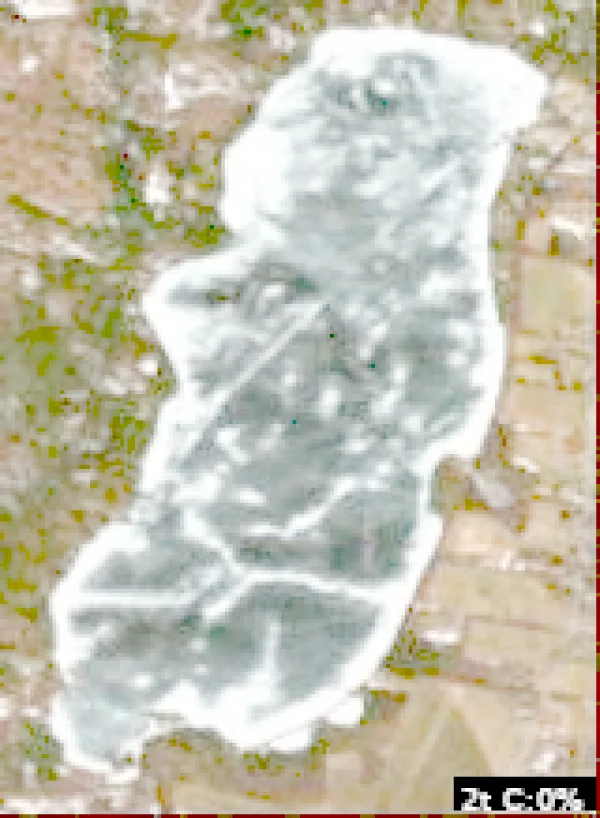
  • Satellite view of Webber Pond

    Webber Pond

    Vassalboro · Kennebec County

    Size
    1,201 acres
    Max depth
    41 ft
    Elevation
    121 ft
    Water temp, Oct 30
    53°F

    Fish: Largemouth bass, Smallmouth bass, Chain pickerel, White perch and 5 more
    Conditions, weather and map

  • Satellite view of Cochnewagon Lake

    Cochnewagon Lake

    Monmouth · Kennebec County

    Size
    397 acres
    Elevation
    272 ft
    Water temp, Oct 30
    51°F

    Fish: Largemouth bass, Smallmouth bass, Chain pickerel, White perch and 5 more

    • Fishing lake

    Conditions, weather and map

  • Satellite view of Aziscohos Lake

    Aziscohos Lake

    Lincoln · Oxford County

    Size
    6,700 acres
    Max depth
    60 ft
    Elevation
    1,516 ft
    Water temp, Oct 30
    49°F

    Conditions, weather and map

  • Satellite view of Saint George Lake

    Saint George Lake

    Liberty · Waldo County

    Size
    1,017 acres
    Max depth
    71 ft
    Elevation
    512 ft
    Water temp, Oct 30
    47°F

    Conditions, weather and map

  • Satellite view of Brewer Lake

    Brewer Lake

    Orrington · Penobscot County

    Size
    881 acres
    Max depth
    48 ft
    Elevation
    125 ft
    Water temp, Oct 30
    51°F

    Conditions, weather and map

  • Satellite view of Swan Lake

    Swan Lake

    Swanville · Waldo County

    Size
    1,370 acres
    Max depth
    87 ft
    Water temp, Oct 30
    49°F

    Conditions, weather and map

  • Satellite view of Highland Lake

    Highland Lake

    Bridgton · Cumberland County

    Size
    1,334 acres
    Max depth
    50 ft
    Elevation
    420 ft
    Water temp, Oct 30
    55°F

    Conditions, weather and map

  • Satellite view of Ambajejus Lake

    Ambajejus Lake

    Millinocket · Piscataquis County

    Size
    1,998 acres
    Max depth
    110 ft
    Elevation
    476 ft
    Water temp, Oct 30
    50°F

    Conditions, weather and map

  • Satellite view of Crystal Lake

    Crystal Lake

    Hannaford · Cumberland County

    Size
    185 acres
    Max depth
    5 ft
    Elevation
    302 ft
    Water temp, Oct 30
    52°F

    Conditions, weather and map

  • Satellite view of Drews Lake

    Drews Lake

    New Limerick · Aroostook County

    Size
    1,057 acres
    Max depth
    49 ft
    Elevation
    482 ft
    Water temp, Oct 30
    44°F

    Fish: Brook trout, White perch, Smallmouth bass, Chain pickerel and 1 more

    Conditions, weather and map

  • Satellite view of Lake George

    Lake George

    Canaan · Somerset County

    Size
    335 acres
    Max depth
    68 ft
    Elevation
    223 ft
    Water temp, Oct 30
    53°F

    Conditions, weather and map

  • Satellite view of Lake Arrowhead

    Lake Arrowhead

    Limerick · York County

    Size
    1,005 acres
    Max depth
    25 ft
    Water temp, Oct 30
    54°F

    Conditions, weather and map

  • Satellite view of Long Pond

    Long Pond

    Rome · Kennebec County

    Size
    2,557 acres
    Max depth
    106 ft
    Water temp, Oct 30
    54°F

    Conditions, weather and map

  • Satellite view of Crescent Lake

    Crescent Lake

    Casco · Cumberland County

    Size
    704 acres
    Max depth
    70 ft
    Elevation
    276 ft
    Water temp, Oct 30
    48°F

    Conditions, weather and map

  • Satellite view of Schoodic Lake

    Schoodic Lake

    Adams · Piscataquis County

    Size
    7,168 acres
    Max depth
    188 ft
    Elevation
    413 ft
    Water temp, Oct 30
    44°F

    Conditions, weather and map

  • Satellite view of Phillips Lake

    Phillips Lake

    Dedham · Hancock County

    Size
    828 acres
    Max depth
    98 ft
    Water temp, Oct 30
    49°F

    Conditions, weather and map

  • Satellite view of Echo Lake

    Echo Lake

    Echo Lake · Aroostook County

    Size
    90 acres
    Max depth
    9 ft
    Elevation
    518 ft
    Water temp, Oct 30
    46°F

    Conditions, weather and map

  • Satellite view of Forest Lake

    Forest Lake

    Cumberland · Cumberland County

    Size
    212 acres
    Max depth
    23 ft
    Elevation
    289 ft
    Water temp, Oct 30
    53°F
    • Fishing lake

    Conditions, weather and map

  • Satellite view of Annabessacook Lake

    Annabessacook Lake

    Monmouth · Kennebec County

    Size
    1,420 acres
    Max depth
    49 ft
    Elevation
    184 ft
    Water temp, Oct 30
    53°F

    Conditions, weather and map

  • Satellite view of Boyden Lake

    Boyden Lake

    Perry · Washington County

    Size
    1,760 acres
    Elevation
    79 ft
    Water temp, Oct 30
    48°F

    Fish: Largemouth bass, Smallmouth bass, Chain pickerel, White perch and 6 more

    Conditions, weather and map

  • Satellite view of Schoodic Lake

    Schoodic Lake

    Schoodic Lake · Washington County

    Size
    408 acres
    Max depth
    37 ft
    Elevation
    220 ft
    Water temp, Oct 30
    51°F

    Conditions, weather and map

  • Satellite view of Square Lake

    Square Lake

    Square Lake · Aroostook County

    Size
    8,150 acres
    Max depth
    122 ft
    Elevation
    577 ft
    Water temp, Oct 30
    41°F

    Conditions, weather and map

  • Satellite view of Pemaquid Pond

    Pemaquid Pond

    Nobleboro · Lincoln County

    Size
    1,515 acres
    Max depth
    67 ft
    Water temp, Oct 30
    54°F

    Conditions, weather and map

  • Satellite view of Alamoosook Lake

    Alamoosook Lake

    Orland · Hancock County

    Size
    998 acres
    Max depth
    28 ft
    Elevation
    36 ft
    Water temp, Oct 30
    48°F

    Conditions, weather and map

  • Satellite view of Crystal Lake

    Crystal Lake

    Hersey · Aroostook County

    Size
    137 acres
    Max depth
    11 ft
    Elevation
    617 ft
    Water temp, Oct 30
    42°F

    Conditions, weather and map

  • Satellite view of Allagash Lake

    Allagash Lake

    Sainte Justine · Piscataquis County

    Size
    4,260 acres
    Max depth
    89 ft
    Elevation
    1,063 ft
    Water temp, Oct 30
    49°F

    Conditions, weather and map

  • Satellite view of Green Lake

    Green Lake

    Beddington · Hancock County

    Size
    94 acres
    Max depth
    170 ft
    Elevation
    384 ft
    Water temp, Oct 30
    48°F

    Conditions, weather and map

  • Satellite view of Spednik Lake

    Spednik Lake

    Vanceboro · Washington County

    Size
    17,219 acres
    Max depth
    54 ft
    Water temp, Oct 30
    48°F

    Fish: Smallmouth bass, Chain pickerel, White perch, Yellow perch and 1 more

    Conditions, weather and map

  • Satellite view of Wilson Lake

    Wilson Lake

    Acton · York County

    Size
    306 acres
    Max depth
    44 ft
    Elevation
    577 ft
    Water temp, Oct 30
    54°F

    Conditions, weather and map

  • Satellite view of Parmachenee Lake

    Parmachenee Lake

    Rump Mountain · Oxford County

    Size
    914 acres
    Max depth
    93 ft
    Elevation
    1,627 ft
    Water temp, Oct 30
    48°F

    Conditions, weather and map

  • Satellite view of Sabattus Pond

    Sabattus Pond

    Sabattus · Androscoggin County

    Size
    1,962 acres
    Max depth
    19 ft
    Water temp, Oct 30
    38°F

    Conditions, weather and map

  • Satellite view of Craig Pond

    Craig Pond

    Orland · Hancock County

    Size
    218 acres
    Max depth
    75 ft
    Water temp, Oct 30
    48°F

    Conditions, weather and map

  • Satellite view of Long Lake

    Long Lake

    Saint Agatha · Aroostook County

    Size
    6,000 acres
    Max depth
    178 ft
    Water temp, Oct 30
    43°F

    Conditions, weather and map

  • Satellite view of Nickerson Lake

    Nickerson Lake

    New Limerick · Aroostook County

    Size
    234 acres
    Max depth
    117 ft
    Elevation
    400 ft
    Water temp, Oct 30
    49°F

    Conditions, weather and map

  • Satellite view of Toddy Pond

    Toddy Pond

    East Orland · Hancock County

    Size
    1,987 acres
    Max depth
    122 ft
    Water temp, Oct 30
    46°F

    Conditions, weather and map

  • Satellite view of Gardner Lake

    Gardner Lake

    East Machias · Washington County

    Size
    3,886 acres
    Max depth
    56 ft
    Elevation
    79 ft
    Water temp, Oct 30
    47°F

    Conditions, weather and map

  • Satellite view of East Pond

    East Pond

    Oakland · Kennebec County

    Size
    1,823 acres
    Max depth
    30 ft
    Water temp, Oct 30
    52°F

    Conditions, weather and map

  • Satellite view of Bog Lake

    Bog Lake

    Northfield · Washington County

    Size
    827 acres
    Max depth
    46 ft
    Elevation
    164 ft
    Water temp, Oct 30
    50°F

    Conditions, weather and map

  • Satellite view of Keene Lake

    Keene Lake

    Red Beach · Washington County

    Size
    91 acres
    Max depth
    37 ft
    Elevation
    207 ft
    Water temp, Oct 30
    47°F

    Conditions, weather and map

  • Satellite view of Boyd Lake

    Boyd Lake

    Lagrange · Piscataquis County

    Size
    1,065 acres
    Max depth
    20 ft
    Elevation
    272 ft
    Water temp, Oct 30
    50°F

    Conditions, weather and map

  • Satellite view of Germain Lake

    Germain Lake

    Grand Isle · Aroostook County

    Size
    85 acres
    Max depth
    3 ft
    Elevation
    659 ft
    Water temp, Oct 30
    43°F

    Conditions, weather and map

  • Satellite view of Pleasant Lake

    Pleasant Lake

    Oakfield · Aroostook County

    Size
    1,818 acres
    Max depth
    63 ft
    Elevation
    548 ft
    Water temp, Oct 30
    46°F

    Conditions, weather and map

  • Satellite view of Pocomoonshine Lake

    Pocomoonshine Lake

    Big Lake · Washington County

    Size
    2,537 acres
    Max depth
    40 ft
    Elevation
    102 ft
    Water temp, Oct 30
    48°F

    Conditions, weather and map

Keep exploring

This list is rebuilt every day from LakeMonster’s lake records. Newest lake data in Maine: . Sizes, depths and amenities are as recorded and are not available for every lake; water temperature readings show their own date.

Lakes in Maine: 674 Lakes, Map & Counties – Page 2 | LakeMonster