Bear Lake, on the Utah and Idaho line

Lakes in Garfield County, Utah

Photo: Bear Lake, on the Utah and Idaho line. kla4067, CC BY 2.0, via Wikimedia Commons

LakeMonster tracks 24 lakes and reservoirs in Garfield County, Utah, with a combined recorded surface of about 326,300 acres. The largest, Lake Powell, covers 162,624 acres and is also the most visited on LakeMonster. Fish species are listed for 3 of them, most often rainbow trout, black crappie and bluegill. Each lake page shows water temperature, lake weather and wind, satellite imagery and a map, so you can compare lakes before you drive.

Lakes
24
Recorded surface
326,300
acres of water
Fish species
14
listed across 3 lakes

Map of lakes in Garfield County, Utah

Loading the map…


Garfield County, Utah lakes by the numbers

Most visited on LakeMonster

  1. 1.Lake Powell162,624 acres
  2. 2.Panguitch Lake1,248 acres
  3. 3.Lake Powell (Wahweap Bay)161,390 acres
  4. 4.Tropic Reservoir180 acres
  5. 5.Wide Hollow Reservoir130 acres

Largest by surface area

  1. 1.Lake Powell162,624 acres
  2. 2.Lake Powell (Wahweap Bay)161,390 acres
  3. 3.Panguitch Lake1,248 acres
  4. 4.Jacobs Reservoir353 acres
  5. 5.Tropic Reservoir180 acres

Deepest on record

  1. 1.Panguitch Lake66 ft
  2. 2.Tropic Reservoir29 ft
  3. 3.Pine Lake20 ft

Highest elevation on record

  1. 1.Panguitch Lake8,215 ft
  2. 2.Lake Powell3,615 ft
  3. 3.Lake Powell (Wahweap Bay)3,615 ft

All 24 lakes in Garfield County, Utah

Showing 1–24 of 24 lakes

ListCards
  • Satellite view of Lake Powell

    Lake Powell

    Page · Garfield County · AZ

    Size
    162,624 acres
    Elevation
    3,615 ft
    Water temp, Oct 29
    73°F

    Fish: Striped bass, Channel catfish, Black crappie, Walleye and 7 more
    • Camping
    • Rentals
    • Concessions
    • Dump station
    • Motor boats

    Conditions, weather and map

  • Satellite view of Panguitch Lake

    Panguitch Lake

    Panguitch · Garfield County

    Size
    1,248 acres
    Max depth
    66 ft
    Elevation
    8,215 ft
    Water temp, Oct 30
    47°F

    Fish: Rainbow trout, Cutthroat trout, Brown trout, Brook trout
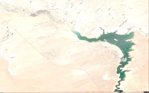
    Conditions, weather and map

  • Satellite view of Lake Powell (Wahweap Bay)

    Lake Powell (Wahweap Bay)

    Wahweap · Garfield County

    Size
    161,390 acres
    Elevation
    3,615 ft
    Water temp, Oct 30
    72°F

    Fish: Striped bass, Smallmouth bass, Largemouth bass, Bluegill and 7 more

    Conditions, weather and map

  • Satellite view of Tropic Reservoir

    Tropic Reservoir

    Bryce Canyon City · Garfield County

    Size
    180 acres
    Max depth
    29 ft
    Water temp, Oct 30
    52°F

    Conditions, weather and map

  • Satellite view of Wide Hollow Reservoir

    Wide Hollow Reservoir

    Escalante · Garfield County

    Size
    130 acres
    Water temp, Oct 30
    51°F

    Conditions, weather and map

  • Satellite view of Pine Lake

    Pine Lake

    Widtsoe · Garfield County

    Size
    77 acres
    Max depth
    20 ft
    Water temp, Oct 30
    59°F

    Conditions, weather and map

  • Satellite view of Roundy Reservoir

    Roundy Reservoir

    Boulder · Garfield County

    Size
    70 acres
    Water temp, Oct 30
    52°F

    Conditions, weather and map

  • Satellite view of Cyclone Lake

    Cyclone Lake

    Escalante · Garfield County

    Size
    81 acres
    Water temp, Oct 30
    46°F

    Conditions, weather and map

  • Satellite view of Purple Lake

    Purple Lake

    Boulder · Garfield County

    Water temp, Oct 30
    41°F

    Conditions, weather and map

  • Satellite view of Lower Barker Reservoir

    Lower Barker Reservoir

    Widtsoe · Garfield County

    Size
    21 acres
    Water temp, Oct 30
    41°F

    Conditions, weather and map

  • Satellite view of Antimony Lake

    Antimony Lake

    Antimony · Garfield County

    Water temp, Oct 30
    34°F

    Conditions, weather and map

  • Satellite view of Jacobs Reservoir

    Jacobs Reservoir

    Boulder · Garfield County

    Size
    353 acres
    Water temp, Oct 30
    42°F

    Conditions, weather and map

  • Satellite view of McGath Lake

    McGath Lake

    Boulder · Garfield County

    Size
    44 acres
    Water temp, Oct 30
    44°F

    Conditions, weather and map

  • Satellite view of Yellow Lake

    Yellow Lake

    Osiris · Garfield County

    Water temp, Oct 30
    43°F

    Conditions, weather and map

  • Satellite view of Joe Lay Reservoir

    Joe Lay Reservoir

    Osiris · Garfield County

    Water temp, Oct 30
    36°F

    Conditions, weather and map

  • Satellite view of Pacer Lake

    Pacer Lake

    Osiris · Garfield County

    Water temp, Oct 30
    42°F

    Conditions, weather and map

  • Satellite view of Horseshoe Lake

    Horseshoe Lake

    Grover · Garfield County

    Size
    13 acres
    Water temp, Oct 30
    43°F

    Conditions, weather and map

  • Satellite view of Blue Lake

    Blue Lake

    Osiris · Garfield County

    Water temp, Oct 30
    36°F

    Conditions, weather and map

  • Satellite view of Long Willow Bottom

    Long Willow Bottom

    Widtsoe · Garfield County

    Water temp, Oct 30
    38°F

    Conditions, weather and map

  • Satellite view of Halfmoon Lake

    Halfmoon Lake

    Boulder · Garfield County

    Size
    10 acres
    Water temp, Oct 30
    44°F

    Conditions, weather and map

  • Satellite view of North Creek Reservoir

    North Creek Reservoir

    Widtsoe · Garfield County

    Water temp, Oct 30
    47°F

    Conditions, weather and map

  • Satellite view of Spectacle Lake

    Spectacle Lake

    Boulder · Garfield County

    Size
    33 acres
    Water temp, Oct 30
    47°F

    Conditions, weather and map

  • Satellite view of Flat Lake

    Flat Lake

    Osiris · Garfield County

    Water temp, Oct 30
    45°F

    Conditions, weather and map

Lakes in nearby counties

All 240 lakes in Utah

Questions about lakes in Garfield County, Utah

How many lakes are in Garfield County, Utah?
LakeMonster tracks 24 lakes and reservoirs in Garfield County, Utah. This counts the lakes LakeMonster follows, not every pond and water body.
What is the largest lake in Garfield County, Utah?
By recorded surface area, the largest lake in Garfield County, Utah on LakeMonster is Lake Powell at 162,624 acres, followed by Lake Powell (Wahweap Bay) (161,390 acres), Panguitch Lake (1,248 acres) and Jacobs Reservoir (353 acres).
What is the deepest lake in Garfield County, Utah?
Of the lakes with a recorded maximum depth, the deepest is Panguitch Lake at about 66 feet, followed by Tropic Reservoir (29 ft) and Pine Lake (20 ft).
What fish can you catch in Garfield County, Utah lakes?
The species listed most often for Garfield County, Utah lakes on LakeMonster are rainbow trout (3 lakes), black crappie (2 lakes), bluegill (2 lakes), channel catfish (2 lakes), common carp (2 lakes) and green sunfish (2 lakes). Species lists are available for 3 of the 24 lakes. Check state regulations and seasons before fishing.
What are the most popular lakes in Garfield County, Utah?
The most visited Garfield County, Utah lake pages on LakeMonster are Lake Powell, Panguitch Lake, Lake Powell (Wahweap Bay), Tropic Reservoir and Wide Hollow Reservoir.
Which lakes in Garfield County, Utah have camping?
Camping is on record at 1 lake in Garfield County, Utah, including Lake Powell. Amenities are not recorded for every lake.
What is the highest lake in Garfield County, Utah?
Of the lakes with a recorded elevation, the highest is Panguitch Lake at about 8,215 feet above sea level, followed by Lake Powell (3,615 ft) and Lake Powell (Wahweap Bay) (3,615 ft).

Keep exploring

This list is rebuilt every day from LakeMonster’s lake records. Newest lake data in Garfield County, Utah: . Sizes, depths and amenities are as recorded and are not available for every lake; water temperature readings show their own date.

Lakes in Garfield County, Utah: 24 Lakes & Map | LakeMonster