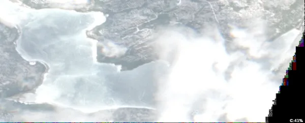
Moosehead Lake, Maine

Lakes in Piscataquis County, Maine

Photo: Moosehead Lake, Maine. J. Passepartout, CC BY-SA 4.0, via Wikimedia Commons

LakeMonster tracks 99 lakes and reservoirs in Piscataquis County, Maine, with a combined recorded surface of about 234,700 acres. The largest, Moosehead Lake, covers 74,890 acres and is also the most visited on LakeMonster. Fish species are listed for 3 of them, most often lake trout, smallmouth bass and white perch. Each lake page shows water temperature, lake weather and wind, satellite imagery and a map, so you can compare lakes before you drive.

Lakes
99
Recorded surface
234,700
acres of water
Fish species
13
listed across 3 lakes

Map of lakes in Piscataquis County, Maine

Loading the map…


Piscataquis County, Maine lakes by the numbers

Most visited on LakeMonster

  1. 1.Moosehead Lake74,890 acres
  2. 2.Sebec Lake6,803 acres
  3. 3.Millinocket Lake8,960 acres
  4. 4.Ambajejus Lake1,998 acres
  5. 5.Schoodic Lake7,168 acres

Largest by surface area

  1. 1.Moosehead Lake74,890 acres
  2. 2.Chesuncook Lake18,881 acres
  3. 3.Chamberlain Lake11,084 acres
  4. 4.Pemadumcook Lake9,779 acres
  5. 5.Eagle Lake9,500 acres

Deepest on record

  1. 1.Moosehead Lake269 ft
  2. 2.Schoodic Lake188 ft
  3. 3.Third Debsconeag Lake162 ft
  4. 4.Sebec Lake155 ft
  5. 5.Chamberlain Lake154 ft

Highest elevation on record

  1. 1.Little Nesowadnehunk Lake1,440 ft
  2. 2.Wassataquoik Lake1,381 ft
  3. 3.Clear Lake1,217 ft
  4. 4.Chemquasabamticook Lake (Ross Lake)1,214 ft
  5. 5.Priestly Lake1,178 ft

All 99 lakes in Piscataquis County, Maine

Showing 1–48 of 99 lakes

ListCards
  • Satellite view of Moosehead Lake

    Moosehead Lake

    Moosehead · Piscataquis County

    Size
    74,890 acres
    Max depth
    269 ft
    Elevation
    1,043 ft
    Water temp, Oct 30
    46°F

    Fish: Brook trout, Lake trout, Smallmouth bass, White perch and 6 more

    Conditions, weather and map

  • Satellite view of Sebec Lake

    Sebec Lake

    Sebec · Piscataquis County

    Size
    6,803 acres
    Max depth
    155 ft
    Elevation
    322 ft
    Water temp, Oct 30
    53°F

    Fish: Smallmouth bass, Largemouth bass, Chain pickerel, White perch and 4 more

    Conditions, weather and map

  • Satellite view of Millinocket Lake

    Millinocket Lake

    Millnocket · Piscataquis County

    Size
    8,960 acres
    Max depth
    86 ft
    Elevation
    469 ft
    Water temp, Oct 30
    48°F

    Fish: Brook trout, Lake trout, Smallmouth bass, White perch and 1 more

    Conditions, weather and map

  • Satellite view of Ambajejus Lake

    Ambajejus Lake

    Millinocket · Piscataquis County

    Size
    1,998 acres
    Max depth
    110 ft
    Elevation
    476 ft
    Water temp, Oct 30
    50°F

    Conditions, weather and map

  • Satellite view of Schoodic Lake

    Schoodic Lake

    Adams · Piscataquis County

    Size
    7,168 acres
    Max depth
    188 ft
    Elevation
    413 ft
    Water temp, Oct 30
    44°F

    Conditions, weather and map

  • Satellite view of Allagash Lake

    Allagash Lake

    Sainte Justine · Piscataquis County

    Size
    4,260 acres
    Max depth
    89 ft
    Elevation
    1,063 ft
    Water temp, Oct 30
    49°F

    Conditions, weather and map

  • Satellite view of Boyd Lake

    Boyd Lake

    Lagrange · Piscataquis County

    Size
    1,065 acres
    Max depth
    20 ft
    Elevation
    272 ft
    Water temp, Oct 30
    50°F

    Conditions, weather and map

  • Satellite view of Rainbow Lake

    Rainbow Lake

    Harrington Lake · Piscataquis County

    Size
    1,664 acres
    Max depth
    130 ft
    Elevation
    1,050 ft
    Water temp, Oct 30
    39°F

    Conditions, weather and map

  • Satellite view of Chesuncook Lake

    Chesuncook Lake

    Shesuncook · Piscataquis County

    Size
    18,881 acres
    Max depth
    76 ft
    Elevation
    938 ft
    Water temp, Oct 30
    45°F

    Conditions, weather and map

  • Satellite view of Matagamon Lake

    Matagamon Lake

    Traveler Mountain · Piscataquis County and Penobscot County

    Size
    4,165 acres
    Max depth
    95 ft
    Elevation
    659 ft
    Water temp, Oct 30
    50°F

    Conditions, weather and map

  • Satellite view of Chamberlain Lake

    Chamberlain Lake

    Chesuncook · Piscataquis County

    Size
    11,084 acres
    Max depth
    154 ft
    Elevation
    948 ft
    Water temp, Oct 30
    45°F

    Conditions, weather and map

  • Satellite view of Lake Hebron

    Lake Hebron

    Monson · Piscataquis County

    Size
    637 acres
    Max depth
    102 ft
    Elevation
    840 ft
    Water temp, Oct 30
    47°F

    Conditions, weather and map

  • Satellite view of Lower Wilson Pond

    Lower Wilson Pond

    Greenville · Piscataquis County

    Size
    1,380 acres
    Max depth
    106 ft
    Water temp, Oct 30
    46°F

    Conditions, weather and map

  • Satellite view of Onawa Lake

    Onawa Lake

    Onawa · Piscataquis County

    Size
    1,344 acres
    Max depth
    92 ft
    Elevation
    531 ft
    Water temp, Oct 30
    46°F

    Conditions, weather and map

  • Satellite view of Echo Lake

    Echo Lake

    Spider Lake · Piscataquis County

    Size
    124 acres
    Max depth
    45 ft
    Elevation
    951 ft
    Water temp, Oct 30
    48°F
    • Fishing lake

    Conditions, weather and map

  • Satellite view of Lobster Lake

    Lobster Lake

    Seboomook · Piscataquis County

    Size
    3,475 acres
    Max depth
    106 ft
    Elevation
    974 ft
    Water temp, Oct 30
    48°F

    Conditions, weather and map

  • Satellite view of Upper Ebeemee Lake

    Upper Ebeemee Lake

    Norcross · Piscataquis County

    Size
    193 acres
    Max depth
    20 ft
    Elevation
    449 ft
    Water temp, Oct 30
    48°F

    Conditions, weather and map

  • Satellite view of First Roach Pond

    First Roach Pond

    Kokadjo · Piscataquis County

    Size
    3,270 acres
    Max depth
    135 ft
    Water temp, Oct 30
    43°F

    Conditions, weather and map

  • Satellite view of Haymock Lake

    Haymock Lake

    Haymock Lake · Piscataquis County

    Size
    929 acres
    Max depth
    61 ft
    Elevation
    984 ft
    Water temp, Oct 30
    49°F

    Conditions, weather and map

  • Satellite view of Cliff Lake

    Cliff Lake

    Churchill Lake · Piscataquis County

    Size
    563 acres
    Max depth
    65 ft
    Elevation
    981 ft
    Water temp, Oct 30
    45°F

    Conditions, weather and map

  • Satellite view of Pollywag Pond

    Pollywag Pond

    Kokadjo · Piscataquis County

    Size
    147 acres
    Max depth
    63 ft
    Water temp, Oct 30
    36°F

    Conditions, weather and map

  • Satellite view of Harrington Lake

    Harrington Lake

    Patten · Piscataquis County

    Size
    1,332 acres
    Max depth
    147 ft
    Elevation
    1,040 ft
    Water temp, Oct 30
    41°F

    Conditions, weather and map

  • Satellite view of Munsungan Lake

    Munsungan Lake

    Chase Lake · Piscataquis County

    Size
    1,598 acres
    Max depth
    123 ft
    Elevation
    833 ft
    Water temp, Oct 30
    49°F

    Conditions, weather and map

  • Satellite view of Caribou Lake

    Caribou Lake

    Millinocket · Piscataquis County

    Size
    4,626 acres
    Max depth
    76 ft
    Elevation
    938 ft
    Water temp, Oct 30
    46°F

    Conditions, weather and map

  • Satellite view of Little Nesowadnehunk Lake

    Little Nesowadnehunk Lake

    Millinocket · Piscataquis County

    Size
    102 acres
    Max depth
    15 ft
    Elevation
    1,440 ft
    Water temp, Oct 30
    45°F

    Conditions, weather and map

  • Satellite view of Pemadumcook Lake

    Pemadumcook Lake

    Norcross · Piscataquis County

    Size
    9,779 acres
    Max depth
    110 ft
    Elevation
    476 ft
    Water temp, Oct 30
    39°F

    Conditions, weather and map

  • Satellite view of Harrow Lake

    Harrow Lake

    Third Musquacook Lake · Piscataquis County
    Size
    405 acres
    Max depth
    30 ft
    Elevation
    1,027 ft
    Water temp, Oct 30
    41°F
    • Fishing lake

    Conditions, weather and map

  • Satellite view of Eagle Lake

    Eagle Lake

    Tramway · Piscataquis County

    Size
    9,500 acres
    Max depth
    124 ft
    Elevation
    945 ft
    Water temp, Oct 30
    49°F

    Conditions, weather and map

  • Satellite view of Churchill Lake

    Churchill Lake

    Churchill Lake · Piscataquis County

    Size
    3,720 acres
    Max depth
    62 ft
    Elevation
    932 ft
    Water temp, Oct 30
    47°F

    Conditions, weather and map

  • Satellite view of Pleasant Lake

    Pleasant Lake

    Spider Lake · Piscataquis County

    Size
    979 acres
    Max depth
    35 ft
    Elevation
    1,004 ft
    Water temp, Oct 30
    48°F

    Conditions, weather and map

  • Satellite view of Millinocket Lake

    Millinocket Lake

    Millinocket Lake · Piscataquis County

    Size
    2,701 acres
    Max depth
    59 ft
    Elevation
    761 ft
    Water temp, Oct 30
    49°F

    Conditions, weather and map

  • Satellite view of Umbazooksus Lake

    Umbazooksus Lake

    Chesuncook · Piscataquis County

    Size
    1,573 acres
    Max depth
    15 ft
    Elevation
    948 ft
    Water temp, Oct 30
    46°F

    Conditions, weather and map

  • Satellite view of Cuxabexis Lake

    Cuxabexis Lake

    Chesuncook · Piscataquis County

    Size
    598 acres
    Max depth
    10 ft
    Elevation
    971 ft
    Water temp, Oct 30
    46°F

    Conditions, weather and map

  • Satellite view of Clear Lake

    Clear Lake

    Musquacook Lakes · Piscataquis County

    Size
    625 acres
    Max depth
    86 ft
    Elevation
    1,217 ft
    Water temp, Oct 30
    48°F

    Conditions, weather and map

  • Satellite view of Ripogenus Lake

    Ripogenus Lake

    Caucomgomoc Lake · Piscataquis County

    Size
    1,801 acres
    Max depth
    76 ft
    Elevation
    938 ft
    Water temp, Oct 30
    43°F

    Conditions, weather and map

  • Satellite view of Silver Lake

    Silver Lake

    Sebec · Piscataquis County

    Size
    279 acres
    Max depth
    28 ft
    Water temp, Oct 30
    49°F

    Conditions, weather and map

  • Satellite view of Ragged Lake

    Ragged Lake

    Big Spencer Mountain · Piscataquis County

    Size
    2,712 acres
    Max depth
    54 ft
    Elevation
    1,125 ft
    Water temp, Oct 30
    43°F

    Conditions, weather and map

  • Satellite view of Nesowadnehunk Lake

    Nesowadnehunk Lake

    New City · Piscataquis County

    Size
    1,368 acres
    Max depth
    46 ft
    Water temp, Oct 30
    38°F

    Conditions, weather and map

  • Satellite view of Telos Lake

    Telos Lake

    Telos Lake · Piscataquis County

    Size
    2,307 acres
    Max depth
    82 ft
    Elevation
    938 ft
    Water temp, Oct 30
    49°F

    Conditions, weather and map

  • Satellite view of First Debsconeag Lake

    First Debsconeag Lake

    Katahdin · Piscataquis County

    Size
    320 acres
    Max depth
    140 ft
    Elevation
    505 ft
    Water temp, Oct 30
    51°F

    Conditions, weather and map

  • Satellite view of Fifth Debsconeag Lake

    Fifth Debsconeag Lake

    Harrington Lake · Piscataquis County

    Size
    87 acres
    Max depth
    42 ft
    Elevation
    820 ft
    Water temp, Oct 30
    45°F
    • Fishing lake

    Conditions, weather and map

  • Satellite view of Fourth Musquacook Lake

    Fourth Musquacook Lake

    Ashland · Piscataquis County

    Size
    729 acres
    Max depth
    42 ft
    Elevation
    1,135 ft
    Water temp, Oct 30
    43°F

    Conditions, weather and map

  • Satellite view of Twin Lake

    Twin Lake

    Ashland · Piscataquis County

    Size
    153 acres
    Max depth
    46 ft
    Elevation
    958 ft
    Water temp, Oct 30
    47°F

    Conditions, weather and map

  • Satellite view of Caucomgomoc Lake

    Caucomgomoc Lake

    Chesuncook · Piscataquis County

    Size
    5,081 acres
    Water temp, Oct 30
    47°F

    Conditions, weather and map

  • Satellite view of Kingsbury and Mayfield Ponds

    Kingsbury and Mayfield Ponds

    Kingsbury Plantation · Piscataquis County

    Size
    530 acres
    Max depth
    62 ft
    Water temp, Oct 30
    44°F

    Conditions, weather and map

  • Satellite view of Fourth Lake

    Fourth Lake

    Spider Lake · Piscataquis County

    Size
    62 acres
    Max depth
    17 ft
    Elevation
    997 ft
    Water temp, Oct 30
    47°F

    Conditions, weather and map

  • Satellite view of Webster Lake

    Webster Lake

    New City · Piscataquis County

    Size
    531 acres
    Max depth
    44 ft
    Elevation
    896 ft
    Water temp, Oct 30
    49°F

    Conditions, weather and map

  • Satellite view of Fifth Musquacook Lake

    Fifth Musquacook Lake

    Fifth Musquacook Lake · Piscataquis County

    Size
    437 acres
    Max depth
    5 ft
    Elevation
    1,122 ft
    Water temp, Oct 30
    46°F
    • Fishing lake

    Conditions, weather and map

Lakes in nearby counties

All 674 lakes in Maine

Questions about lakes in Piscataquis County, Maine

How many lakes are in Piscataquis County, Maine?
LakeMonster tracks 99 lakes and reservoirs in Piscataquis County, Maine. This counts the lakes LakeMonster follows, not every pond and water body.
What is the largest lake in Piscataquis County, Maine?
By recorded surface area, the largest lake in Piscataquis County, Maine on LakeMonster is Moosehead Lake at 74,890 acres, followed by Chesuncook Lake (18,881 acres), Chamberlain Lake (11,084 acres) and Pemadumcook Lake (9,779 acres).
What is the deepest lake in Piscataquis County, Maine?
Of the lakes with a recorded maximum depth, the deepest is Moosehead Lake at about 269 feet, followed by Schoodic Lake (188 ft), Third Debsconeag Lake (162 ft) and Sebec Lake (155 ft).
What fish can you catch in Piscataquis County, Maine lakes?
The species listed most often for Piscataquis County, Maine lakes on LakeMonster are lake trout (3 lakes), smallmouth bass (3 lakes), white perch (3 lakes), yellow perch (3 lakes), brook trout (2 lakes) and chain pickerel (2 lakes). Species lists are available for 3 of the 99 lakes. Check state regulations and seasons before fishing.
What are the most popular lakes in Piscataquis County, Maine?
The most visited Piscataquis County, Maine lake pages on LakeMonster are Moosehead Lake, Sebec Lake, Millinocket Lake, Ambajejus Lake and Schoodic Lake.
What is the highest lake in Piscataquis County, Maine?
Of the lakes with a recorded elevation, the highest is Little Nesowadnehunk Lake at about 1,440 feet above sea level, followed by Wassataquoik Lake (1,381 ft) and Clear Lake (1,217 ft).

Keep exploring

This list is rebuilt every day from LakeMonster’s lake records. Newest lake data in Piscataquis County, Maine: . Sizes, depths and amenities are as recorded and are not available for every lake; water temperature readings show their own date.

Lakes in Piscataquis County, Maine: 99 Lakes & Map | LakeMonster